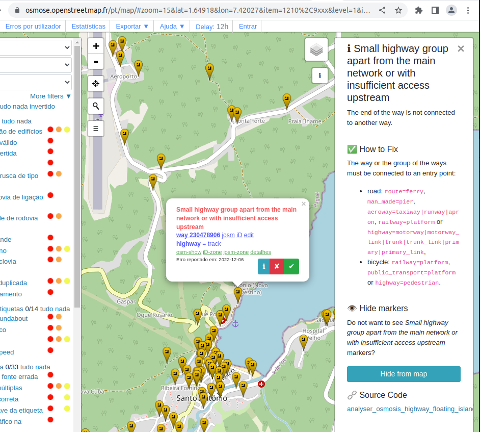
Hi! So, I’m still a new mapper, but iD is smart enough to warn when I try to add unconnected roads. However this “1210 not-connected highway/cycleway / Small highway group apart from the main network or with insufficient access upstream” seems to only hit Osmose (and even then, is not something that normally pops up on that site with green squares). I got a bit scared at first because every small road, not just the few ones I added, started to get warning Level 1 errors!
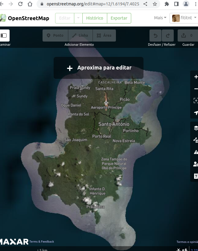
But in this case, I hit a strange warning that actually seems to make sense. But I’m really in a place that does not have a motorway and really makes no sense creating one! (in this case, Santo António, north of São Tomé e Principe, which is a CPLP country like where I’m based).
So my question is: what you here could recommend? I read the “how to fix” but still unsure if it is just to do that without asking feedback.
The real use case
Its an island (seems to not happens on mainland)
The region already have an airport
The region already have an pier
The region does not have a motorway (but not make sense, small island)
Mere existence of airport or pier seems not sufficient to make the roads in the place “routable”
The way or the group of the ways must be connected to an entry point:

road: route=ferry, man_made=pier, aeroway=taxiway|runway|apron, railway=platform or highway=motorway|motorway_link|trunk|trunk_link|primary|primary_link,
bicycle: railway=platform, public_transport=platform or highway=pedestrian.
The problem by Osmose seems to me that there is not at least one primary on Principe.
One solution to overcome this would be to upgrade at least one secondary road on Principe to primary.
A second possibility not so much “mapping for the tool” would be to introduce a ferry line from Sao Tomé to Principe connected at both ends to the road network since at least a passenger ferry exists.
I know that there’s even smaller islands (which obviously would not support primary because would be just one settlement) but considering the description of Tag:highway=primary be “A major highway linking large towns.” depending of what is “large town”, this would change from a country with population of 223.364 (this example) an town in a country with 1.393.000 (like India).
So, in theory, maybe one of these roads are primary.
Some tourist sites like this one São Tomé & Príncipe | São Tomé & Príncipe mentions ferries (but for tourists tend to recommend Inter-island Flights). So in theory, except by highway=motorway, it somewhat could have all the things, just that the scale of population is different (which in this case clearly affect the highways). But yes, the idea of primary/secondary/tertiary was clever!
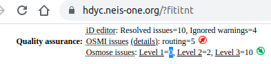
To be honest, I wouldn’t worry about hdyc warnings either, at least not initially.
For example, apparently I am responsible for 19,000 Osmose level 3 warnings (I’m not). Just looking at the first example from that list, this way (added from one source) overlaps with this way (added from another). It’ll likely need an on-site survey to resolve it properly, and it’s good that the Osmose warning exists so that other mappers can see that they perhaps ought to have a look at it.
It would be definitely the wrong thing to do to try and reduce the number of warnings given by Osmose rather than trying to get the mapping correct (matching what actually exists on the ground).
I have discovered a similar situation in a Swiss canton. I don’t know if it has the same origin, but it seems to be related to the missing “highway=primary”. Presumably, if the cantonal borders were different, the error would not exist.
I don’t know the situation exactly, but if that Swiss canton contains an isolated street network, it is really an error/incompleteness. Cars in that insulation won’t get there by air transport or ferry .
No, it didn’t. More for fun, but with the this routing we start in Liechtenstein, drive through Switzerland and through the faulty area, cross Austria and end in Germany.
We cross four European countries without any problems. The Swiss, Austrian and German Autobahn (motorroad/motorway) are used. So “isolated street network” I don’t see any here
The canton “Appenzell Innerrhoden” is even crossed by a highway=secondary, but not by a “highway=primary”.
I’m following the GitHub comments, and I think the example you mentioned was actually a different issue, so it was asked to create a different one. Here’s the link for others interested in the future
I was also somewhat curious how the osmose was able to calculate so many things at once, so it seems that it breaks things by blocks (e.g. not the entire country), but this is likely to be addressed in the validator.
But a priory, likely the pier and airport of my example, have some missing tag. We’re likely to know soon. But the thing about know if things are routable is not as trivial, it really needs to test the routes.