Thanks for that. I think it should be something like this:
(highway=* & mkgmap:unpaved …
Not sure where the mkgmap: comes from. I think we need a test for the existance of the surface tag and anything that is not sealed, paved, asphalt, concrete, … needs to be set to unpaved. I think this is important and the 4044 is a very good example why. The Eastern half is a nice two lane highway and in the middle of nowhere it turns into a goat track. The road number tag was obviously copied from either an online map or the “official” Garmin map, as I bet there are no markers once you enter the dirt section.
Now imagine you have planned a trip on this road. 25 km out of Chiang Rai you hit the dirt. A few km further and you wonder how long this will continue. At which point do you give up and go for the 70 km backtrack and detour? Me, probably once I have picked up my bike for the third time out of the mud. I had to stay overnight in a remote village once, because of a similar mistake.
I used to tag all dirt roads as tracks, but that inevitably gets changed by people who know better. “Don’t tag for the renderer.”
Can we incorporate this into the “new style”, please?
Are you sure to set all highways with unpaved into tracks?
What if it is major primary that is unpaved?
In the new style we use a TYP file so we can think of an overlay or bitmap pattern next or on top of the road to indicate it has an unpaved surface.
Something like that we do with bridges. What do you think of that?
That would be a solution, except that route avoidance for unpaved roads will not work with that. Personally, I want to know when a road is unpaved. This is more important to me than knowing where in the road network a road ranks or what number it has.
What we do in the NZOpenGPSMap: we raise the zoom level of a dirt road that is important, so it stays visible as you zoom out. I don’t know whether that would be achievable in mkgmap. Also, we could colour a dirt highway, could we not?
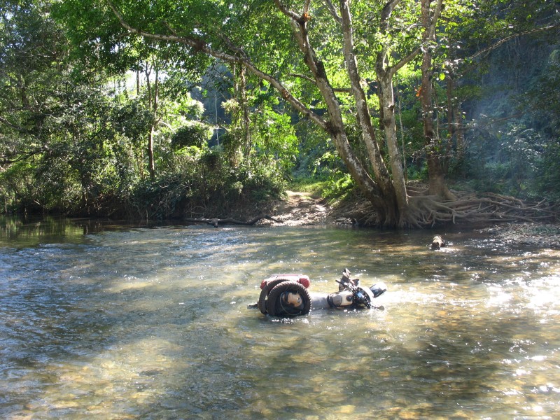
When I travel in Thailand I feel that I can’t trust the OSM map. Where it shows a road there could be a dirt track and in the rainy season I would not want to travel over too much of that. Otherwise, this happens:
Route avoidance still works with overlays which are non routable. I use it for bicycle routes, direction arrows bridges tunnels etc and this works well.
We can’t colour dirt roads if we still render it as unclassified, tertiary etc. It is very hard and unpredictable to render another bitmap on top of a vector line.
That would be very hard unless I completely modify all lines in the typ file specifically (which I dont like to do because this means a lot of work).
An extra overlay line for unpaved roads is quite easy to implement, I’ll post a test map later.
Thank you very much for doing that. It looks good on the GPS and in MS. The dotted line starts to disappear when zooming in past 500m, but I think we can live with that. I can’t test routing, as in this particular sample there are no sealed alternative routes to the dirt ones. I have to take your workd for it that if I select ‘avoid unpaved’ that I will be sent the long way round.
If you are confident that this works, can you iintegrate it into the style, please?
Changes are committed.
Unfortunately the dotted line and other custom lines from the typ file do not scale like the Garmin lines. Mkgmap is only capable of rendering a few zoom levels and Garmin seems to have more.
This can be improved a little by adding a few more dotted lines for each mkgmap zoom level and for every road type but first see how this works out.
You’re welcome Peter. Should have asked it earlier then, it was a quite simple solution
BTW routing in Basecamp and the newer GPS devices with active routing has improved a lot since the release of mkgmap-r3111.
I hope Lambertus can use this version (or later) for the next update.
Also please use --link-pois-to-ways to take bollards and barriers into account (in earlier mkgmap versions this was very buggy but this seems to be solved too)
Can you add postboxes to the map?
Including the ref if they are tagged with that.
I think postboxes are useful features to find when out and about, and they can be landmarks for navigation. Plus I want to get all of my local postboxes mapped on OSM, so it would be handy to have them on my Garmin.
Use Garmin POI Loader to load them into your GPS. That way they are not subject to the POI restrictions, like no duplicate names and you can easily search them.
I noticed that the exported gpx files from overpass-turbo.eu seem not compatible with Garmin Mapsource.
To convert it to Garmins gpx/gdb format you can use http://www.javawa.nl/rtwtool_en.html
I don’t think they would clutter the map much. It doesn’t have to have a large obvious symbol, just so long as they are marked in some way (and searchable on the Garmin). Its no more clutter than bus stops or phone boxes, which are shown on the map.
I had a question sent to Lambertus, but Im sure he gets so many he wont have time to reply, so I’ll post here as it looks relevant .
It relates to the new style he offers on his garmin maps page, but as mkgmap is doing the translation, I presume the problem lies there…
“Great new style, and looks much better on Mapsource. However, when viewing on my Zumo 400 there is a display problem in the “Map page” - rivers are displayed in the same colour as roads. But, when you touch the screen and static map shows, the colour is back to blue. Strangely, riverbanks are rendered blue in both screens. From memory, I also think roads lose their colour differentiation too, but I will have to confirm this.”
Can anyone here help, resolve, or show me a work around ? Cheers.
Feature request - I not that on the Garmin “slippy map” (i.e the map that scrolls as you drive, while the cursor remains central), very few of the poi’s show up. Strangely, Toilets do, but petrol stations do not.
I tend to try to waypoint all petrol stations as a matter of course, but now we have so many on the map, I often find when I get home, and edit, they are already there.
Is there a way that they can be treated like toilets & place names and have them show on the slippy map ?
I appreciate the slippy may should be less cluttered but i think this poi is an important one.
Rgds.
Ligfietser - Going back to the way of displaying unpaved roads, along with Beddhist, I think this is a really fantastic feature to have, and I too, ride a lot in Thai, and agree with his sentiments.
Maybe Im being picky, but the new overlay you have created, to me at least, looks like someone has plotted a track alongside the road! I thought someone had made a mistake at first !
For the OSM highway=unclassified, surface=unpaved (or dirt), can the dash be incorporated “inside” the road edges ? This would give a grey road with brown dashes.
For ref, currently (on the Zumo) an OSM highway=track is rendered on the unit as a white road with hashed edges.
The highway=path is a white road with brown dashes.
I’m not complaining … just fine tuning ! Cheers, Russ.