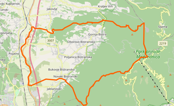
The problematic boundary in question: Way: Grad Zaprešić / Općina Bistra (1067231608) | OpenStreetMap
It seems to have all the proper tags and that it is added to all the necessary relations. However, when I try to plot it in R, it just doesn’t appear. Here is the code from R and image that is produced.
library(osmdata)
library(sf)
library(tidyverse)
theme_set(theme_classic())

bb <- getbb("Zaprešić", featuretype = "city", format_out = "polygon")

boundaries <- getbb("Zaprešić", featuretype = "city") %>%
  opq() %>%
  add_osm_feature(key = "boundary", value = "administrative") %>%
  osmdata_sf() %>%
  trim_osmdata(bb)

ggplot(boundaries$osm_lines) +
  geom_sf()
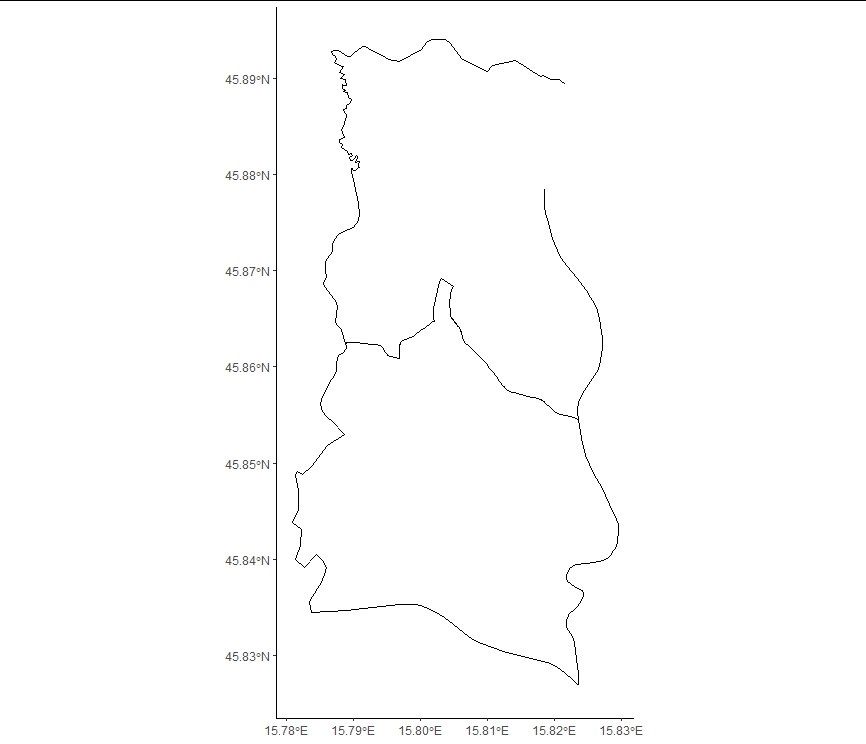
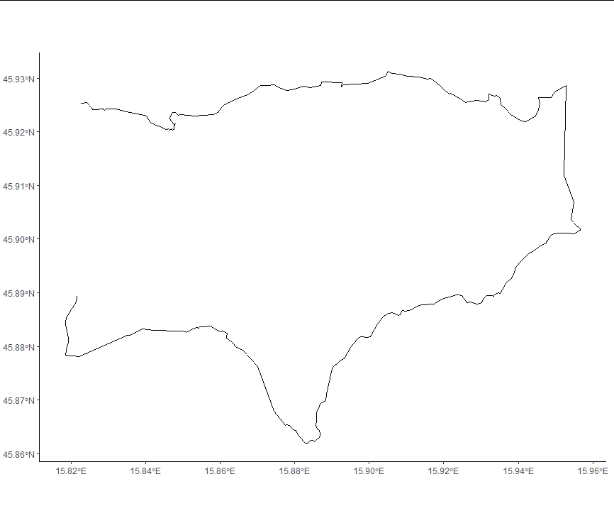
As you can see, the top right part of the border is missing. It is likewise missing in the neigbouring municipality of Bistra:
bb <- getbb("Općina Bistra", featuretype = "city", format_out = "polygon")

boundaries <- getbb("Općina Bistra", featuretype = "city") %>%
  opq() %>%
  add_osm_feature(key = "boundary", value = "administrative") %>%
  osmdata_sf() %>%
  trim_osmdata(bb)

ggplot(boundaries$osm_lines) +
  geom_sf()
On OpenStreetMap both Zaprešić and Bistra look like their border is fully defined:

So I am wondering what’s wrong and what is missing here. Any help would be appreciated!