I would like to see how much Mapillary imagery helps OpenStreetMap. My first attempt at this analysis is here, but it has the serious mistake of not accounting for changesets. I would like to correct that error and look into changesets. As an example, I looked at Lithuania’s GeoFabrik page.
The line I find most relevant:
- .osc.gz files that contain all changes in this region, suitable e.g. for Osmosis updates
The .osc.gz link leads me to:
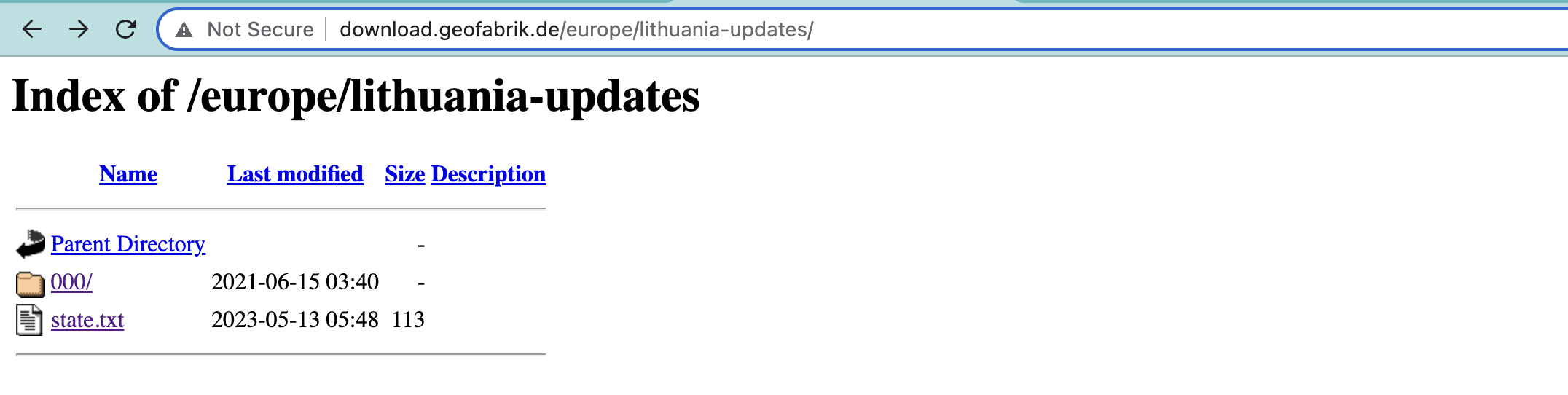
where state.txt is:
# original OSM minutely replication sequence number 5572108
timestamp=2023-05-12T20\:21\:24Z
sequenceNumber=3693
and 000/ contains the empty directories of 001 and 002, and the non-empty 003:

If we download 563.osc.gz and descompress (curl http://download.geofabrik.de/europe/lithuania-updates/000/003/563.osc.gz -o 563.osc.gz, then gzip 563.osc.gz --decompress), we get 563.osc. First few lines:
<?xml version='1.0' encoding='UTF-8'?>
<osmChange version="0.6" generator="osmium/1.14.0">
  <modify>
    <node id="32083700" version="25" timestamp="2023-01-02T20:10:26Z" uid="0" user="" changeset="0" lat="54.6681112" lon="25.2388765">
      <tag k="highway" v="motorway_junction"/>
      <tag k="name" v="Tūkstantmečio g."/>
    </node>
    <node id="56619670" version="4" timestamp="2023-01-02T08:23:47Z" uid="0" user="" changeset="0" lat="54.7106057" lon="25.3659565"/>
    <node id="56619671" version="4" timestamp="2023-01-02T08:23:47Z" uid="0" user="" changeset="0" lat="54.7104167" lon="25.3655478"/>
    <node id="101293595" version="21" timestamp="2023-01-02T20:07:43Z" uid="0" user="" changeset="0" lat="55.3669568" lon="23.8882335">
      <tag k="crossing" v="uncontrolled"/>
      <tag k="crossing:island" v="no"/>
      <tag k="highway" v="crossing"/>
    </node>
    <node id="249526548" version="12" timestamp="2023-01-02T08:23:47Z" uid="0" user="" changeset="0" lat="54.7126483" lon="25.3739687"/>
    <node id="266373801" version="4" timestamp="2023-01-02T15:04:09Z" uid="0" user="" changeset="0" lat="54.7025542" lon="25.2678349"/>
    <node id="266373802" version="4" timestamp="2023-01-02T15:04:09Z" uid="0" user="" changeset="0" lat="54.7026282" lon="25.2676597"/>
    <node id="266373803" version="4" timestamp="2023-01-02T15:04:09Z" uid="0" user="" changeset="0" lat="54.7026471" lon="25.2670489"/>
    <node id="266373804" version="3" timestamp="2023-01-02T15:04:09Z" uid="0" user="" changeset="0" lat="54.7025945" lon="25.2665295"/>
  </modify>
  <delete>
    <node id="266373805" version="4" timestamp="2022-11-06T07:23:49Z" uid="0" user="" changeset="0" lat="54.7025665" lon="25.2666452"/>
  </delete>
  <modify>
    <node id="266373808" version="4" timestamp="2023-01-02T15:04:09Z" uid="0" user="" changeset="0" lat="54.7022033" lon="25.2660959"/>
    <node id="266373809" version="4" timestamp="2023-01-02T15:04:09Z" uid="0" user="" changeset="0" lat="54.7019941" lon="25.2663473"/>
    <node id="266373810" version="4" timestamp="2023-01-02T15:04:09Z" uid="0" user="" changeset="0" lat="54.7018598" lon="25.2665701"/>
    <node id="266373811" version="4" timestamp="2023-01-02T15:04:09Z" uid="0" user="" changeset="0" lat="54.7017539" lon="25.266781"/>
    <node id="266373812" version="4" timestamp="2023-01-02T15:04:09Z" uid="0" user="" changeset="0" lat="54.7017206" lon="25.2668672"/>
    <node id="266373813" version="4" timestamp="2023-01-02T15:04:09Z" uid="0" user="" changeset="0" lat="54.7017328" lon="25.2673217"/>
    <node id="266373814" version="4" timestamp="2023-01-02T15:04:09Z" uid="0" user="" changeset="0" lat="54.7017784" lon="25.2674612"/>
    <node id="266373815" version="4" timestamp="2023-01-02T15:04:09Z" uid="0" user="" changeset="0" lat="54.7018759" lon="25.2676558"/>
    <node id="266373816" version="4" timestamp="2023-01-02T15:04:09Z" uid="0" user="" changeset="0" lat="54.7020041" lon="25.2679182"/>
    <node id="266373817" version="4" timestamp="2023-01-02T15:04:09Z" uid="0" user="" changeset="0" lat="54.7021039" lon="25.2678356"/>
    <node id="266373818" version="5" timestamp="2023-01-02T15:04:09Z" uid="0" user="" changeset="0" lat="54.7021954" lon="25.2677495"/>
    <node id="266373819" version="4" timestamp="2023-01-02T15:04:09Z" uid="0" user="" changeset="0" lat="54.7022408" lon="25.2677484"/>
    <node id="266373820" version="4" timestamp="2023-01-02T15:04:09Z" uid="0" user="" changeset="0" lat="54.7023579" lon="25.2675678"/>
    <node id="266373821" version="4" timestamp="2023-01-02T15:04:09Z" uid="0" user="" changeset="0" lat="54.7024179" lon="25.2675946"/>
    <node id="266373822" version="5" timestamp="2023-01-02T15:04:09Z" uid="0" user="" changeset="0" lat="54.7024073" lon="25.2677976"/>
    <node id="266373823" version="4" timestamp="2023-01-02T15:04:09Z" uid="0" user="" changeset="0" lat="54.702462" lon="25.2678543"/>
    <node id="266373824" version="5" timestamp="2023-01-02T15:04:09Z" uid="0" user="" changeset="0" lat="54.7024963" lon="25.2678598"/>
    <node id="267148401" version="3" timestamp="2023-01-02T11:27:28Z" uid="0" user="" changeset="0" lat="54.7035275" lon="25.29938">
      <tag k="noexit" v="yes"/>
    </node>
Which seems nice. The .txt files are similar to the one quoted above. To proceed successfully, it seems I need to understand though how these osc.gz files are structured.
Based on what logic OpenStreetMap edits end up in 563.osc.gz, or another file, ie 564.osc.gz? I am interested in how this path structure is set up, and what changes go to each file.