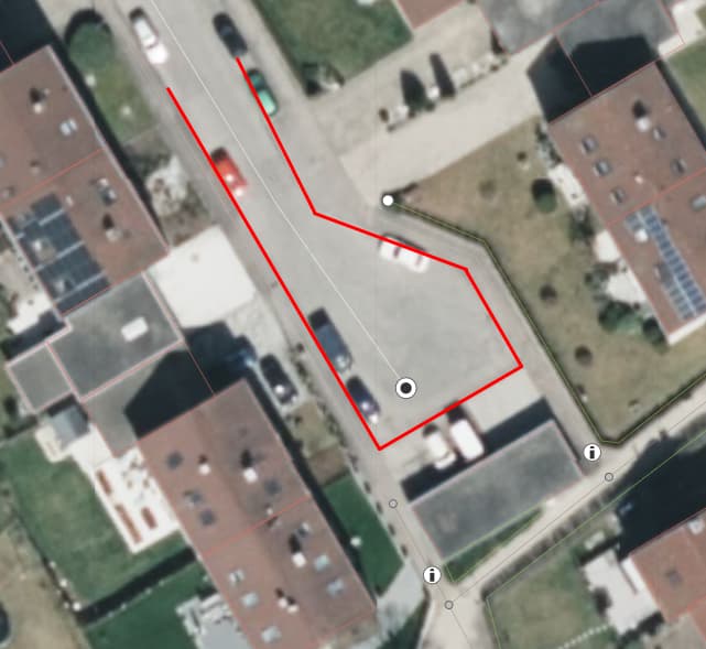
I’ve been trying to find if there is a option for a turning circle for like half a square. As you can see in this picture I have outlined the road in which cars are allowed to drive and turn around in red:
In my city and probably a few other cities this kind of Turning “Circle” is quite common so I have been trying to search for something like this on the Wiki Page for Turning circles. I have not been able to find something like this tho. The closest I managed to find was the square one which you can see on the page.
This isn’t exactly what I am looking for tho as for the turning circle I am searching for one side (either left or right) would have to be removed as you can see in the first picture. If anyone could help me further that would be very nice, thank you.
We always have to do some level of abstraction when transferring real world objects into the OSM data base. Concerning the type of turning circle, the wiki could be expanded. Maybe just wait for some more mappers to chime in to find a good value for those kinds of circles.
There is Key:area:highway - OpenStreetMap Wiki which can be used to map the actual extend of a road, but this is not routeable, rarely rendered and is only to be used in addition (!) to the “classic” highway mapping.
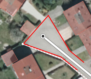
Another option could be turning_circle=triangle as the half square has roughly a triangular shape. This tag is used 4 times. Anyhow I believe tagging the shape of the turning circle is not very important and does not add too much value to the database.
If you believe it is helpful to add detailed information about the exact shape and size (!) of a turning circle you can tag highway=turning_circle for the routable way and then draw the exact area and tag it as area:highway=turning_cirle as already suggested by @highflyer74 .