Agree on that (including above mentioned exclusion of sidewalks and roads). Only open point, what about sections with multiple routes? Should they get name=name_A;name_B or no name and only route-relations?
Excatly this was what I was talking about. Though first case might only be occuring rather seldom in the US.
I also think of these as corner cases for hiking trails, but they do happen so we should consider them if attempting to develop guidelines. I’m also not confident that this sort of thing is definitely always a corner case for all US hiking and walking trails. It is definitely more common for multi-use and bike trails (see several of the examples @1ec5 posted).
This is a good point, and I agree. It’s really about the current primary identity of the path, not the reason it was built in the past. Although being purpose built for the route would generally lead to the path having the route name as a primary identity, upon reflection I realize I was just using that as a proxy.
I don’t know if it’s actually that rare. If there is anything potentially regional here, I think it’s that folks on the East Coast enjoy a concentration of long-distance trails that are so well-known that people use their names for wayfinding, even on the spot. Even though the Buckeye Trail is well-known among backpackers in Ohio, and the American Discovery Trail isn’t quite obscure, these names matter more to people who are deliberately following these routes than to day trippers who are hiking locally or enjoying a park that’s connected to the trail.
I’ll obnoxiously apply another road analogy: many of these long-distance trails remind me of state scenic routes and National Scenic Byways. Regardless of whether the individual component roadways have names, the scenic route exists more for route planning (tourism! economic development!) than for wayfinding.
This reminds me that someone tagged the names of Minnesota’s scenic routes all over that state’s highway ways. I don’t think a user should be told to hang a left at “Amish Buggy Byway/Laura Ingalls Wilder Historic Highway”, which is really just an unnamed portion of U.S. 52.
3 Likes
Further to the east, beyond the Atlantic Ocean, in a small village in the Alps, where two long-distance-hiking routes cross, which are dutifully signed and one even dutifully trailblazed (at leas in the woods), nobody ever would go walk their dog on the stretch of “Jakobsweg” or “Via Romea” (the long distance trails) hat locally we call “Lansersteig” or “Schlosssteig”. Neither - where there are just nameless paths.
@ConradWard - Here (Austria) there are a lot of short trails, created, maintained and signed by different bodies, route=foot rather than route=hiking, if that makes a difference for anybody. The local community does not mind having them on the ways, after all, that is how they are known.
Not for every part of every route, however. I doubt Hanover, NH residents would say they took the Appalachian Trail (AT) to work just because they walked down this section of West Wheelock Street sidewalk. They certainly would say they went for a quick afternoon walk on the AT when referring to this nearby section through the woods though. It turns out the AT traverses about 2 miles of sidewalks and crosswalks between Norwich, VT and Hanover, NH. That’s not such an edge case after all.
1 Like
Adding an example to my above point:
I have been hiking around Mt Hood and was wondering about the naming in OSM (though haven’t touched anything). In my understaning, the loop-trail should have name=Tinberland Trail and ref=600. Additionaly there should be a route-relation with similar name and ref (which is existing). Some sections are used as well by the Pacific Crest Trail, so there should be as well a route-relation with name=Pacific Crest National Scenic Trail and ref=2000, though the name of the way (in my understanding) should follow the local trail, since this is the name locally the trail is usually refered by.
Area in OSM: OpenStreetMap
Edit: Btw. in my opinion also a good sample why a hiking-focused data consumer needs to dig into route-relations to properly display hiking paths.
Thanks for the reminder, I keep meaning to fix these.
1 Like
If you ask hikers and locals question “how this hiking route is named” at least hikers would answer Foobar Route.
If you ask hikers and locals question “how this path is named” at both answer that it has no special name.
Then in such case named hiking route with name=Foobar Route goes on unnamed path.
Maybe in USA this is very rare. It definitely happens in Europe.
They would likely be confused and ask which country you’re visiting from because the grammar in both examples is horribly wrong (which of course is perfectly expected when English isn’t your first language). No hiker in the US would the phrase “hiking route”. It doesn’t make sense linguistically or logically, which is likely why we’re having this discussion. They are “hiking trails”.
You would say to a hiker or local, “what trail am I on?”, and they would say (example) “You’re on the Appalachian Trail!”. Or if two long distance trails are concurrent, they might either say “It’s both the Long Trail and the Appalachian Trail in this section” or they might just say name of one of the two.
If the Appalachian Trail traversed a sidewalk and you asked a local “what trail am I on”, they would probably be confused because you’re on a sidewalk and not a hiking trail, or possibly think that it was some kind of trick question and you’re trying to hustle them. Or they might think you’re playing some kind of trivia game (“did you know that this bit of sidewalk is actully part of the Appalachian Trail?”)
Now, you MIGHT ask something like “does this section of the Appalachian Trail go by any other name?” And then you might get some answer like “oh yes, this part is also the XYZ Trail, because the XYZ Trail was already here when the Appalachian Trail was built, so they just had it use the existing trail.”
If the nomenclature and language I’ve used is confusing, that’s because the distinction that you’re drawing between route names and path names is in fact very weak at best in real world usage. Basically, there is no difference and we’re just kind of handwaving to say “ehhh this one is long enough that we should probably model it with a route relation rather than just a series of highway=path ways.”
I would encourage you to look at how the Appalachian Trail (one of the longest long distance trails in the US) is described in English Wikipedia. In short:
The Appalachian Trail , also called the A.T. , is a hiking trail in the Eastern United States, extending almost 2,200 miles (3,540 km) between Springer Mountain in Georgia and Mount Katahdin in Maine, and passing through 14 states.
Now, it is clearly a route=hiking at that length, but we might also describe a short path of a few miles or less in a local nature preserve as a “hiking trail” in normal English usage.
So, in short, US English vernacular draws no distinction between hiking trails that are 1 mile long versus ones that are thousands of miles long, and “route” is not really a concept that we have linguistically.
3 Likes
In other words, wherever there’s a gap in dedicated off-road facilities, the trail’s managers or route log don’t prescribe exactly which sidewalk, crosswalk, or parking lot aisle you need to follow to follow the trail. It’s much too specific for a long-distance trail.
We specify these details because our data model requires a contiguous linear path, rather than a collection of trees and poles that happen to have blazes on them, but you could make a point of walking on the grassy verge or the middle of the street for all the organizers care. Yet a long-distance trail is still a route, when you zoom out a bit metaphorically.
Can we find another example? I think the Appalachian Trail is a bit of an outlier. Few trails are so famous. I wouldn’t be surprised if the trail has even lent its name to nearby streets.
I don’t quite agree. A long-distance trail is different in nature than a dedicated physical trail. It’s a technical distinction that relies entirely on intuition. Pointing at the ground and asking “What is it?” is silly and doesn’t help at all, because no normal person would care about this distinction.
Perhaps an extraterrestrial visitor can pick up on the fact that one tends to hike or bike on a dedicated trail but follow a long-distance trail as it in turn joins, continues on, and forks from a road, path, or dedicated trail. Or that many long-distance trails are marked by Reuleaux triangles or blazes, and one can order a guide book from a non-profit association. Or that a route log might refer to some trails by name and others by descriptive terms.
In the US, for the sort of situation where you drive to a trailhead and there’s a blazed hiking trail that loops around the forest back to the parking lot, and the trail really serves no other purpose, would you still consider a route relation appropriate (even if it only has one member) or would most appers consider that unnecessary?
I saw a related exchange on the waymarkedtrails issue tracker: someone suggested that the map could show paths with the trailblazed tag, even if there isn’t a route relation, because otherwise people were mapping route relations “for the renderer”, and the response was (paraphrasing) that they should absolutely be mapping route relations and if the community disagreed that was to be discussed on the forum and documented on the wiki before a change would be considered.
I’ve seen quite a few named trails in North America without route relations, and I’m not sure if that’s because mappers generally agree they’re unnecessary, or if it’s more that no one’s got round to creating them yet.
1 Like
Seems likely. There certainly are businesses borrowing the AT name. That said, this particular street just looks like a typical mix up from our orange feline friend ![]() .
.
I don’t know if it’s appropriate or not, but it happens all the time. I’ve done it myself since it seems to be common practice. I just don’t want the presence of such a route relation used as justification for deleting the name off the way(s). With some OSM based trail maps pulling info only from relations and others only pulling from ways, trails basically have to be dual mapped like this if they are to show up on all the different maps. If using a route relation for a minor hiking loop like this were deemed inappropriate, then the criteria for where a route relation is appropriate in the US would become quite vauge. As @ZeLonewolf said above, “US English vernacular draws no distinction between hiking trails that are 1 mile long versus ones that are thousands of miles long”. They are both just called hiking trails.
The name of a way and the existance of a route-relation are simply two pair of shoes. Adding such route is as mandatory as anything else in OSM. ![]() Though adding such route-relation would be the global best practice.
Though adding such route-relation would be the global best practice.
If a way has a name, that name should be tagged in name of that way. If there is a hiking, biking,… route using that way, then in OSM this route is added as route-relation. If the route has a name, that name is tagged in name of that relation. The two names might be same or might be different.
2 Likes
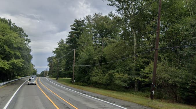
The North South Trail is a nearly 80-mile long trail that runs the length of the Rhode Island / Connecticut border, mostly on the Rhode Island side. I’ve personally surveyed the entire length of it while I was bored during COVID.
For a brief stretch, the NST follows US 6 in Foster, Rhode Island. In the snap below, you can barely make out the blue blaze painted on the telephone pole on the lower-right corner of the image.
Much further south at this location, the NST passes over the Ben Utter Trail, which is one of the named and blazed trails in Rhode Island’s Arcadia Management Area.
I’ve modeled the NST as a hiking route relation and the Ben Utter Trail just as a set of ways with a common name. Why is NST a “route” but Ben Utter Trail isn’t? Well, like Potter Stewart, “I know it when I see it.”
1 Like
New rule: OSM should have a route relation for each street by name.
Sounds extreme, right? Some folks thought so about the per-street “route” relations in Australia that were created to allow Wikimedia Maps to highlight them on a locator map. But this is clearly analogous to the route relations that many mappers have created to represent trails by name, presumably for the sake of a conveniently highlighted and detailed presentation on Waymarked Trails or OpenCycleMap, semantics be darned.
At least this was my motivation when I created route relations for local trails spanning 2½ miles (4.2 km), 4¾ miles (7.8 km), and 78 miles (125 km) back in 2011, after seeing that others had done the same. Whatever the developer thinks, I definitely was mapping for their renderer, and I don’t think I’m alone. No one should be removing name=* from these trails’ individual ways, because the relations are merely compatibility shims that technically shouldn’t exist.
3 Likes
This would be 100% consistent with the “one feature, one object” rule, provided that attributes which apply to “the whole street”, e.g. name, only appeared on the street relation.
That doesn’t make it a good idea, though.
2 Likes
Sure, and I like how you said “street relation” there. Who says these have to be route relations, other than the renderer?
1 Like
This discussion has been very interesting to follow. Regarding the original post, I certainly think that short trails should preserve name= on the ways. Relations are fine if some mapper really wants to, and might even be best practice, but are not required for such short routes and definitely don’t replace names on the ways.
But to continue digressing toward the broader name vs relation issues, I’d like to put forward an example near me that’s been the subject of some slow-motion edit wars to help with this:
The Backbone Trail is a regionally, but I don’t think nationally, well-known 70 mile long trail that traverses the ridge of the Santa Monica Mountains in Southern California (network=rwn). Along its route, it uses some trails, some wider, but unpaved, fire roads, and brief stretches of paved road. The naming in OSM can be sorted into a few broad categories:
-
Some portions follow another named way which clearly has a separate name, so
namedoes not contain “Backbone Trail”. This is most obvious when the trail follows a major road for a brief portion: this way is clearly called Malibu Canyon Road despite carrying the Backbone Trail. -
Some portions are only referred to, in speaking and by signage/maps, as “the Backbone Trail”. These are simply
name=Backbone Trail, like this way. -
Some portions are part of the Backbone Trail, but also have another identity. These are more murky, and their tagging has gone back and forth. Take for example this way. It seems like it has a separate name than Backbone Trail, Temescal Ridge Trail, but just happens to carry the Backbone Trail for a portion. You can tell because the name continues to the south when the Backbone Trail branches off. This is what it looks like on a map at the Hub Junction, at the north end of the way:
On this map, the Backbone Trail is just indicated by the red and yellow blaze along named trails it follows. I think this way should havename=Temescal Ridge Trail, but you can see the OSMnamehas gone through a few different values over the last few years, and is currentlyname=Backbone Trail - Temescal Ridge Fire Road, which seems like tagging for the relation-naive renderer. -
That one seems fairly cut and dried, but there are more complicated locations. Take the Etz Meloy Motorway, currently tagged
name=Etz Meloy Motorway (Backbone Trail)(aside: sometimes fire roads, usually taggedhighway=track, are called ‘motorways’ in Southern California, which is quite the OSM oxymoron). This seems like the same deal as the Temescal Ridge Trail above, but look at the guide sign along it!
I’d still probably leanname=Etz Meloy Motorwayalone, but it’s certainly ambiguous. -
Then there’s the portion near Sandstone Peak. The NPS map indicates it’s named “Sandstone Peak Trail”, with the Backbone Trail highlighted in orange:
Compare especially to the southeastern portion on this map, which was my second example above. That part is clearly named “Backbone Trail” on the map and also carries the Backbone Trail, whereas the central section has its own name. But here are the signs on either side of “Sandstone Peak Trail”:
This looks to me a lot more like the trail is named the Backbone Trail, with Sandstone Peak as a destination. That’s why I settled on tagging itname=Backbone Trail+alt_name=Sandstone Peak Trail, with an explanatorynote.


This ended up being long winded, probably because it’s been bothering me for a while. But I guess the summary is that on many US trails, the division between a route and a named trail is pretty ambiguous and hard to pin down. I think favoring the most local possible name as the best value for name is probably a good rule of thumb, but there will certainly be weird edge cases abounding, and local knowledge will be key. I think having hyphenated names or other separators is not to be encouraged unless it’s really clearly signed or referred to as such on the ground. That is what route relations are for, although it has the unfortunate side effect of hiding the route on naive renderers.
4 Likes
I’m slowly building a hiking map for Canada/US. This has been a fascinating thread to follow.
As a mapper, I’m focused on a single object at a time. When locals would call the thing I’m standing on “Trail X”, it feels right to me to duplicate the name onto the way even in the presence of a containing relation also named “Trail X”. My understanding (prior to this thread!) was that this was the consensus in Canada/US trail mapping.
As a consumer, I’m trying to unify locale-specific mapping norms, data coverage problems and data quality issues. I’ll do whatever I can to get something to show up. You could maybe argue that it’s nice to duplicate the name onto the way so that it lures the newbie in to OSM with a seductively simple seeming data model. I’d argue this isn’t tagging for the renderer, it’s tagging for a lower barrier to entry. Then, by the time the newbie understands that relations exist, it’s too late, and sunk cost fallacy has set in. (I speak from experience here. ![]() )
)