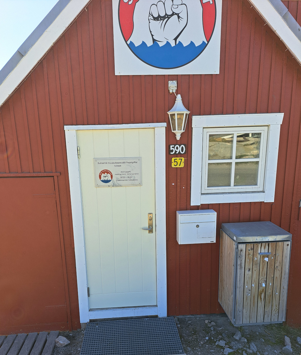
In Greenland, building numbers, “B-numbers” are seen on signs on houses, next to/above the street number sign. Photos of such B-number usage may be seen here.
In smaller villages, there will only by B-numbers. B-numbers reflect when a house was built, rather than where on the street it is placed.
In Greenland’s Grunddataregister a building will have:
- a B-number
- several GUID-like numbers
- a street number (or simply a copy of the B-number without “B-” if it’s in a small village)
In OSM, B-numbers are currently tagged in different ways, if at all. It seems different traditions have been used in different parts of the country. When I’ve tagged buildings, I’ve mostly tried to keep the tradition which seemed to be prevalent in the area.
Examples of how the B-number is tagged:
- In Qeqertarsuaq the name tag is used. Example.
- In Ilulissat, the ref tag is used a lot, alternatively the name tag. Example.
- In many places, addr:housenumber is used. Example. Unfortunately, this will often conflict with being able to use addr:housenumber for the street number.
- I’ve tried using addr:housename at a few places. Example.
I think it’s time to streamline it, because:
- New mappers in Greenland should be able to find a guide on how to map B-numbers. We can’t write a good guide, if it’s done differently at different locations.
- If we were to set up synchronization of addresses from Greenland’s Grunddataregister, we will need more consistent tagging.
I should mention that in some parts of the world, addr:conscriptionnumber is used, and it seems to work a lot like B-numbers in Greenland. Example.
What would be the best way to map B-numbers?
Different aspects to be considered:
- Even though - in principle - we don’t map for the renderer, I think it’s rather disheartening if we settle on a tagging scheme which is not generally displayed in major OSM renderers; also, if B-numbers aren’t shown in popular apps, there is less chance that folks will flag errors.
- The tag should not clash with other purposes. For example, quite a few buildings have signed names, and for such places, there would be contention for the name tag.
Some might argue that we should differentiate between the building and the address, but this would make it quite difficult to sync with the official registry (Grunddataregister) which does not seem to differentiate: It has house number and building number as two properties of the same address/building.
Personally, I lean towards the addr:housename tag, because I think it fits well semantically, and it also seems to render well in both the OSM’s default web map, in OsmAnd, and in CoMaps.
One aspect I haven’t properly investigated yet: Is there a searchability aspect to this: If we’d like for the OSM’s web map’s search engine to be able to search for B-numbers (for example), would some tagging be better than others?
Thoughts/comments?