Use height=*
Without height the renderers have to guess…
Yep, I think what Matija was trying to say is that the currect “guess” is too tall. I also think the standard (when no height is available) should be shorter.
There’s no support for layer tag yet
3 Likes
There is already a GitHub issue for that
3 Likes
Footways only have one material right now which is concrete. I really should add several more.
Roadways have much more variety for instance, there’s like 5 different materials.
First attempt at a water tower, building in me amateur hour, 6 floors before reaching the top reservoir, just think of the windows to be empty frames. Did not find any good mapped samples to clone and pilfer from, has to do for now, not even in the land of Audi, BMW and MB most were just 1 tag man_made=water_tower… enttäuschend.
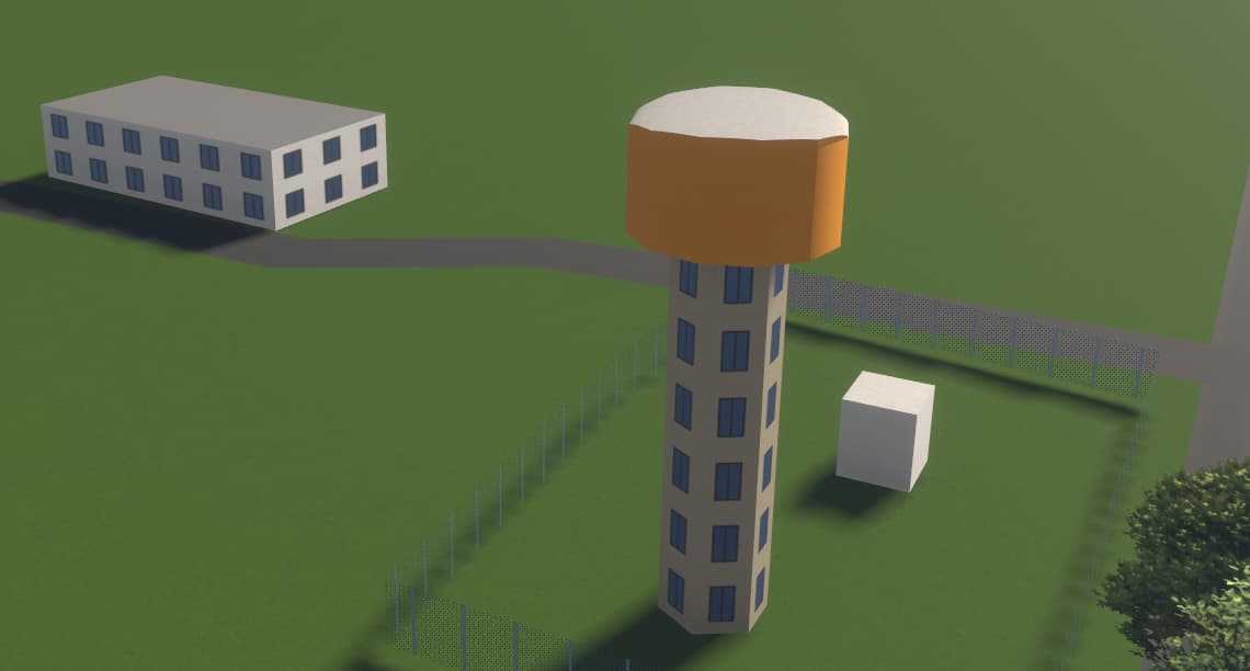
Yes the colorimeter did it’s job, the correct hues inclusive. The ground floor doors were tagged on all three structures, but they have to be imagined for now. No elevator, 6 flights of stairs to scale.
You shouldn’t use building:levels if there are not actually levels but rather height or est_height if it is only estimated.
4 Likes
Travis asks “are you talking to me?”
You wrote a couple of times you estimated heights:
but so far you tagged height=* only (describes the actual height of a feature), not est_height=* (the estimated height of an element). I agree with @westnordost, if Streets GL doesn’t support such tag, you could request it on the Github (like “Use est_height=* when height=* isn’t present”).
3 Likes
This tower is about 3KKM away from the one that would not render.
That tower is this one, isn’t it: Way: 1050262443 | OpenStreetMap ?
You wrote in the message that you added “height estim” but you tagged it with height=20, not est_height=20, that was my point. Hence my advice to open a issue in the GitHub, since I suppose you added those values for the renderer.
2 Likes
Today randomly arrived at a place of worship node /o religion, then did 1 big pancake they are in out of a town full of pancakes. Split the biggy in 3 parts, two student housing blocks and a retail area in between. Think there’s a bit more tagging to do here. Those who recognise the place, roll up your sleeves, don’t hesitate to put some levels and real roofs on there, the maple syrup on the pancakes so to speak.
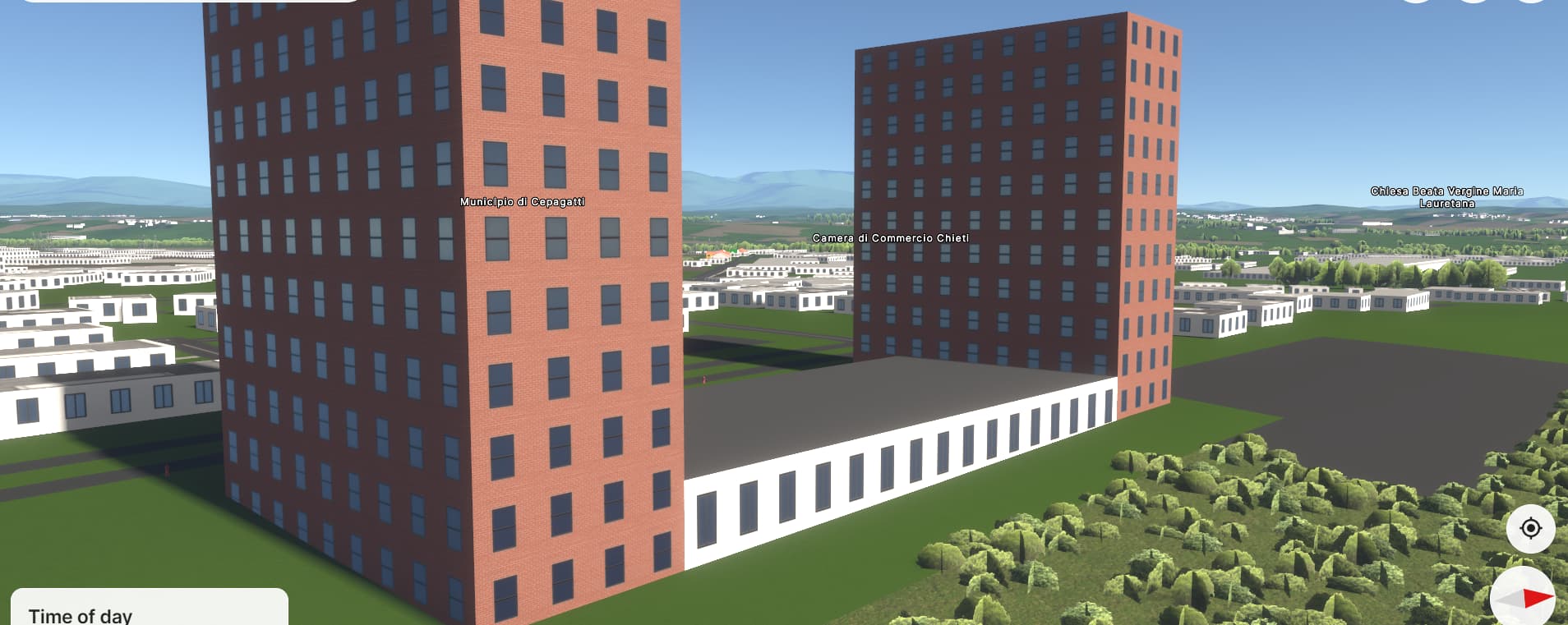
PS the names superimposed on the high rises actually belong to buildings 5-10km away from this location.
Personally I don’t find est_height= scalable as this requires a cumbersome est_min_height= and the roof:*= combinations to complement. Is roof:est_angle= needed for roof:angle= too? Random sources online or even signs and info panels (including rounding-off to nearest tens for 100ft+ and 100m+ tall buildings) may still be estimates, unless referring to drawings and measurements. It’s unclear when est_height= should become height= either.
Semi-topic-wise as some have called for more detailed road rendering, same problem is encountered in est_width= for the est_*= equivalence in parking:*:width= , shoulder:*:width= , width:carriageway= , etc. (already ignoring est_width:lanes= )
4 Likes
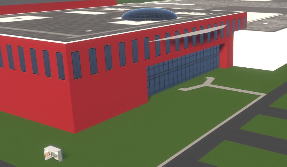
Got me receded glass facade and roof dome, bus stop, only need a parking filler and fountains to render, and a big totem with name tag to dot the i.
TBC
2 Likes
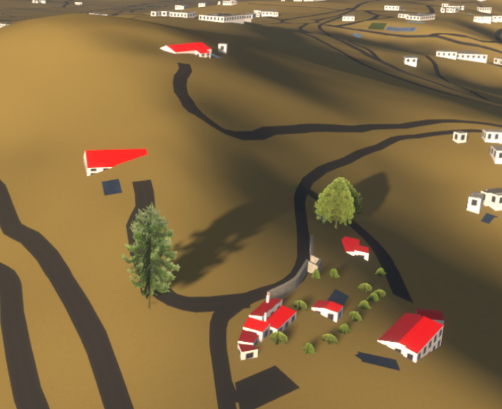
The ‘old’ village centre almost done, some roofs are reticent, splitting the sides did not work as sloped with orientation/direction turns flat so the roof_tiled, with default colour, look off.
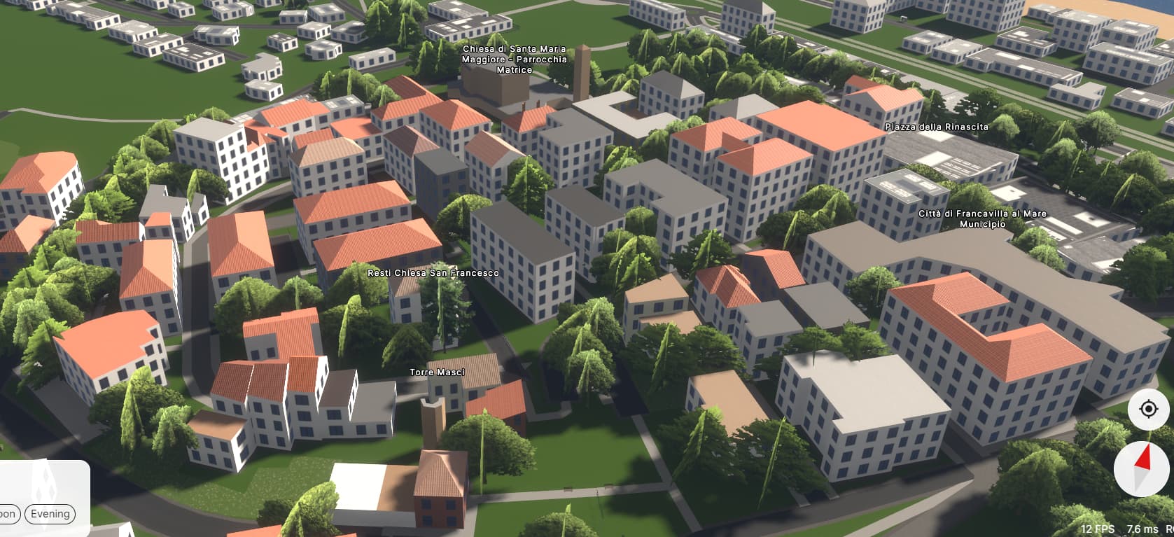
Some large buildings to be redone, base ground layer and a high centre, still fun seeing the progress near instantaneous, upload, Crtl+F5, 30 seconds.
TBC
PS Is it me, the trees without having added height estimates look a whole lot less ‘rising’
Edit: update image 2x after tweaking more buildings parts and adjacent building features. Church looks mighty fine now, no windows on the ground floor.
2 Likes
Looking really nice! I love to see the progress in my own area as well.
Btw, Ctrl + P reloads the tiles without reloading the whole application. Can be useful if you want to see the latest changes often.
12 Likes
If
- bandwidth is slim (got 6-7MB at best over the fixed copper line)
- and you keep Streets.gl in an open tab of your web browser
- and you don’t want the your mapping speed to suffer, mine does badly in JOSM,
Then set the ‘vertical field of view’ setting of SG as low as 8 or less. Before turning back to mapping zoom out and Streets.gl quickly switches back to the regular OSM carto view which stops the constant data fetching from the site. When done mapping and returning to SG to view the results just zoom-in a little to get the 3D picture back and with the previous post’s tip of Ctrl+P or Ctrl+p, presto pronto you’re back at the auwesome SG view.
2 Likes
It seems like est_min_height is never used, as are other tags with est_ prefix (except est_height). So it’s better to just use conventional tags.
est_height is also really unpopular, but Streets GL supports it.
2 Likes
Yup, programmed the ‘popular’ height tags into a JOSM custom preset with a select box for source:height=* which I’ve given a wrong default so as to force a choice of the origins (yes JOSM has great validations build-in). Happy as a clam.
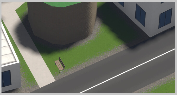
Meanwhile was tagging an historic tower, brick/stone, pattern visible in close up, on a grass covered and only now noticed the transition zone rendering from street and buildings to grass, not path and the bench has to go, is no more. Auwesomeness comes daily here.
keep it up
1 Like