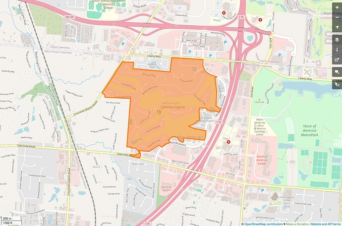
As a mapper, it isn’t for me to judge the ideology that produces this landuse. Urban planners have been discouraging car-centric suburban development for generations, but real estate developers are unfazed. They are in charge, and I can observe that they’ve built homogeneous landuse. If this is bad urban planning, let the map be a testament to that. Sometimes an old subdivision does get redeveloped, in which case the landuse area gets broken up and renamed, in the real world as in our world.
If you’re referring to the boundary relation I highlighted in that screenshot, this is a census-designated place. A CDP represents a populated place with name and a certain population density. Its boundaries would be defined in terms of roads among other things – yes, even Interstates. The U.S. community has always had an uneasy relationship with the CDP boundaries, because they don’t really correspond to anything on the ground. In some cases, the extent may not even align completely with what the name refers to according to locals. I bring them up here to show that place areas come with their own challenges.
The landuse area corresponds much more closely to the residential development, though it also connects to some adjoining roadways. Indeed, the local community used to join landuse areas to roadways as a rule, based on essentially the same reasoning that I described in this thread about boundaries, but applied to property lines. We’ve since abandoned this approach, but there are still a great many landuse areas to detach from the roadway and move to… well, no one can agree what to move it to, but something away from the roadway. ![]()
Is it a neighborhood? Maybe by some definition of neighborhood, but terms from traditional place hierarchies like hamlet/village/town/city or neighborhood/quarter/suburb are very difficult to apply meaningfully to American suburbia or even country-living developments like Lake Waynoka, which after all are designed to provide an artificial experience.
