Seemingly non selectable bike path map element

I am trying to edit a section of The Loop bike path in Tucson, AZ. In this small area, a new bridge was built, the trail re-routed and the old section completely removed. I managed to delete the old trail segments but there is still a solid blue line there that I can’t even select with a purple tag that says “90”.

Hovering over or trying to select that solid blue line does nothing. It just shows the hand icon to move the map around. Can you explain what that blue line is and how to get rid of it?

Thanks

1 Like

The blue line is probably on the background CyclOSM tiles. The way was removed but it didn’t rerender yet. Select a different background in the toolbox on the right.

2 Likes

Confirmed this. Here is the standard rendered view:

1 Like

Welcome to the project forum @Mike_Bianco_2. Looks like the tiles are updated now. However it looks like the ‘90’ in the screenshot is USBR 90, a national bicycle relation for United States Bike Route 90, a border-to-border route that is continuous through Arizona.

Your edit to the bridge looks to have broken the USBR-90 route relation. Do you happen to know if AZDOT has rerouted USBR 90 over the new (old) bridge? I figure you may have some on-the-ground insight here.

Let’s work with the community here to fix the broken relation. @stevea can you talk to Kerry about the question as to whether the route should be rerouted?

It would require an application (for realignment) from AZDOT to AASHTO for an actual realignment, and Kerry would have notified me of that if it were taking place in this (AASHTO’s Spring 2023) Round. As he and I are quite literally as of today (and over the next several weeks) endeavoring to incorporate these new (and realigned) routes into OSM (except for USBR 37 in Indiana, which I posted to talk-us [Talk-us] AASHTO publishes Spring 2023 USBRs “is available” for someone to enter), and a “bridge change in Arizona for USBR 90” was not among these changes / new route applications, it would be correct for the “original” (previous) routing to be re-established.

I can certainly do this, and will in the next few minutes, but meanwhile I’ll double-check with Kerry (and I doubt he’ll confirm these recent changes in Arizona). Thank you for posting this to the forum and calling to my attention. Stand by for Kerry’s response and my confirmation I’ve “re-established” 90 in Arizona to what AZDOT applied to AASHTO and AASHTO approved as the route.

The old routing no longer exists at all. It has been physically destroyed. This is a matter of a few hundred feet. Without knowing anything about USBR 90, I can 100% assure you that it has been re-routed to the new alignment as the old one is just not there anymore. Please don’t put it back…

Thanks, Mike, that is helpful, I almost DID put it back using my JOSM editor, even seeing in (fairly recent, Bing) imagery that the old routing’s infrastructure does appear to be destroyed.

What might be MOST helpful is if you can confirm if there are any “USBR 90 signs on the ground” which direct cyclists onto the NEW infrastructure. That would be a “slam dunk yes” that re-routing upon that is correct.

This is a mild ambiguity in how AASHTO and state DOTs “re-establish” changes / realignments to a USBR: the “old” (routing) infrastructure is destroyed and replaced with new, but no “realignment application” is made from the state DOT to AASHTO. It would be correct for AZDOT to do that, but as it hasn’t yet, it leaves this mild ambiguity in place.

I have asked Kerry “what to do?” here and await his reply. Meanwhile, I’m correcting my edit session to “incorporate the new” where the old is now “gaps in the route.” Again, please stand by for both: the “healing” of the route in minutes, Kerry’s reply might take a day or so, perhaps by early next week he might even have spoken with / emailed a circuit with AZDOT and has some news for us as to their plans with AASHTO (in the Autumn round?) We’ll see, and again, thanks for the heads up to me about this. We’re getting it right for now, we’ll get it even more right with AZDOT and AASHTO (depending on what they do and when) as that happens.

“Good save,” everybody.

I have ridden through that intersection at least 15-20 times over the last few months and I have never noticed a USBR sign anywhere. I just googled what one looks like and I have not noticed that anywhere along the route of USBR 90 in Tucson that I normally ride. I am a curious type; if I had seen one, I would have wondered what it was and looked it up, which I have never done.

Unfortunately, I had some back surgery last Friday (I am fine) and I am off the bike for a few months, so I can’t physically check for you, or I would…

Thanks for putting it back. And, you answered another thing I was curious about but did not quite understand, which is what does the OpenCycleMap layer provide and who can edit it…

Again, thanks for your “eyes on the ground,” as that is one of OSM’s most powerful set of skills at work, “local geo knowledge turning into data in our map (database).”

If you want to know more about the USBRS, check out United States Bicycle Route System - OpenStreetMap Wiki and a similar Wikipedia entry. You’ll see what the signs look like for each state where there is a route (thanks, @Minh_Nguyen!) Some states are admittedly “spotty” in their erection of signs (or failure to do so), it is said (by Kerry, others at ACA…) that “about 25% of the System is signed, this number is growing.” So, no surprise you don’t see signs. BTW, ACA (Adventure Cycling Association) is a long-distance bicycle touring advocacy group that works closely with state DOTs on getting their AASHTO applications (for new routes and realignments to AASHTO) ship-shape so they get Approved. Kerry is a sort of “architect” of the System and I work with him and Jennifer Hamelman (the USBRS Program Manager at ACA) in my/OSM’s efforts to keep the System in sync in OSM. There are two “Rounds” (Spring and Autumn) every year that DOTs submit to AASHTO and become “on ballot,” then when we get approvals, the routes become “official” in OSM. See also From Sandbox to Construction Zone to a Beautiful National Network of Bicycle Routes | OpenStreetMap US .

There remains a small gap in this “new, improved” USBR 90 in Arizona I can’t quite figure out: just east of the Santa Cruz River at Ina Road, there’s a tricky “cyclists must cross auto traffic” interchange I really don’t know how to express in OSM. That will simply have to wait for “more eyes on the ground” to remedy, but we’re mostly there for now.

Mike, I hope your back heals well. The OCM layer isn’t something “people edit,” rather, we edit “infrastructure” in OSM (like highway=cycleway segments and bike lane segments…) and we edit “routing” in OSM (relations of type=route, route=bicycle). When OCM “picks up these changes” (our edits, whether additions or changes), it will render or re-render these, and they’ll appear on that rendering.

Again, nice work, everybody. With forthright communication about all this, we can do it!

I know that intersection Ina Rd also. Cyclists do not have to cross auto traffic. This is my typical way through that intersection:

image

I can only do one media item per post, so two more posts coming in a moment…

You can also do this:

image

You can see my Strava paths through that intersection here:

image

Thanks for the other info and links. Very interesting stuff.

Mike

Hmm, when crossing the bridge, there is one-way traffic for automobiles. Is this also true for cyclists? In other words, do cyclists have to use the “top” bridge for westbound and the “bottom” bridge for eastbound?

1 Like

Ah, it looks like “I am corrected,” at least “above” (north of) the West Ina Road bridge’s westbound auto traffic segment, there is (new?) bicycle infrastructure, I’m guessing highway=cycleway would be the correct tag. Is this right? Or maybe there are even TWO such “bicycle bridges?”

So, both sides of the bridge have narrow walkways - wide enough for one bike only. There are no signs to direct you through this, so you are kind of on your own.

The typical usage is to always use the eastbound south side of the bridge. If you are heading north (going west over the bridge) you always take the walkway.

If you are heading south (going east over the bridge), as you make that sharp right hand turn, you look, and if there is someone coming at you on the walkway, you drop out into the shoulder of the road. If it’s clear, you take the walkway.

All of this is at least a few years old. I’ve only been here for 3 years and I don’t think this intersection has changed in that time.

Pondering now. I think I can make this work in OSM as you say and will confirm when I do. Maybe an hour or two as I’ve got something else going on.

OK, USBR 90 https://www.osm.org/relation/5509062 , at Ina Road around Tucson, because it is now “double-routed” (both north side and south side of sidewalks/cycleways of/at/near/on the bridge) is “better” than it was, as it no longer has a gap. In fact, it has TWO methods by which the river may be crossed here.

Call it a “better first draft,” anybody is welcome to further improve this in OSM, especially if you’ve got “eyes on the ground” data to offer.

Pretty neat the way that in just a few hours, from the east coast, to Arizona, to California to even Estonia (!) OSM collaborates on our data to improve it. And we’ll hear from Kerry (Michigan), or maybe Jenn (Oregon) and/or AZDOT (Phoenix) and/or AASHTO (Washington, DC) over the next days/weeks/months and it will simply get better and better. Good ol’ OSM!

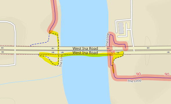
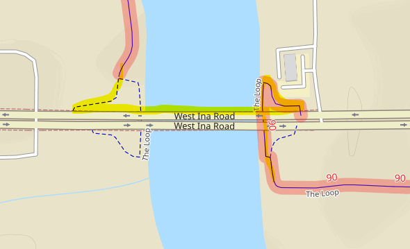
I discover there are other gaps in 90 (e.g. East Irvington Road, Rillito River isn’t clear). It shouldn’t take a skilled route mapper more than minutes here-and-there to “heal” these. I can do it (next week?), others can, too. So, getting “the first one done” like this puts us on a roll.

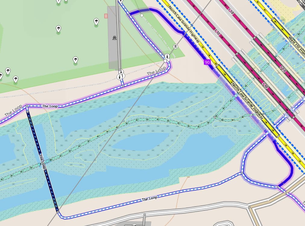
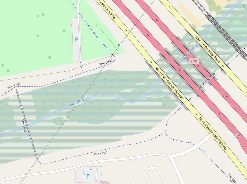
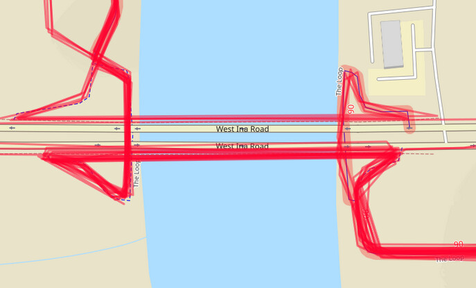
A short version of (one thing that’s) going on here (in addition to infrastructure demolition and re-routing on new) is that so-called-locally “Loop” infrastructure (at regional, network=rcn level) is partially replacing existing USBR 90 (national, network=ncn) infrastructure. The two choices are to either “subsume” (sometimes a USBR will “absorb” a regional route) or to “co-exist as concurrent” where routing in both networks exists. In OSM we do concurrency by repeating membership of the underlying infrastructure way in both relations. Many renderers / routers are smart enough to “pay attention to both” (or more) where you might get “purple and red” routing (and numbering), for example (representing in OCM, both regional and national routing). It isn’t clear whether a regional route can “subsume” a national one, so OSM will wait to see what ADOT might say about the USBR, while OSM maps things as “the physical connectivity that must exist upon the ground.”

Postscript (April 29, 2023): Kerry says

“ADOT will update the USBR 90 route as they see fit. It…is in the hands of the DOT…to make these corrections.”

Meanwhile, OSM “sees fit” to “map what is on the ground,” especially as local cyclists ride it, even as there are no (USBR 90) signs directing cyclists to or on a particular route. If this means that existing routing is broken as previously-USBR-routed infrastructure is demolished, then OSM will (does now, actually) re-establish routing connectivity by using the newly-built “replacement” infrastructure, even if/as ADOT has not (yet) applied to AASHTO for this/these specific realignment(s).

Of course, if/as ADOT does make an application for realignment and AASHTO approves this, OSM will hew to the AASHTO-approved route (as we always have so far). Eyes remain wide open here, as “the ball is in ADOT’s court” while OSM is in both “listening mode” and “routes (90) as what is physically connected.” A few eraser crumbs to be blown away and sketched anew, is all. We’ve seen similar.

Final update (May 1, 2023): Elaine Mariolle (ADOT) with concurrence from Jenn Hamelman (ACA) say
“I think this has to do with the road construction that is taking place over the next couple of years. …We’re moving ahead on USBR 90 but it is slow… We haven’t forgotten - progress is just slow at our end.”

Again, really nice collaboration, everyone. “Many hands make light work!”

1 Like