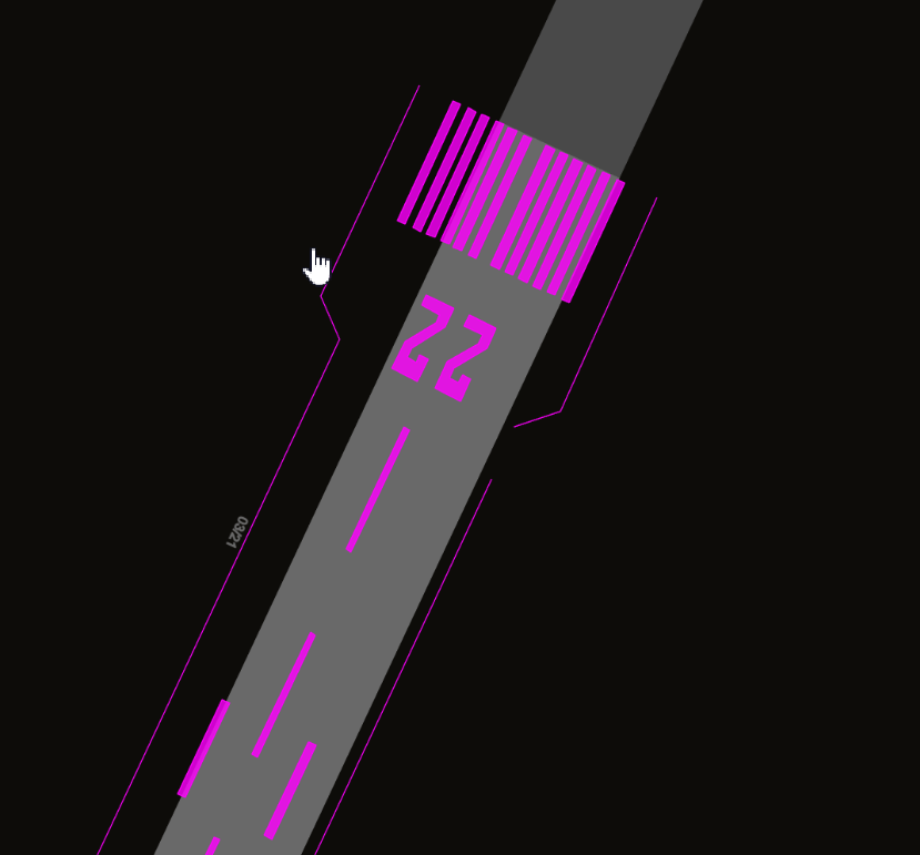
I came across of an airport on iceland (OpenAirportMap: BIEG) and found many elements tagged with aeroway=marking.
Is that really supposed to be tagged that way?
I came across of an airport on iceland (OpenAirportMap: BIEG) and found many elements tagged with aeroway=marking.
Is that really supposed to be tagged that way?
Literally drawing in the marking outlines goes against the basic guidelines of OpenStreetMap. If someone wanted to devise a mapping scheme for runway markings, I would recommend only considering things like the threshold markings, aiming points, and the touchdown zone markings for tagging as nodes on the aeroway=runway way (which already represents the centre line) with suitable tag-values.
Actually drawing them is an impressive effort, but not very useful (they lack tags that indicate what they represent) and just a runway paint job away from becoming obsolete.
Good point! I will not delete it but it’s good to know that nobody should be encouraged to do the same.
I can confirm drawing runway markings makes no sense at all. Runways are normally marked depending on the available type of approach system. There are standards with slight regional differences.
I don’t see how it “goes against the basic guidelines of OpenStreetMap”. As long as they do not misuse tags intended for something else to make it show up on some particular map (i.e. mapping for the renderer), this appears to be perfectly factual, verifiable information about the reality on the ground, and therefore eligible to be mapped in OSM.
But would you draw road markings…? Runway markings are even more standardised across the globe.
I probably wouldn’t consider that a good use of my time, but that is very different from a claim that mapping these markings goes against OSM’s guidelines. I would even say that not having notability requirements is among the basic principles of OSM.
If runway markings are indeed sufficiently standardized that it’s possible to produce these shapes automatically, then it would be great if someone built a renderer (or pre-processing software) with that ability built in. If you can show people who want to draw markings that there already exist maps / 3D models / flight simulators / … based on OSM data which show the markings perfectly without the need to map them by hand, I suspect it won’t be hard to convince them to spend their time on something else.
which principle do you have in mind? Personally I never mapped these but I do not see why it cannot be done. (I do not want to encourage anybody to do it, just questioning the reasoning)
Yes, we probably should draw some of them, e.g. those areas (not necessarily the individual lines) that mark surfaces where you are not allowed to drive on (diagonal hatches in many countries)