I’d say, the “path” up Mount Everest deserves “highway=mountaineering”. Such a key would be perfect, to fix the note you placed there, wouldn’t it?
1 Like
not entirely sure - is there even a strict route there? Or various group using navigation markers (like dead bodies) and route is not constant?
From the frequency, there should be a path better visible than in the picture of yours from Poland. On snow, a single person can make a path of great visibility. From what I know, on a lot of the ascent to Everest there are fixed ropes, so people do not stray so much. You certainly have seen the photo of the queue. Visitors only use it seasonally, no idea, if there is a path out of season.
PS: for OSM trail_visibility key values trail blazes do not factor in. This was deliberately decided when coining the key.
“Path or next marker always visible, but sometimes has to be searched for” - Key:trail_visibility - OpenStreetMap Wiki
Also, it seems that it used to be described differently - https://wiki.openstreetmap.org/wiki/Talk:Key:trail_visibility#highly_confusing_tag
Funny, the SAC scale https://www.sac-cas.ch/fileadmin/Ausbildung_und_Wissen/Tourenplanung/Schwierigkeitsskala/Wanderskala-SAC.pdf does not mention this. They only talk about the “Trassee” (trail) visibility on the ground (OTG), and that does not include markings. Many taggings in OSM then are wrong, as only ways that are not trail_blazed can be anything but “excellent” or “good” in OSM.
So I messed up here. But I never understood, why the sac_scale tag and the trail_visibility got separated, it was very late in the proposal process, to make tagging more OTG, seems to be the opposite came to be.
Broadly I’m in favour of the idea, although probably in the highway=mountaineering form. However, there are other similar “routes” which aren’t continuous marked paths, but may be extremely well known by people interested in them:
- Traditional alpine routes. Hoernligrat, Matterhorn Nordwand, Brenva Arete, Eiger Nordwand. These would typically be graded by traditional alpine scales F/PD/AD/D/TD/ED (French) /WS/ZS/S/… (German) or their equivalents in other countries. Some at the lower end may also be graded with SAC scale, or parts of the approach could use this tag.
- Expedition style ascents in the Himalaya, Andes etc. I’m not aware of any traditional grading for these, and their nature is completely different if one is making the first ascent in season, leading, guiding or being guided. The classic example is Everest via the Western Cwm and South-West Ridge.
- Alpine style ascents in distant ranges. Again I’m not aware of gradings, but keen amateur mountaineers may attempt peaks of 6000m & over (I know at least one OSMer who has done this).
- Mountaineering ski tours: with ascent & descent. Obvious examples of well-known routes are the Haute Route & the Patrouille des Glaciers.
- Downhill ski routes which lie beyond typical off-piste descents. The Mer de Glace is a well-known example with few difficulties, but many objective hazards. It is usually skied with a guide. In the Chamonix valley there are hundreds of these routes, some of which are not only technically very demanding, but involve severe objective dangers. A number of published guides are available for various favoured locations in the Alps, but in other locations knowledge will be limited to the local enthusiasts.
- Bushwacking hiking routes in back country. This applies in particular to parts of North America, Australia and New Zealand, but there are also plenty of places even in Europe (e.g. NW Scotland). I presume in tropical countries where vegetation grows fast there are well known routes which require use of a machete to traverse.
Ideally I’d like a solution which also encompassed the ability to tag these other options. highway=mountaineering would cover most of them (
1 Like
Changed topic to trending terminology. First sentence in post above referenced the old title “Sport=Mountaineering”.
1 Like
Tagging paths indeed needs some improvements. It would help if OSM database recognizes that difference among walking path, hiking/mountaineering trail and alpine climb is significant and required different type of highways instead of subtle and often hard to understand, implement and render decorations with additional tags.
Situation with tagging paths is like if we have just one type of highway for the all roads and then have do make distinction using additional tags. For roads that is not the case. Various types of roads are recognized as different highway types which is logical, useful and very helpful. Same should be with various types of paths. there should not be just one type of path highway.
I would not worry much about updating existing data. If tagged correctly, most of them could be automatically updated to new highway types.
That would also make some force one renderers to pay more attention to rendering such highways. For start, all those that do not render them properly now, would stop rendering them at all, as that would be new highways, they do not recognize - until they update, meaning pay attention.
Other than resolving issues like this which initiated discussion, it would help properly tag all other pedestrian ways, especially in rural and mountain areas. It seems like that people who designed highway tagging scheme did not pay much attention on way objects other than regular urban traffic. Tagging pedestrian ways out of urban areas is quite lacking.
So, I would gladly vote for adding new types of highways to differentiate walking paths, hiking/mountaineering trails and alpine climbs as such. Those three I meet regularly but I guess there are more types that could be considered too, as others already pointed out.
3 Likes
Situation with tagging paths is like if we have just one type of highway for the all roads and then have do make distinction using additional tags.
no it’s not, we have footway, cycleway, bridleway, pedestrian, via ferrata and path…
And in the ancient times of OSM the proposal for path wanted to replace footway, cycleway and bridleway so until today it’s often equivalent and the wide definition can mean all or nothing
1 Like
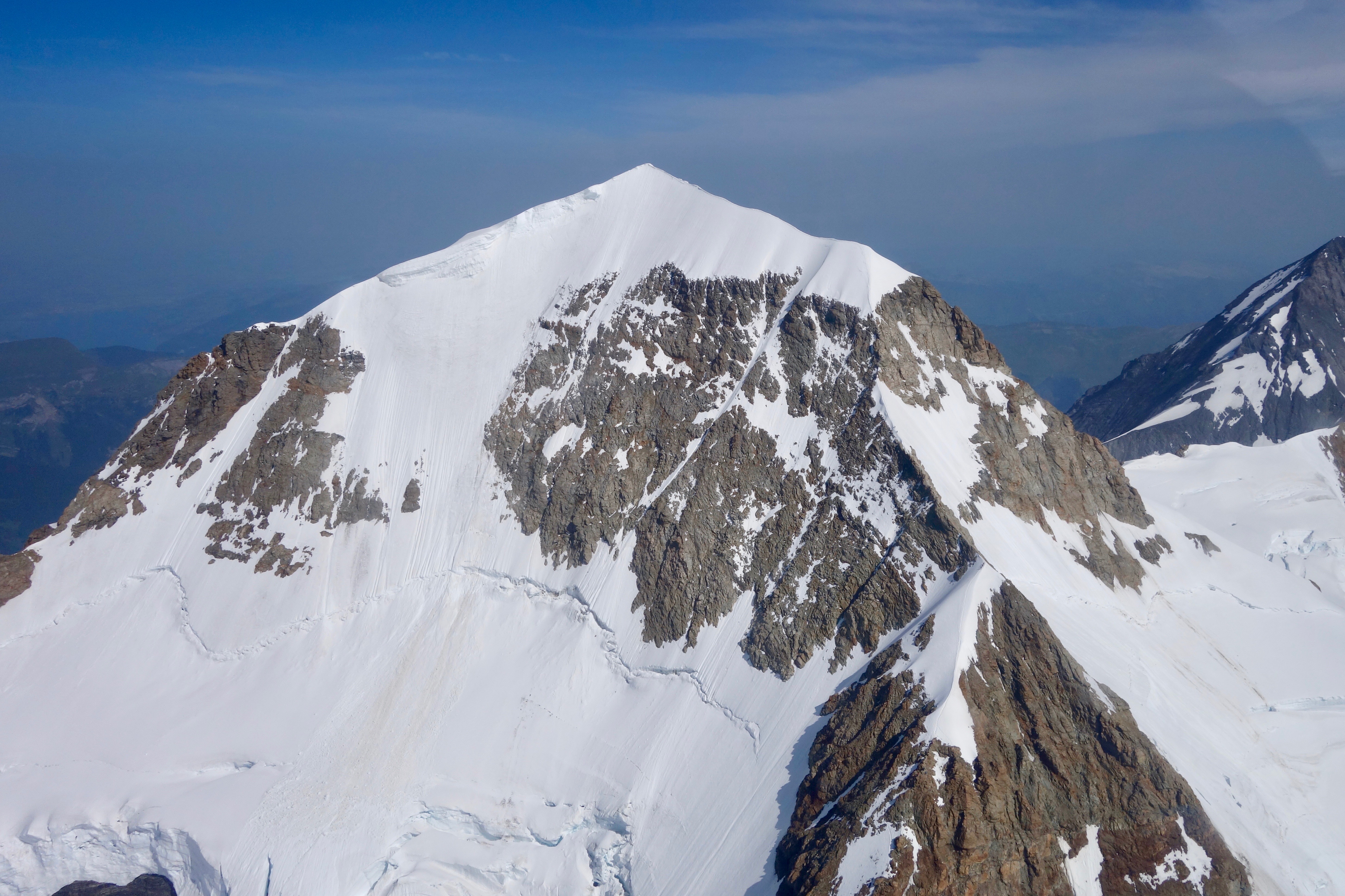
I am constantly perplexed, why data consumers consider what is mapped as highway=path an easy walk or even something, where you can ride a bike on. From the Prosecco Bar to the summit of Mönch, OSRM gives 41 minutes - OpenStreetMap - whereas https://www.sac-cas.ch/de/huetten-und-touren/sac-tourenportal/moench-1194/hochtouren/ (watch out the nice map!) says 3-4 hours. Brouter with https://raw.githubusercontent.com/poutnikl/Brouter-profiles/master/HikeProfiles/Hiking-Alpine-SAC6.brf gives 2:01 hours. Something definitely not out of reach for trained mountaineers. Speaking as someone, who met people, that would correct me, if I said three quarter hours, to restate 41 minutes instead; Not this hike though.
PS: Aerial view of a section of the path here https://upload.wikimedia.org/wikipedia/commons/9/93/Aerial_View_of_Mönch%2C_Switzerland.jpg
Perhaps because highway=path is also used for generic “shared use” paths that are genuinely suitable for bicycles. The wiki describes a path as open to all non-motorized vehicles by default.
Presumably this path would be smoothness=horrible or even worse, I don’t know if routers would take that into account as it is directly related to wheeled vehicles (whereas using sac_scale would require interpreting what a tag intended for pedestrians implies for a bicycle).
For anyone who isn’t following all 3 threads, this topic is being discussed in other threads as well:
- OSM Community: RFC: Highway=Mountaineering
- OSM Community: RfC: Highway=Scramble
- [Tagging]: Feature Proposal - RFC - highway=scramble
While the thrust of each discussion is similar, there are a few interesting ideas that have popped up in one versus another and slightly different key suggestions have been discussed (highway=mountaineering, highway=scramble, highway=demanding_path, etc).
2 Likes
Because of ambiquity of meaning if term path. It may be interpreted in various and sometimes contradictory ways and even that does not caver all on the ground situations.
I also see a strong need for further distinction of pathes in the alpine range. But I still have difficulty to find the distinction between the proposed highway=scramble (for which the definition is clear to me) and highway=mountaineering.
The list of these route types (except for the last entry) encompasses what in the alpine terminology would be “Hochtour” and covered by the SAC Hochtourenskala.
I definitely agree that highway=mountaineering should contain this type of routes. My question is: Should there anything else be covered by that tag? If yes, what? And how to distinguish it from highway=scramble?
Whereas I would like an all encompassing way of solving the various issues outlined, I’m not prepared to let “perfect be the enemy of the good”, so for now highway=scramble is OK to solve the pressing extant problem. As you say more work is needed to provide guidance on classifying the other examples.
2 Likes
Highway=mountaineering is just an idea. Highway=scramble, which was born from it, received all the polish. It is not bound to high mountain ranges, it suits much better my own whereabouts. During RfC it turned into a micro-mapping tool. I am still happy with that. Will there be a need to distinguish? Using the same key, certainly, formally, there will. Practically, I do not think so. When mountaineering, scrambles are bread and butter. There, I’d say, Abseil and the like are much more in need of distinction.
I supported the voting for highway=scramble as I see the need to distinguish demanding hiking trails from “regular” paths. Later I read the suggestion by eartrumpet to use instead something like highway=demanding_path and differentiate by demanding_path=scramble or mountaineering or whatever ist needed.
I see the need for distinction of easy to moderate mountaineering routes e.g. on glaciers as well, for which I feel highway=path inappropriate (and highway=scramble as well, of course).
Would it be better to have one additional main tag (such as highway=demanding_path) and then specify this tag by subtags, or should we really introduce a whole set of new highway= tags?
I would prefer the first and not the latter.
1 Like
Thank you for the support. I must admit, I am into openstreetmap for the fun. That is why I coined highway=scramble, because this makes me immediately feel home: I like scrambles. Certainly a bold move, to single out walkability from the sac_scale compound measure and occupy a value in the highway key in one step; Not the least encouraged by Lonvia, who suggested to make mountaineering do the latter in this very topic; thank you a lot for this.
So personally, I absolutely prefer scramble top level. It is certainly not for no reason, that the DAV made its modern Karwendel Tour avoid its old Freiungen Höhenweg, because it is challenging for some. Browsing strava in the area of my local knowledge, I can see quite well, where the scrambles start. Among the favourite comments on the proposal vote is therefore that by Richard: The reference to duck-tagging made me smile quite a bit.
Consequently, highway=mountaineering still seems appropriate to me. It even received a positive mention on the scramble vote. With these two, the mountain hiking community should be set. Others may come up with their own tags, e.g. in the deserts, in the rainforests. I have a hard time imagining bringing all that under a single umbrella.
One word of caution, because you mentioned this in the wiki: demanding_path by itself is very unspecific in what makes a path demanding: this is shifted to the attribute. When drafting a proposal, you will have a very hard time to define, what attributes will be allowed to get summarised under this major key. Or you will end up with a key, that can be used for most anything, much like path is now.
2 Likes