I’ve mulled over the idea and come up with a simpler version (and a more elaborate one, but let’s keep it simple)
What if what we need is routes that can be routable even though they contain elements that are not ways? It would be the responsibility of apps to decide how to render series of cairns, areas, etc.
Thinking about the data model, there are nodes, ways (= ordered sequences of nodes), and relations (= ordered sequences of nodes, ways, and relations).
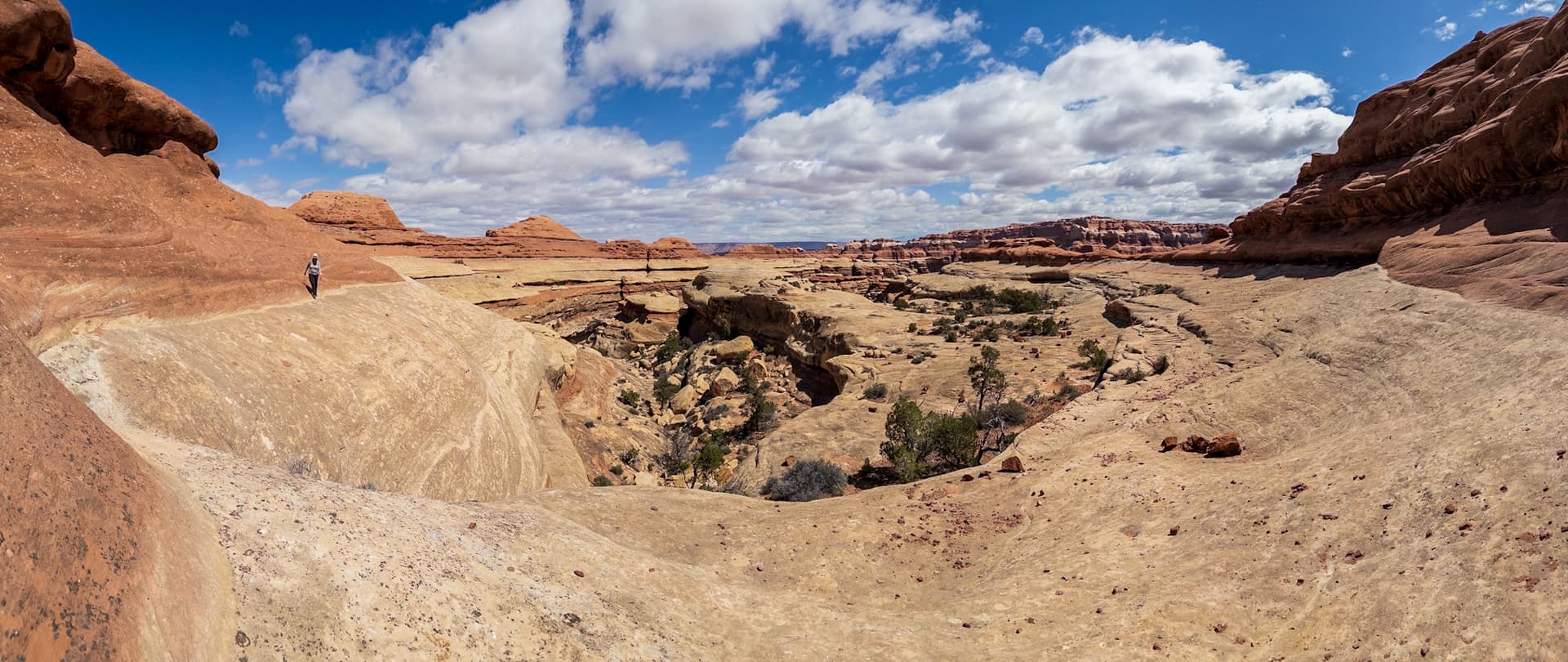
For routefinding in the wilderness, @erutan would like a way to describe a route as a series of way points without having to draw a highway=path between them. I can relate to that. A lot of hillwalking routes in Scotland are variations of the form “park your car at spot X, walk to the saddle, then follow the ridge to the summit and back down again”. To draw a highway=path here, with trail_visibility=no trailblazed=no, would essentially be troll tagging. If people in the US have been doing that, it’s natural that we should look for a solution.
Now, it seems to me that there are two questions here. The first is, how can this be represented in OSM? We would need new tags for the nodes, to say that they are waypoints. @erutan has made some suggestions. For simple routes, an ordered list of nodes can be represented using a way whose elements are the way points. You don’t need a relation at all. In fact, the typical route=hiking relation is a sequence of highway=path objects (or similar), and that is exactly what we don’t want. The question is just, what would be an appropriate tag for such a way? pathless-hiking=route? And when the situation is more complex, because there are alternative way points, what would a suitable relation look like to hold this data? Should this be modelled after how climbing routes are mapped, or after how node networks are mapped, or some combination of both?
The other question is, should this data be in the OSM database at all? Are such routes verifiable? Besides, you can already map summits, saddles, cairns, and (for better or worse) arbitrary named locations, so how much would it add to group them in a relation? I think many of these questions need to be answered by more experienced mappers than me… but it seems to me like these are the questions we need to be thinking about?
If a tagging scheme can be agreed, we would then need to lobby existing data consumers to support it, or new maps and apps would need to be developed.
The ‘alpine routes’ that have been discussed here are a little bit different, aren’t they? When there is an obvious route between two way points, because you follow an arête or a steel cable or way markers (trail blazes) placed every few metres, there is a verifiable geometry that can already be mapped as a way using established tags. So if these should come under the same tagging scheme, then we would need relations that sometimes consist just of nodes and sometimes consist of nodes and the ways between them.
Exactly what I was thinking! I understand that what @erutan calls a node network is like a series of ordered “virtual cairns” that suggests a route where there is no visible path (or markers). I think it is a good idea by itself, but in the spirit of https://en.wikipedia.org/wiki/Wikipedia:No_original_research, it should be developed outside OSM. Once such a system of virtual cairns is established and made official (by a National Park authority, the American XC Association (if it exists), etc.), we can quote them by adding these virtual cairns to the map. Adding them to the map without some form of official endorsement, they would be like
In my early days as a mapper, I did add paths to the map in mountainous areas based on GPS tracks I found on Internet, not even knowing if they represented visible paths or not. My motivation was to help other hikers and myself by showing that “this is a safe way to cross that pass” and to be able to get an idea of distance and time needed to hike that path (using a routing app). What I should have done it to upload those GPS tracks on my own phone, and upload my own GPS tracks to wikiloc to show people where it’s safe to go.
What we can do, of course, is to add information to the map to show hikers where it’s not safe to go, such as cliffs and screes, as long as they exist on the ground.
(off topic) On the topic of not promoting the creation of more informal paths, the European approach (by National Parks and the likes) is often to provide (marked) paths on purpose while at the same time forbidding hiking outside those paths. In stead of spreading the bootprints as much as possible like the American XC community tries, the Europeans generally try to concentrate them on a limited number of paths so that the rest of the area stays undisturbed.
I think that makes sense, and that a “path” is a special kind of route which has to have trail_visibility. (linked to above, currently a matter of some controversy). The Sierra High Route is 200+ mile route that is a mix of official trail (paths), social/informal trails (not maintained, which have visible wear to follow), and off-trail routes.
I think having a top and bottom node would allow for “routing” connecting it to paths in a mapping application. That would then require that said nodes connect to a path, which isn’t always the case. In the Little Joe Pass example above with four nodes, the top of the pass opens into a SAC 1-2 open area which one can then routefind to the nearest trail as they see fit. There’s a few options but they are all a few miles away and creating an arbitrary route just to allow for that case doesn’t seem appropriate to me.
OpenStreetMap there was an existing path here that I deleted from OSM because a) it had no ground truth b) it made some poor routefinding decisions leading from lake reflection to the base of the pass.
I’m pretty sure the nearby Millie’s foot pass doesn’t have any ground truth, but haven’t verified that.
Harrison Pass follows an old trail that hasn’t been maintained for 90 years, but a path probably exists in some fashion except for the steep northern part of the pass where there’s been enough collapsing terrain that it’s gone.
These are sort of “power user” type things and I’m not sure someone that wants to find the fastest way from A to B should have off trail routes included in that by default.
We’re definitely on the same page here!
As to “alpine routes” I’m not familiar with the ones in Europe, in the US they are generally informal and don’t have Via Feratta, though climbing_routes will often have bolts on them which may or may not be officially sanctioned. Any markers are informal user made cairns, which may or may be helpful (some people cairn bad routes - I generally ignore them unless they’re marking the top or bottom or something to be honest).
I would say if there’s markers every few meters that would fall into a path… there’s technically some routefinding to be made between each marker but that’s within the margin of error of GPS for someone checking the path on their phone or other digital mapping device and there’s no real experience needed in routefinding or orienteering as you can presumably find the next marker easily, that’d fall under trailblazed:visibility=good or trailblazed:visibility=excellent.
I honestly wouldn’t mind a policy that just bans pathless routes, but there’s an appetite for them and having something like a relation of nodes to me seems like a possible compromise.
In the Sierra Nevada a lot of these pathless routes are marked by a saddle feature, which is not actually a saddle feature (see little joe’s pass above). This indicates that a pass is there, but doesn’t say anything about the safety or ease of reaching it (some are simple, some are deadly). If we can have the top, why not the bottom (which in some cases is just as important), if we can have the bottom, why not a few points in between… it’s a bit of a slippery slope argument, but one that I think needs to be addressed.
I’m not sure about marking out scree/talus fields that are unsafe - a lot of times that comes down to individual experience and skill. I’ve “boot-skied” down collapsing scree and found it fun, while my partner shook her head and just potholed down a steep snowfield (that I didn’t feel comfortable on). Some named off-trail passes & cols include unstable talus, others are simple walks, and others require some simple climbing. Cliffs should already show up via the new high resolution slope angle shading, at least in most of the US ala Latest High Resolution Elevation Data Updates - CalTopo
Some areas of the US ban off trail travel, or do so in specific fragile areas. I think a major factor is we just have a lot more wilderness that hasn’t been impacted for as long - I do enjoy how entire basins are left pathless instead of building trails up to them and I do my best to destroy any cairns I see in them.
I’m not sure about how to mark that (having an area that overlays terrain would be noisy) but it’s something to considered even if there is “ground truth” for an informal path. There are some tags for paths that are not recommended by land managers if I recall.
I’ve personally added some informally named XC passes (that are known in the local mountaineering community, sometimes mentioned in guidebooks, etc) as I think they provide useful information, but would not add nodes in the middle except in relatively rare cases where there is genuine routefinding confusion or people often make routefinding mistakes (and have not). There’s only one or two cases where I’ve been tempted to add a bottom node. I think in terms off of trail passes the majority are fine just having a top marker. When writing up passes I generally push back on people that think their way of doing a pass is the way to do it, or the optimal way, as everyone has their own comfort levels and terrain preferences, though at times there is an obviously safer or simpler route.
One issue I can see if how to enforce the subjective bright line of keeping the nodes sparse enough to feel like a route. Someone can just put a node every meter etc if they want to, which would defeat the purpose (or create their own cairns and map them). On a related note, if trail_visibility changes to include both the surface and markers, someone can just stack a handful of cairns for a route and just tag it as trail_visibility=no and that would technically be a valid path, as it is mostly pathless but includes some markers.
The ones, the Alpine Club marks with respective sign on their guideposts certainly are different. I am fine with them mapped as paths. Not so though with the routes from the guidebooks, comparable to the Swiss High Alpine Routes (where the Mountain Hiking Routes, that are covered by its SAC Mountain Hiking scale are the approach routes.)
Cliffs are fine to see, not all users have excellent DTM; screes get mapped already, they rarely are dangerous, often fun instead, going down.
I agree, a perfect example why a path with trail_visibility=no can still be mapped a path, without breaking the verifiability credo. Mind you, these cables are no suitable to plug carabiners, just something to hold on. Sometimes they are more a nuisance, if having to step over them to not fall, when they lie on the ground. But some people cannot get enough of them.
One more reason to map an invisible path, where there is no path to be seen OTG, while still being verifiable as used for human traffic.
I heard, asking locals about a name makes it verifiable, cant this apply to routes
Routes can contain paths, that is what we have now. Lots of routes get by with that. Routes can also only mentions waypoints where no path leads to. The goal is to map those, and not pull paths out of the thin air, to meet the current model. Please continue your research!
I didn’t know that existed, and presumably most people outside of Russia won’t either. A lot of rating systems include some aspect of risk and exposure, though those can be masked by a more difficult mode of travel (unexposed simple climbing, and exposed walking can get the same rating). An unknown GPS route from the internet doesn’t necessarily mean something is safe, just that it’s been done.
There’s a number of US guidebooks that detail XC routes (including an entire book for one route) where the original author would be horrified to see them as a path.
According to a certain interpretation of it (original intent and my and others understanding of it), but not with it is commonly being used according to some data analysis, and what it might be changed into.
Yeah, if something is trailblazed:visibility=excellent or good it seems like it’d clearly be a path to me and not a route. Intermediate would also indicate this to me.
Yeah trying to mark up levels of risk on off-trail terrain seems like it’d be an infinite task and highly disputed. Rating a route (which assumes good routefinding ability) seems simpler.
This would fall under a “common name” which is a criteria that I’ll use for terrain features or passes.
Having pathless routes be outside of the scope of OSM also seems like a viable alternative to me (I’ll happily delete some existing ones) - having them show up as paths (which is currently happening) doesn’t.
this is a Wikipedia guideline, it doesn’t apply at all to OSM, in OSM original research is welcome and at the base of a lot of mapping. Contrary to Wikipedia, we do not prefer secondary sources but encourage people to go out and map what they see with their own eyes.
Crux of the problem seems (to me) that some people are unhappy about “regular” (linear) ways tagged with highway=path + trail_visibility=no because they are subjective and not really verifiable - which I agree is not ideal (but I also happen to think that something is better than nothing, so if nothing is mapped there, and I successfully walked there, I might map my .gpx as highway=path + trail_visibility=no + informal=yes + note=*)
The much better (and verifiable) solution, is marking the area (whole area which is traversable by foot and connects end-points “A” and “B”, e.g. end of official roads/parkings/whatever) mapped as area=yes + foot=yes (+ perhaps some other tag simulating what highway=pedestrian + area=yes mean in urban setting).
That is of course significantly more work (one would have to check that all of it was actually traversable, of course, and not just “guess”!) but doable, and router apps should be able to cope with that (as they do with abovementioned highway=pedestrian + area=yes “closed ways” AKA “areas”). That would then be verifable, and would allow for users choosing any way across those areas they like (be it the shortest one, or any other criteria)
The issue there is that “ground truth” often means that these routes don’t exist with their own eyes - or at the very least means that they should not exist as “paths” as they currently do.
yes, generally routes should be verifiable on the ground, and if these node-routes are only described elsewhere but not signposted, they would not be fit for integration into osm
I’d disagree - I think nothing is better than something in this case. There is a LOT of terrain that’s passable, and can be done in multiple ways. Having people create arbitrary paths on OSM creates more informal paths, which can lead to more erosion, the creation of paths where none existed, etc. A lot of people in the alpine community don’t share gps tracks (or do so only on peak bagging sites as some kind of proof) in order to help not create more paths.
This is obviously a subjective opinion, but it’s shared by the majority of the US Trails OSM Working Group, the ultralight community, major alpine online groups, etc.
This would be an interesting use case for the example in the previous thread, where a 19km trail has an area in the middle that is pathless but passable. I still think a pathless path there probably makes more sense to someone just looking at a rendered map (it’d show up as a faint line connecting to the rest of the trail rendered heavier ideally).
Hmm.
One could create a large passable area up to Valor Pass from Martha Lake shaped like a triangle with two points on the lakeshore and one near the pass. Verifying all of that terrain to a certain criteria isn’t as useful as knowing where the pass is (creating an arbitrary path up from the lake to the pass isn’t all that useful either) as it’s all pretty much SAC 2-3 and you could keep it to SAC 2 if you took the time to routefind carefully. That’s a lot simpler than creating and grading the entire area of terrain on the way to the trail down in lightning meadow on the other side.
To use the previous example of adding a gpx route of something that worked, there could be hundreds of different paths up to the pass itself in this case, as the terrain is pretty trivial. That’s unlikely to happen, but it’s surprising how often someone thinks “the way I did this is better” - there’s already areas where you have multiple sets of informal cairned paths a few meters from each other.
Just below the pass is a YDS Class 3 / SAC T4-5 short crack that has to be climbed. That isn’t “walkable” but is easily passable for a moderately experienced hiker. No photos will show if you don’t have an account, but I contributed to a write-up of the pass online. Aside from the terrain near the pass itself there’s nothing tricky as long as you don’t walk off the large cliff on the valor lake side.
This could create unintended routing issues if areas if “passable terrain” was given the same weight as paths and people were suggested passable areas. At the very least terrain would have to be evaluated and classified according to SAC, YDS, or something else which would be difficult to do over a very large area (think a mountain range). Do we want pathless routes to be included in routing by default? Most mapping software (that I’m aware of) doesn’t allow people to choose difficulty, formal vs informal, or other factors when creating a route.
In the past few weeks I’ve found passable terrain that was fatally exposed, but technically simple. I wouldn’t add the route I took that included that to OSM as it was just our personal routefinding / wandering, but it’s passable.
We already have arbitrary features (valor pass in the example above is not the lowest part of the natural saddle, but the only section which is less than YDS 4 / UAII 3/ SAC T6+) that are parts of routes. I personally feel as these have common names, and are referenced in guidebooks and local communities this is fine.
On this note, I wonder about tagging a SAC scale onto an xc pass feature to indicate it’s rating.
Would having the bottom of a route also be acceptable in your view, as illustrated in the first image in this comment.. I assume you’d be against the middle two “decision points” (I know someone that took a wrong turn at the second one and had to turn around and change his trip heh).
I can see how a node network of sorts could exist without fixed routes between the nodes. I imagine a cluster of recognizable objects (poles, stones) with unique labels (numbers, codes or names of nearby landmarks) distributed in a region, serving as intermediary destinations in a composed itinerary. There would be verifiable ground truth and fixed geolocations, so it’s OSM-mappable. Named landmarks themselves could serve as network nodes.
You can do network planning using just the nodes, no problem. The routes would be bird routes as placeholders, to be replaced by real routes by the user, who has to find her/his way from Node to Node.
If enough people use the same trails while gps-tracking and uploading the gps-tracks afterwards, gps-heatmaps could be available, and I am sure software/apps could use this to suggest possible routes (even with seasonal variations) realtime.
How to map? I think you just map and tag the designated Nodes as separate features, then determine possible connections. Each connection connects two Nodes, and if intermediate features, whch show the way but are not destinations themselves, are known (ways or nodes) they are entered as members of the connection relation, in the right order.
I would think such a way-less network should have its own network:type value.
The connection relations would require their own ground truth, I think. A relation starting at Node Elms_Peak and ending at Node Rock_Bottom, how can you verify on the ground that it exists? I think the Nodes need to actually point the hiker to the adjacent Nodes vice versa.
Just brainstorming. Hope this is relevant, somehow.
By bird routes you mean straight lines between the nodes? I’d prefer a wavy slightly dotted line or something just to make it clear that it’s arbitrary (or perhaps a very thick partially transparent line to show possibility).
Without the infrastructure in the first half of the post (conveniently ignoring ground truth of markers for the moment), nodes can just reference real features - in the case of the little Joe pass sat imagery I’ve referenced a few times, the bottom would be the bottom of the avalanche chute, the two decision points in the middle would be junctions in it (though that is a very obvious linear example).
In terms of the major decision point on the palisade lakes side of Cirque Pass people take the wrong turn at a little pond - marking that pond then having a note (description?) to go SE vs NW would work. The other side is open enough to need no route IMO, just make your way up from the nearby lake to the pass as you see fit.
I think it’s important to keep nodes to where they actually make a meaningful difference (say avoid exposure, keep things down 1-2 SAC levels, etc) vs someone’s personal route choice through open terrain. In terms of auto-generating routes based on the season - every season has slightly different snow coverage and unless it’s pulling in historical snow coverage data and changing that by the week it’d still give potentially poor results. Creating a “path” gives a false sense of security that routefinding / orienteering isn’t necessary.
There’s also just the fact that a lot of routefinding comes down to personal preference, and trying to stick a path on it kills the spirit. Even doing the same route together, with pretty similar levels of technique my partner and I will often make different decisions.
From the OSM US Trails group:
I guess what I need to get my head around is why do folks feel the need to load non-trail/path routes into OSM at all. My bias is that route-finding in-and-of-itself is an activity that depends on a blank slate mapping-wise. Just your eyes see the landscape and understand the topography of the (USGS?) map. That’s the joy of it.
I also wonder if this has to be, or should be, a global standard. Perhaps each country or region can have its own policy regarding making routes into paths.
Apparently you didn’t read what I wrote (“in the spirit of”) and what’s in the link. Wikipedia’s “Original research” applied to OSM would for instance be if I would create a hiking route relation named “Richard’s favourite hike” that includes my favourite hiking paths, but that only existed in my own head before. It’s similar to OSM’s verifiability principle.
no, it’s not, WP doesn’t want your observations and interpretations of the world, they want you to select information and interpretations from experts (sources), OpenStreetMap’s verifiability requirement states that everybody is an expert for their area.