@Peter_Elderson [quote=“Peter_Elderson, post:4, topic:7566, full:true”]
PlusCodes zijn rechtstreeks afgeleid van de geolokatie, begrijp ik dat goed? Als dat klopt is het dubbelop om aan objekten in OSM ook nog een PlusCode toe te voegen, want de lokatie is in OSM immers al precies bekend. Als een toepassing de geolokatie in een PlusCode wil omzetten kan die dat altijd doen. Of is de methode afhankelijk van de organisatie Plus Codes?
Iets anders is als een huis een bordje heeft met daarop een PlusCode (of welke andere aanduiding dan ook) die als adres dient. Verifieerbaar dus. Dan kan dat ergens in de adresvelden opgenomen worden.
[/quote]
Onder welke Geocode-tag is de exacte Lat/Lon in OSM oproepbaar?
PlusCode makes sense as address if it’s used on site and actually signed. I have heard of such plans in countries in Africa and South-East Asia but I haven’t actually seen it implemented.
At the moment I see no other use case. It would be useful to describe what’s the purpose of PlusCode in OSM and why it cannot be calculated dynamically or fetched from Plus Code API on the fly.
Anyway, I personally think that you should not abandon this idea but you should present it in a way that is attractive and has a specific use case.
The API is open source and can be used.
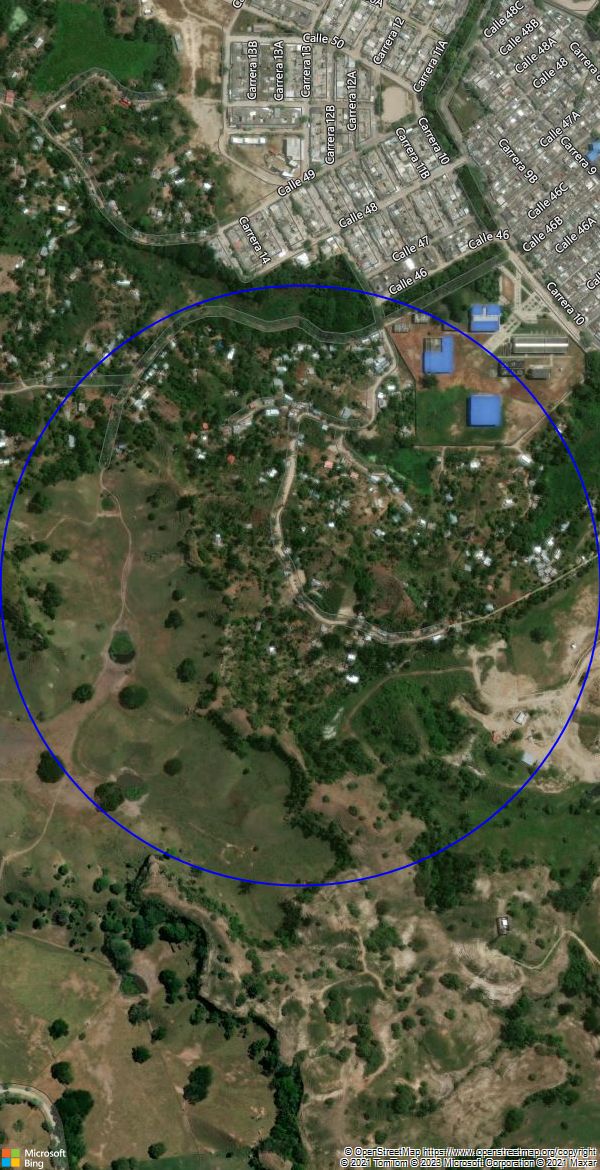
I work in the state entity that carries out the main statistical studies in my country, for two years (visiting the area every six months) we have been working in an area that does not have road delimitation, house numbers or some other way of identifying the dwellings except for the name and surname of the Head of Household and/or the reference number of the electric meter. It is a headache to address this small area due to the number of homes built without the usus order of urbanization, they are invasion zones (several families appropriate land, build buildings of any material and with the passage of time the state recognizes their ownership of housing and built land).
This specific case could be addressed with an unusual home identification system (PlusCode), I’ve been thinking about it and I can’t find another way to try to reference those households.
Similar to this case you can find hundreds in my country and thousands throughout South America.
As I said before, PlusCode is not exact to represent a coordinate, but to identify an area it could be valid, each building polygon could carry its PlusCode that identify.
Next week I will visit the area again and I plan to visit the Planning Secretary of the Municipal Mayor’s Office and inquire more about it, specifically about what address system have or plan to implement in the area. In a previous visit the issue of PlusCode arose for this area since the municipality has several similar areas (polygons with buildings without any order, houses along abandoned train tracks, populated centers with buildings along the courses of rivers,…)