Please update and include Somalia’s newest state in the map!

Please don’t keep posting “travel news” here; it’s not relevant. We know that Somalia claims that it controls the area that you are interested in. We also believe (based on this post above) that Somaliland also claims that area.

Three days ago I asked the deleting user to join this discussion. Their last edit was a couple of months ago, so we may need to wait a little while for them to be in a position to comment - 3 days certainly isn’t long enough. Please be patient.

2 Likes

I only tagged you because you requested evidence (will link picture). Andy I wouldn’t have tagged you if that was the case. Also this may not be relevant to you or others but is very relevant to me, as the person who deleted it believes SSC-K doesn’t even exist nor does it control any territory. So hopefully when he does come back online and see this he will see my strong case in why SSC deserves to be on the map and that he was completely wrong in deleting it.

I’ve provided you both — as you requested — the greatest evidence known to man: the Prime Minister of Somalia visiting SSC-Khatumo for the first time in history. If that isn’t considered on-the-ground evidence and de facto control, then I don’t know what OSM’s policy actually is.

Thanks

I did - and you replied with pictures of a person visiting a place. I then (3 days ago) asked the person who deleted the relation to comment. Two days ago you posted more holiday snaps, and again 1 day ago, and again 1 hour ago.

Please be patient until we can get a point of view from the other side of the dispute. Posts repeating the same message will make people less likely to want to help you, not more.

10 Likes

Hi, and thank you for bringing this to my attention.

My main issue with including Khatumo is the fact that firstly, it has only been recognized as an interim administration for two years awaiting its recognition as a full federal state. Since it is not a federal state yet (even Somaliland which is de facto independent is still on paper a federal state) I see no reason to include it. You wouldn’t include territories controlled by rebel groups, and there are a dime a dozen clan groups and quasi administrations across Somalia with no representation.

Secondly, Khatumo’s borders have not been demarcated and are very fuzzy as control fluctuates due to clashes with Somaliland forces. There are no hard borders on the ground at the moment. The currently proposed borders are problematic as it includes areas that are indisputably part of and controlled by Somaliland and Puntland and which Khaatumo itself hasn’t even laid claim to officially. The map below is a more accurate depictions of the claimed area.

Which is roughly in-line with the territories inhabited by the Dhulbahante clan who represent Khaatumo.

In conclusion we should wait for the stabilisation of the situation, recognition of Khaatumo as a full federal member state as well as the demarcation of borders before we add it to the map as to not jump the gun. The fact that Somalia’s Prime Minister is set to visit Las Anod as Somaliland is issuing statements and possibly preparing for war shows that the situation is still very volatile.

Dhulbahante clan map for context.

“ My main issue with including Khatumo is the fact that firstly, it has only been recognized as an interim administration for two years awaiting its recognition as a full federal state. Since it is not a federal state yet”

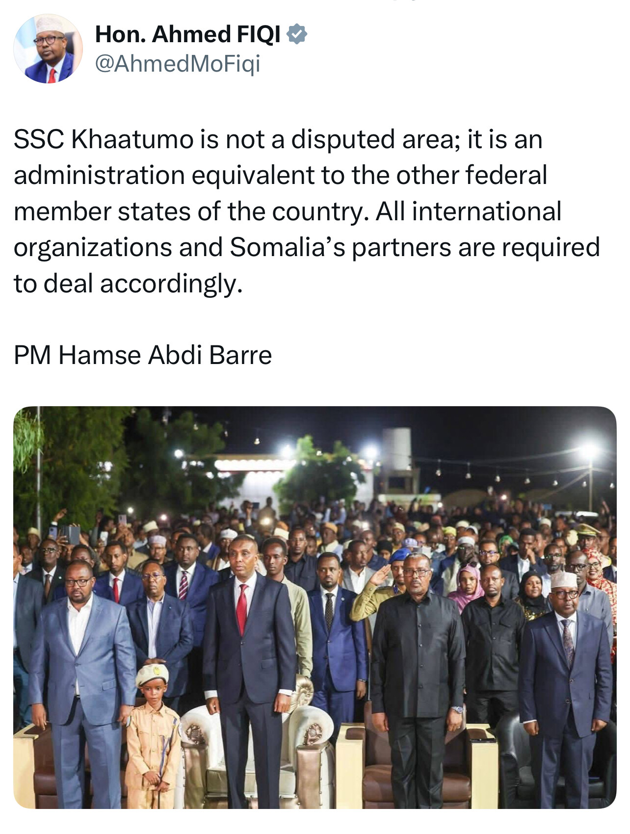
Your excuse for excluding SSC-Khatumo from OpenStreetMap is both dishonest and politically motivated. SSC-Khatumo is not just some “interim” admin it has been recognized as a full federal member state by the Somali Federal Government.

Proof:

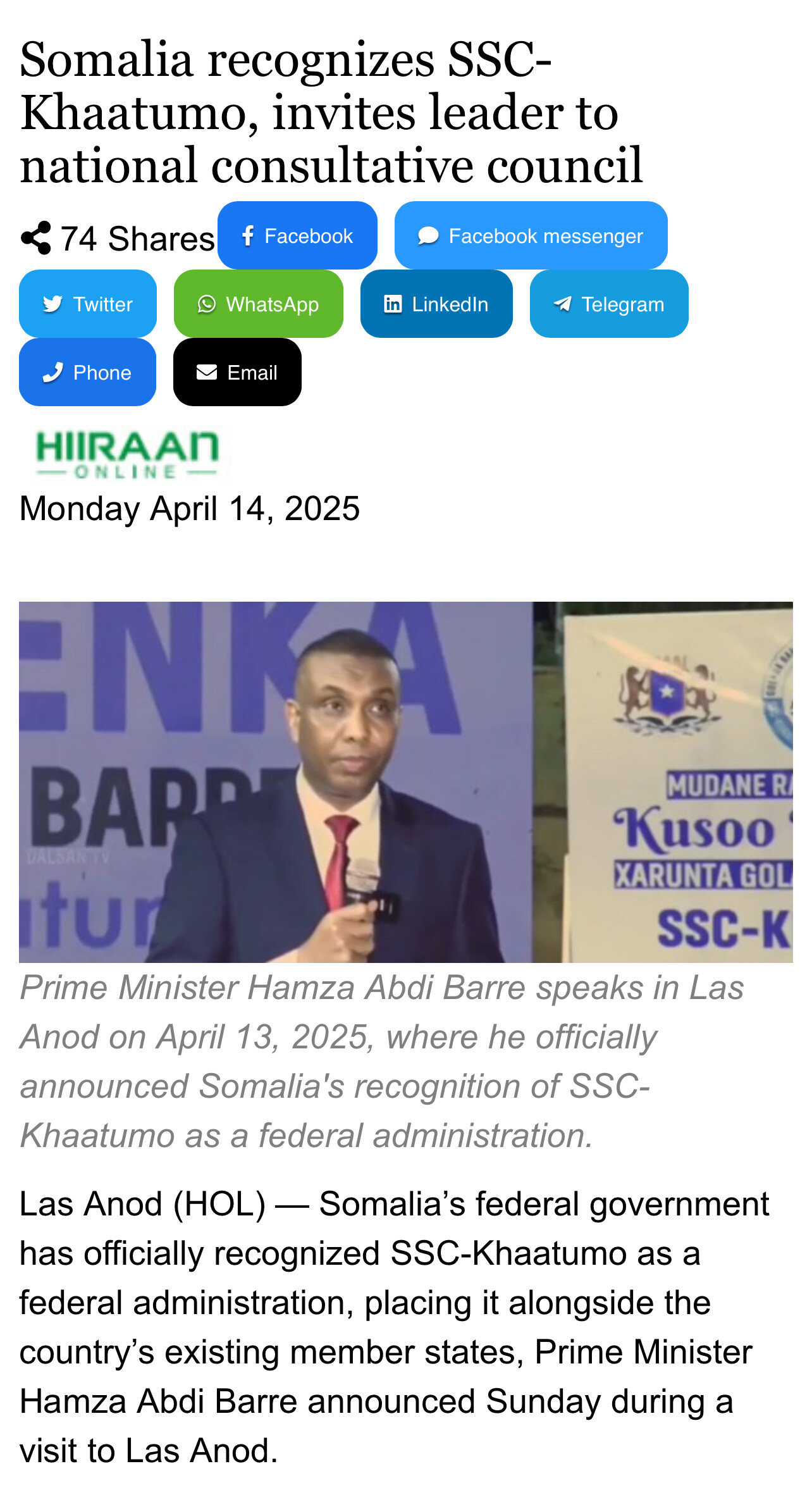
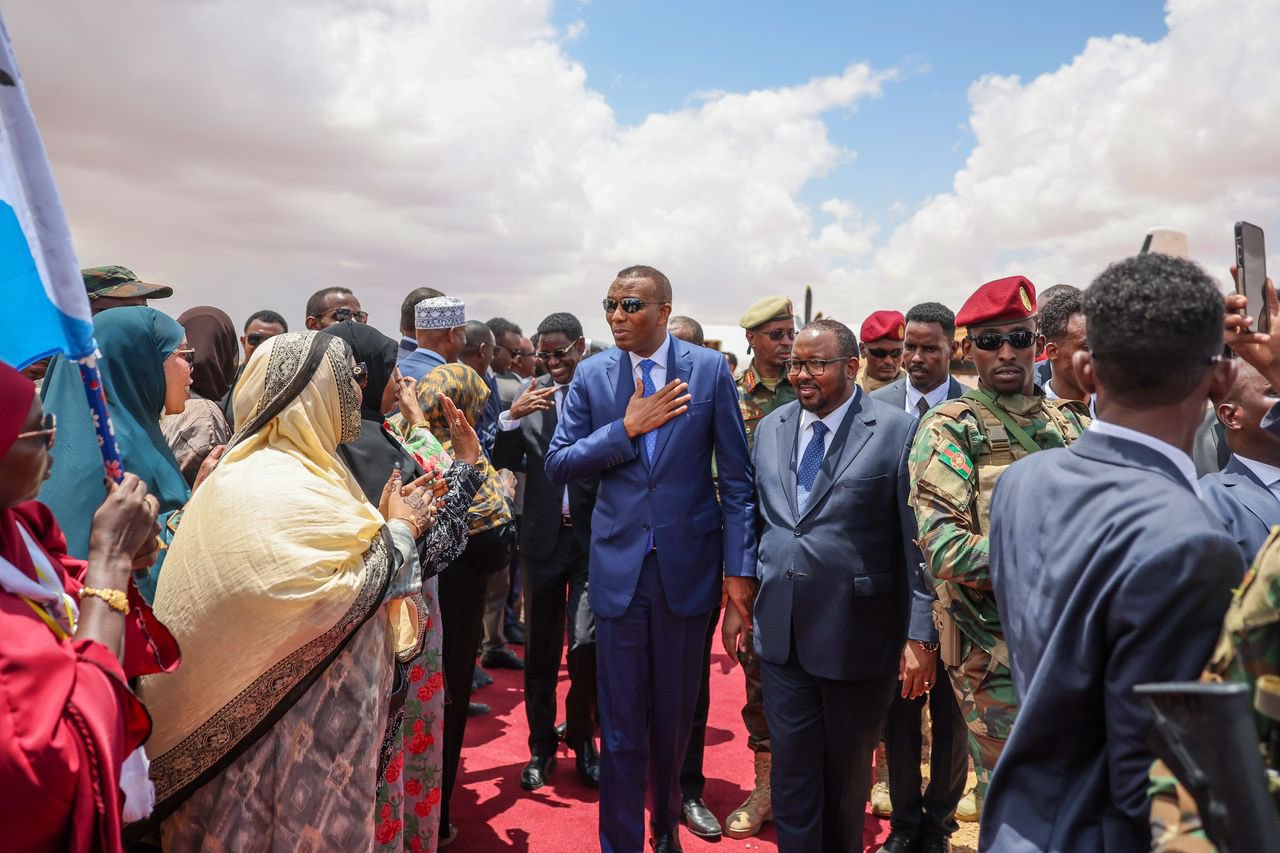
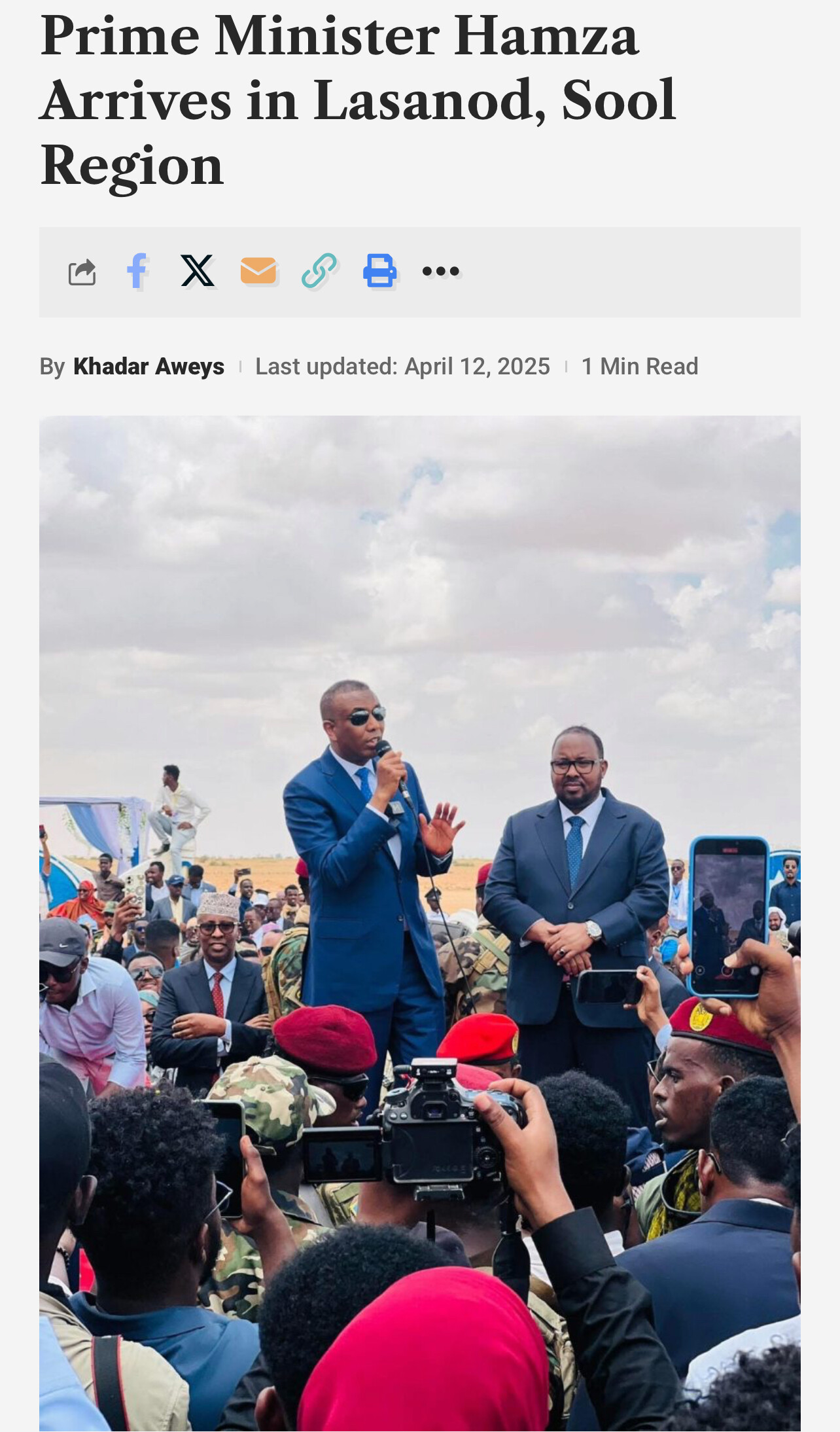
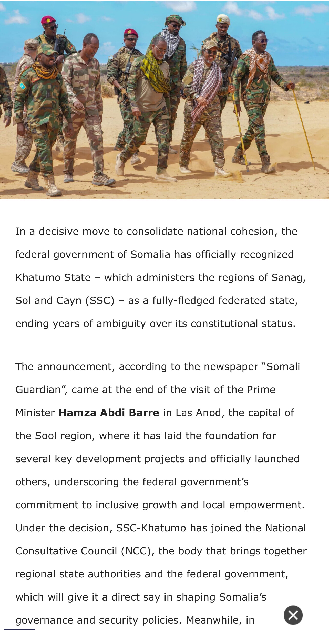
The Prime Minister of Somalia is currently in Las Canod, the capital of SSC-Khatumo, meeting with its legitimate leadership and federal institution

The massive delegation, includes:
• Minister of Foreign Affairs
• Minister of Internal Security
• Minister of Planning
• Minister of Federal Affairs
• Minister of Education
• Deputy Minister of Information
• Members of Somali Parliament
• Chief of the Somali Police Force
•Somali National Army commanders

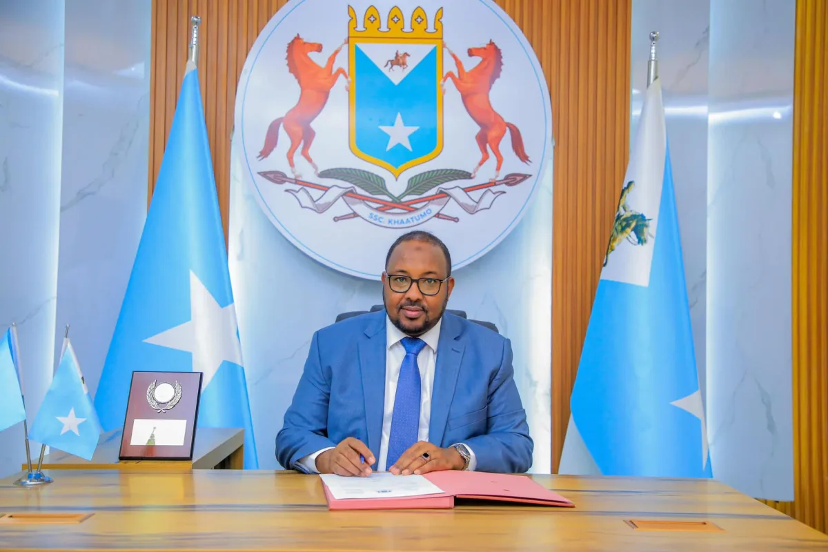
Picture Prime Minister of Somalia meeting with SSc Khatumo president:

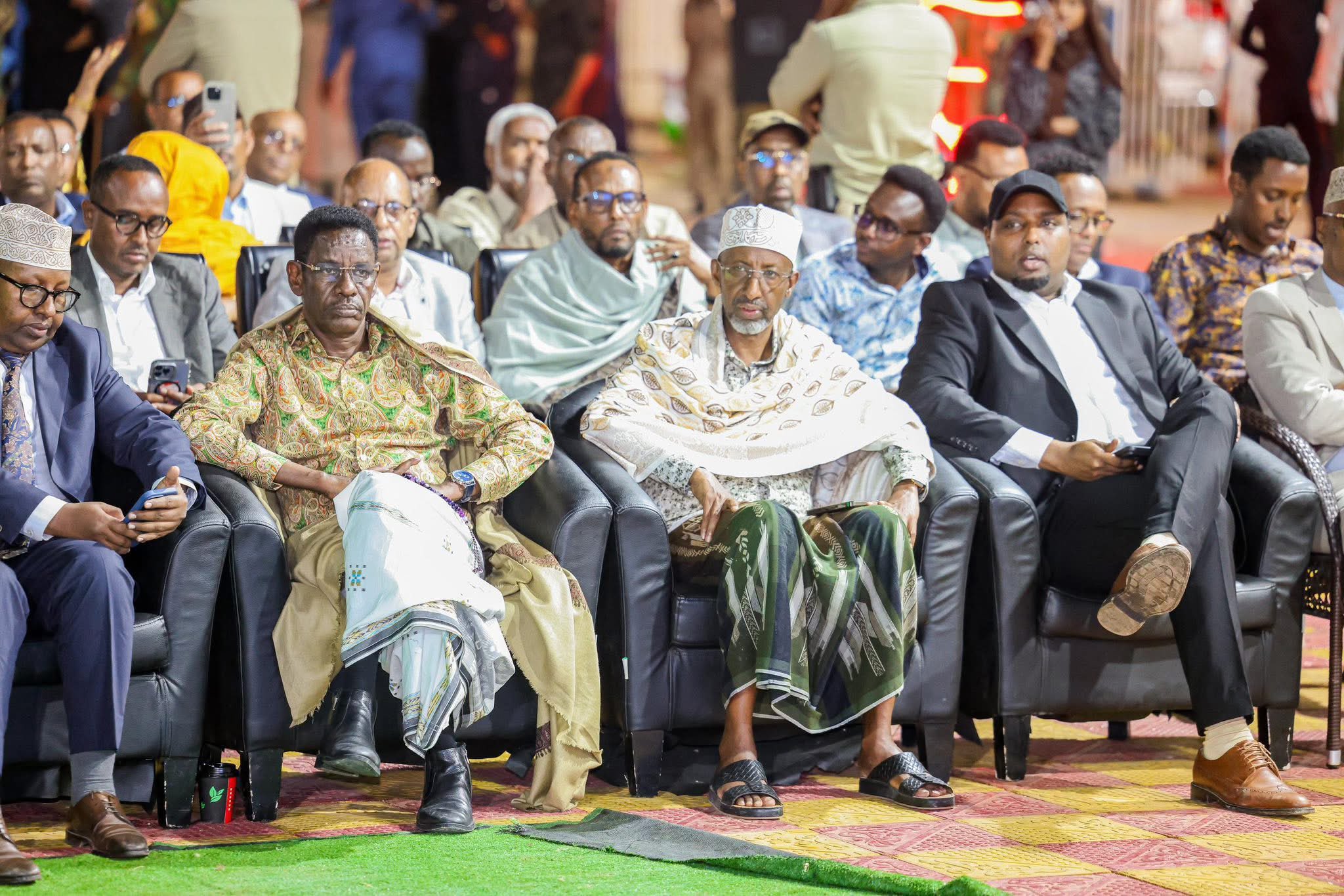
Picture of ministers sitting front row for prime minister speech in Las Canod (yesterday):

This is unprecedented in over 30 years not since the collapse of the Somali state has a top federal official set foot in this region to formally recognize and work with its local administration. That alone destroys your argument.

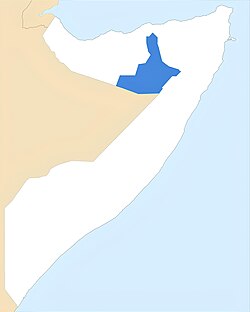
Your claim that “Somaliland is threatening war” is another weak argument you could make and it proves my entire point: you don’t threaten war or issue paper statements over land you control or lost.

OpenStreetMap’s own policy is clear: mapping should reflect de facto control and facts on the ground, not political fantasies or deliberate misrepresentation of reality.

SSC-Khatumo is a full federal member state which has its own:

• President
• Vice President
• Parliament
• Ministers of Govt
•Police
•Military
•Intelligence Agency

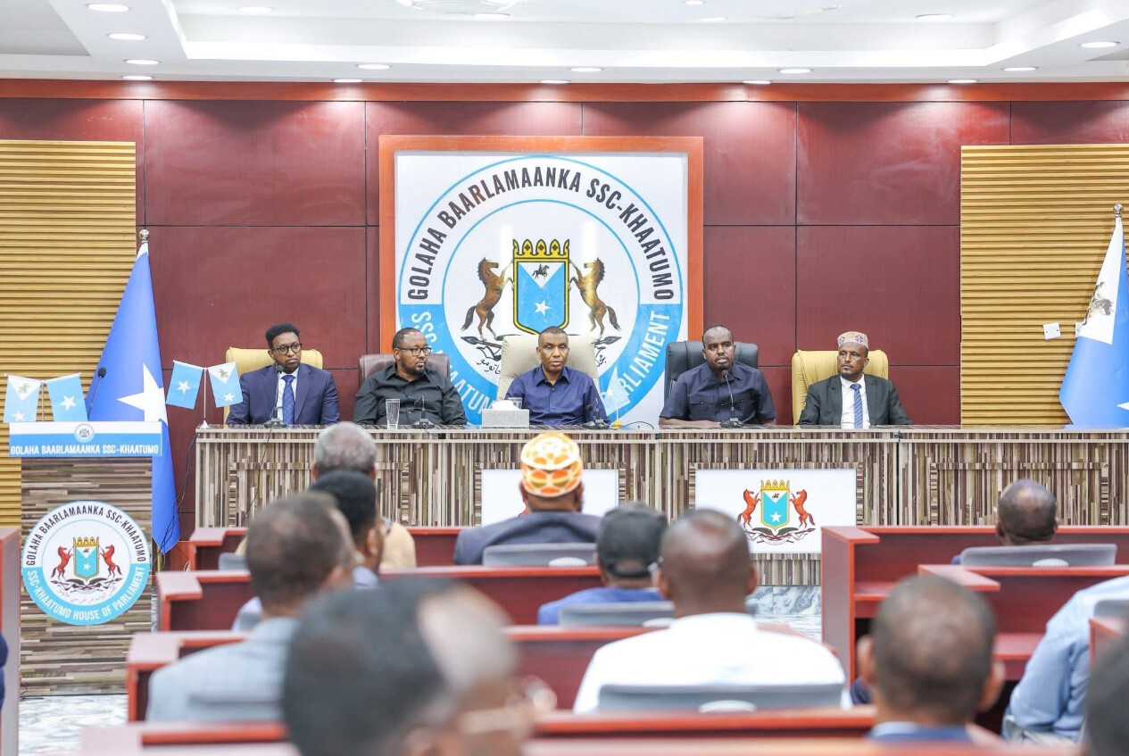
Prime minister of Somalia visiting SSC-Khatumo Parliament and giving a speech:


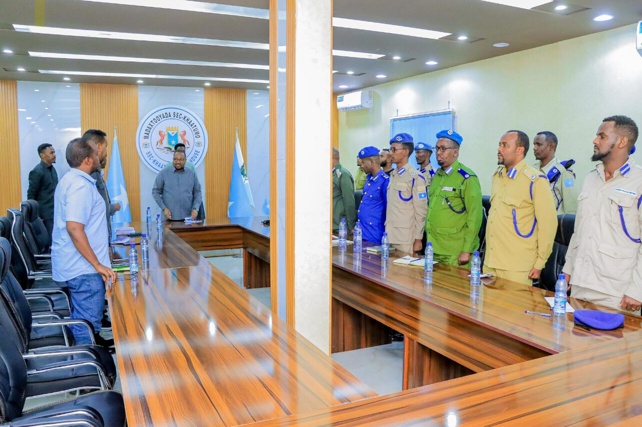
Branches of Military and police briefing the president

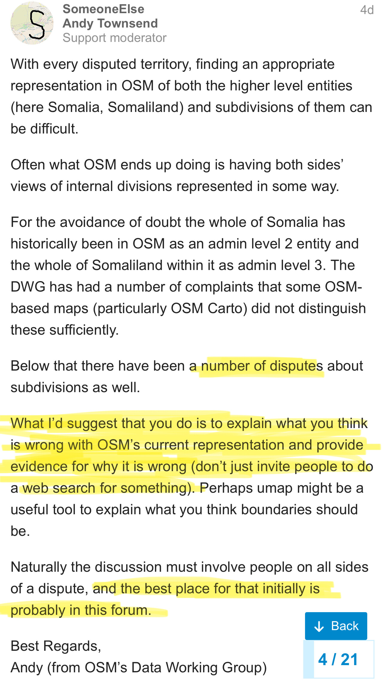
No more can we sit idly and allow SSC to be lumped together with somaliland or Puntland. SSC is no longer disputed it is a reality it is a full fledged state ran by its own government and secured by its own people.

@Balli_Abokor

Thanks

So, @bobo10 @Balli_Abokor I’m from far away european country you might not even know where to look for it xD
I opened gugle map just now, zoomed out so that i could see earth is round there (or so they lie to us), looked around Africa and started wondering if i shouldn’t look in Asia instead ;d
But lucky i found Somalia to the right and started to wonder if i even care if part of it is called Somalia and part Somaliland, but appearently OSM say it’s something like “Soomaaliya” in Latin letters?

Anyway, you guys see… it’s not about you. It’s about all the other people around the world how they see and call you.
Personally, I don’t care. I only care to know which zones of the territory are nuts, meaning that 2 different gov groups can try to enforce their laws on me and that’s what i need to have mapped. If you need to add names to it, so be it. If you need to add multiple names, it’s fine as well.

If you can’t come to agreement, then I dont’ know. Find someone who will do it for you if you can’t figure it on your own? ;]