Osmose drives me mad

I would tend to agree about tracing the edge of the canopy. This would be consistent with the way we typically map buildings as roof extents and don’t map a true footprint. In some cases I think we also concede the “true” coastline to one side of mangrove areas for similar visibility issues.

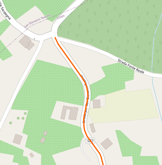
My tendency would be to show natural=wood crossing the road if the road can’t be clearly seen from the available aerial imagery (or vice versa seeing sky from the road) and to separate them if it can be.

In the orchard case I would also leave joined if it was the same functional unit. I would also be against splitting landuse=forest for forestry roads, but I don’t think we’ll get any sort of conclusion if we end up re-arguing natural vs landuse for “areas with trees”.

1 Like

I think you’re not the only one who complains about spurious warnings in Osmose. Apparently, people in the Polish community (@Mateusz_Konieczny) suggested improvements in some checks, however they were not fixed - compared to JOSM devs who were more open to fixes in their validator.

1 Like

Sure, avoid whatever is written before that, that doesn’t mean nothing. Anyway, if you don’t want to break down landuse you are free to do that, but don’t complain if a QA tool suggests you to do otherwise.

EDIT: well, I see that you split the orchard landuse, so what’s the point of this thread?

The part left out where the ellipsis was inserted in the quoted paragraph is “it is strongly discouraged to glue landuse to road lines.”, which is why with the first sample I happened to be including writing the OP was fixed as well, disconnecting the single node from the road. ;P)

Maybe there’s other text between the lines printed in the same colour as the background that I can’t see. Maybe you can point me to a wiki that ‘best practice’ and proposes how to avoid the landuse crossing roads issue in general rather than the one specific to residential. Scrub and wood are flagged as well and those are natural. The one Minh Nguyễn linked to makes no recommendation at all, just has open discussion items so I do wonder how this got into Osmose.

Anyway, case you missed it, Osmose is passé for me. The others

On a good day.

  1. Osmose has many spurious and invalid reports, so fact that Osmose reports something does not matter

  2. You can report problems to Osmose authors, some systematic mistakes gets fixed

  3. This specific one does not look fully spurious and may reveal some cases worth tweaking, like ones screenshoted

  4. trying to reach 0 errors reported by Osmose on objects you last edited is waste of time and often leads to bad mapping to appease misbehaving QA tool.

You can just use better validators, like one in JOSM. And ignore Osmose.

other road classes can also go through forest without even interrupting canopy

4 Likes


|

  • | - |

What you appear to be mapping is private residential property.

actually I do not care for the type of property owner, it is also about public residential property. But it is about residential properties as opposed to generic space like roads, which are there to be driven and walked on. You don’t have to be a resident to walk on the street in a residential neighbourhood, and you are free to walk there as long as you like.

It would be as convenient, and more useful, to map the dedicated public highway areas.

Just do it if you believe it would be more useful. I am fine, and think it could be done, but find it less useful because it is basically all the space around the roads up to the properties.

I know people like how it looks, but it is extremely difficult to edit such data (as I have found over the weekend). Landuse in OSM is used for a whole range of purposes both inside and outside the project. This kind of detailed splitting of landuse often negates the value of such polygons.

Historically almost all landuse maps have used a minimum feature size, usually of a few hectares (25 has for Corine).

This is for medium and large scale analysis and not what the public authorities, who keep track of the actual landuse, usually apply (land register). They not only look at parcels/plots, but even below this (or e.g. they say the same plot is used for residential and commercial purpose).

Corine is not comparable to what we are doing in OSM. It is about remote sensing and generalising, not about recording the actual landuse in a way that it is associated with the land at a human scale level.

the intended use is mapping what the land is used for, and this is what I am using it for. The term “micromapping” is pejorative. “generalized” does not bear meaning without scale.

This is just not a landuse application.

Well it isn’t the roads, it isn’t the gardens, it isn’t the buildings, it isn’t the pavements, it isn’t the street furniture, it isn’t the amenities etc … what is it then?

2 Likes

And, may I add, this OCD tendency is almost peculiarly seen among mappers in the western world. The ‘it is technically correct’ crowd. Oh well.

As this analyses initially produced too more issues (note Osmose-QA report issues, not error). We choose to remove the reports of waterways and keep only motorway, trunk and primary for highway (removing all *_link too).

me ignore button is again in overdrive.

@SekeRob note, it is not your ignore button, but as explain in the confirm dialog it is false positive report. It hides the issues for all other contributors too. This should help us to improve the analyzers. Over using false-positive flood the real false positives. If the analyzers reported too many false positive, it is more a bug to be reported on github. There is no feature to hide issues only for you, yet. In this just ignore the class of the item, you can uncheck it in Osmose-QA.

3 Likes

Noticed this new expanded ‘confirm’ screen before stopping to look at OsmOse… I’m now on Mare Tranquillitatis, if JOSM validator does not moan I’m cwol.

Careful there or you get labelled as not collaborating :scream:

I wish osmose had a ignore button/function which I could use to delete some of osmose issues marked with my user. In order to keep my issue list length down, I mark some issues as false positives. Because Im not going to fix them.

Note that you can just untick boxes on the map view, while having a filter on your username only.

Careful there or you get labelled as not collaborating :scream:

Lol

Good tip!

But the map doesn’t show all item types of the lists. For example:

I can’t find Issue #1190 in the left map menu.

EDIT: I noticed I have only selected: Severity=High
When I changed this to “All” I also got #1190, but still my personal list shows issues with 1190?!

EDIT2: I now realize I didn’t understand the previous tip about filters. Unticking a issue type in the left menu on the map page, only affect markers on the map, not issues in the personal issue lists.

In order to keep my issue list length down, I mark some issues as false positives. Because Im not going to fix them.

please, do not this with actual problems

6 Likes

Dug out of the bin, moved into a farther yonder area some 2 months ago to map landuse and cover and noticed dear Osmose (has not updated in the last 2 days), since at least then no longer flags areas straddling secondary and lower denominated roads i.e. only flags when an area crosses a primary road or up and railways (yes there’s an abundance of those here) and dutifully started splitting and simplifying the existing areas.
Also noticeable landuse=residential does not get flagged when crossing primary roads nor rail quite contrary to many a mapping practitoner.

Previously, at the top the first comment was “Osmose is right, though” so did the view change on the matter, did Osmose change it’s view (too many giving the problem thumbs down causing the flag to get eliminated)?

TIA for your feedback.

AFAIK there is nothing done (yet) with the “False Positives” also not sure how realistic that would be.

What I like from Osmose is that it is very good to give access to the source code responsible for the warning.

If you press the details link of the issue you can find the source code for finding the issue pretty easy, for “Bad intersection with major highway” it is:

At the top I see that the code is last changed 7 months ago.

1 Like

Thanks for that. If reading this code snippet at bottom correctly then highways crossing the argument included area elements, then there’s no problem. Oddly though if understood correctly the included wood does stand out as being flagged momentarily i.e. if a primary road and railway goes into a scrub & wood area, pins show. For rail I’m fine as there I was mapping landuse=railway anyhow. Roads crossing railway landuse I can understand, that’s a normal I’d think.

I missed to read if there’s any distinction for roads below primary, In the example of the OP, this highlighted tertiary road was flagged back then running through an old orchard, the orchard came first, but not seen any single pin show up in this large new mapping zone for tertiary or secondary, cutting through grassland, scrub, wood, forest, farmland etc where primary and rail is where corridors were not mapped.

The code snippet:

WHERE
(
landusekey = ‘landuse’ AND
landusevalue NOT IN (‘civic_admin’, ‘commercial’, ‘construction’, ‘education’, ‘grass’, ‘harbour’, ‘industrial’, ‘military’, ‘port’, ‘proposed’, ‘quarry’, ‘railway’, ‘religious’, ‘residential’, ‘retail’, ‘winter_sports’)
) OR (
landusekey = ‘natural’ AND
landusevalue IN (‘bay’, ‘cliff’, ‘scrub’, ‘shrubbery’, ‘sinkhole’, ‘tree_group’, ‘wetland’, ‘wood’) OR
(
– Special case as highway=* vs. natural=water is already included in item 1070 class 4/5
landusevalue = ‘water’ AND
mobility_way_type != ‘highway’

Just trying to understand where/what drives this change in alerting.

If you click on Blame button on that file in GitHub, you should be able to see what commit changed that, and from commit comment perhaps gain more knowledge about why it was done.