English
Routing with OpenTopoMap, i have some routing on streets with more traffic instead of small roads.
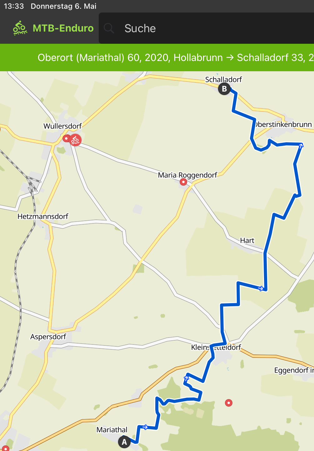
With Komoot, routing is fine (pic 1)
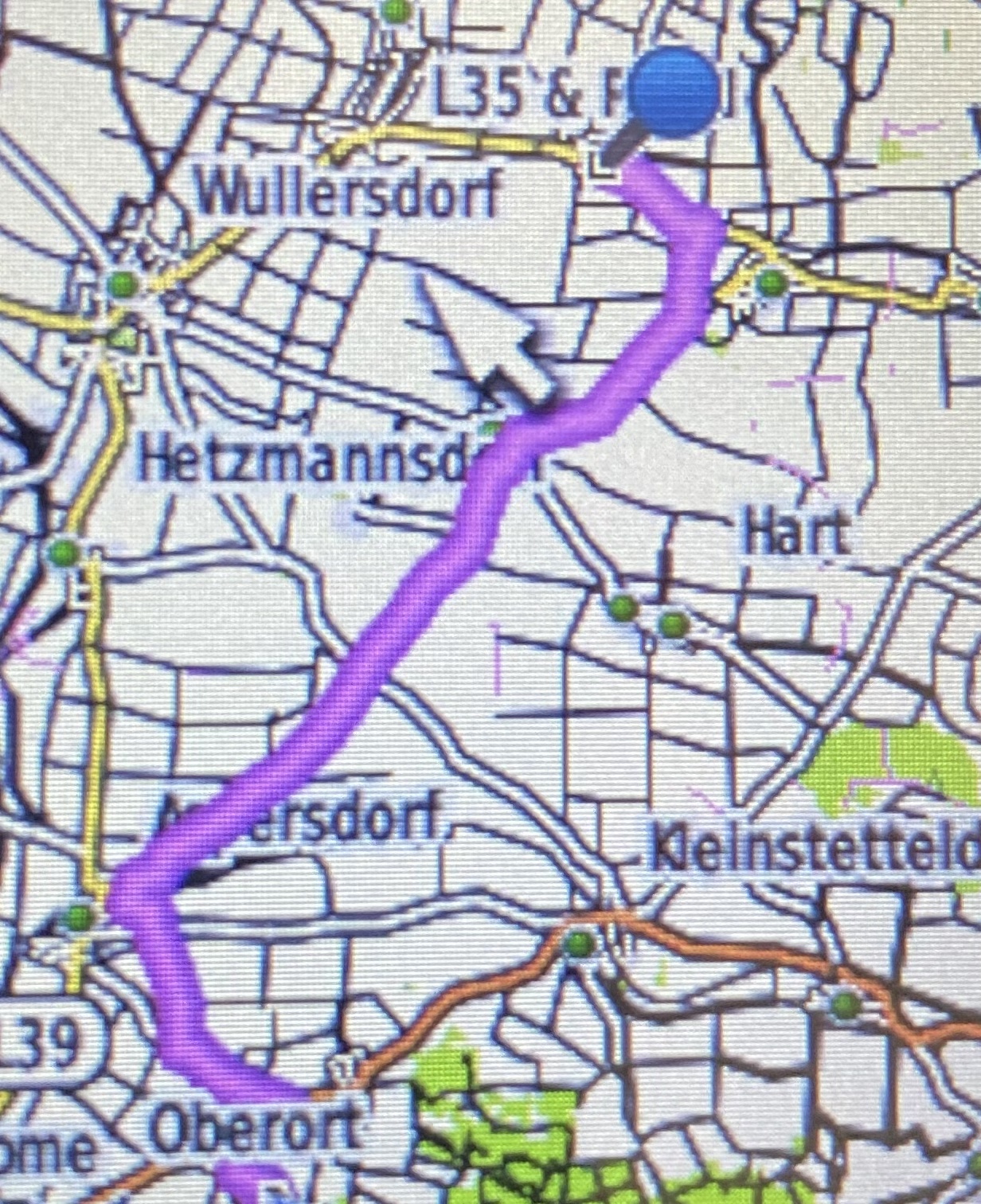
With OpenTopoMaps on garmin gpasmap 66 and routing option MTB and minimize distance, i get routing on bigger streets (pic 2)
How to proceed to get routing on small streets like komoot on my gps with opentopomap?
Routing example in austria
From 2020 Mariathal to 2022 Schalladorf
Deutsch-German
Was muss man eigentlich einstellen, damit das Routing auf Waldwegen7Feldwegen, verkehrsarmen Wegen erfolgt?
Habe eingestellt am Gpsmap 66 mit Firmware 7.20 im Routing:
Mountainbike
Minimize Distance
Aber die Ergebnisse sind Umwege auf leider stärker befahrenen Landstrassen
Mit Garmin Topo kommen gute Ergebnisse
Mit Komoot kommen auch gute Ergebnisse heraus
Mit OpenTopoMap leider nicht
Routenbeispiel in Österreich
2020 Mariathal nach 2022 Schalladorf
Gut gelöst von Komoot - keine stark befahrenen Strassen
Leider mit der OpenTopMap am GPSMAP 66 über eine stark befahrene Strasse und nicht über kaum befahrene Feldwege