I am excited to introduce OpenStreetEditor, a new mobile editor for OpenStreetMap, specifically designed for the iOS platform. The application is now available for alpha testing.
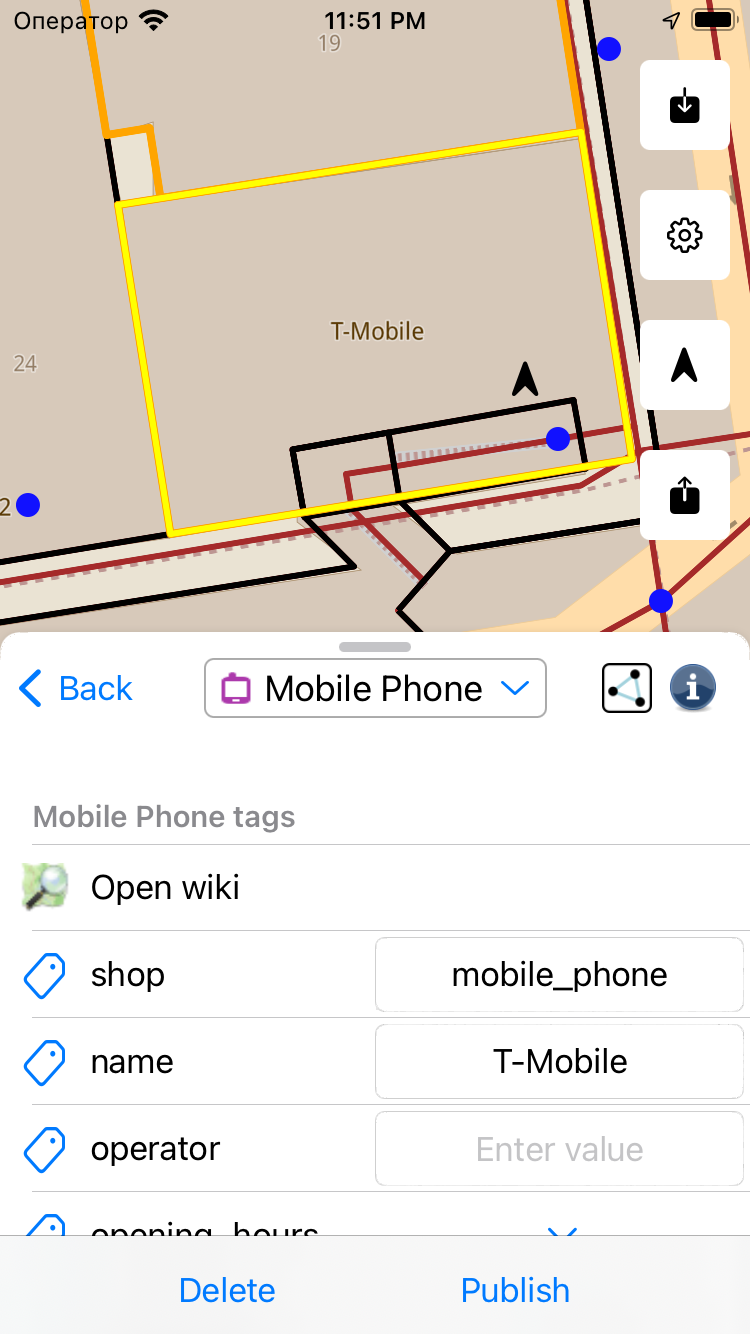
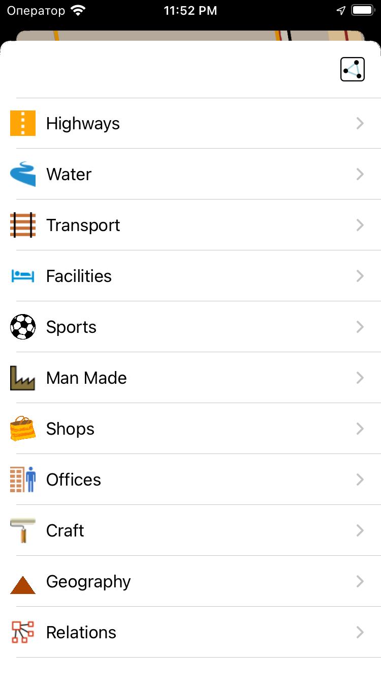
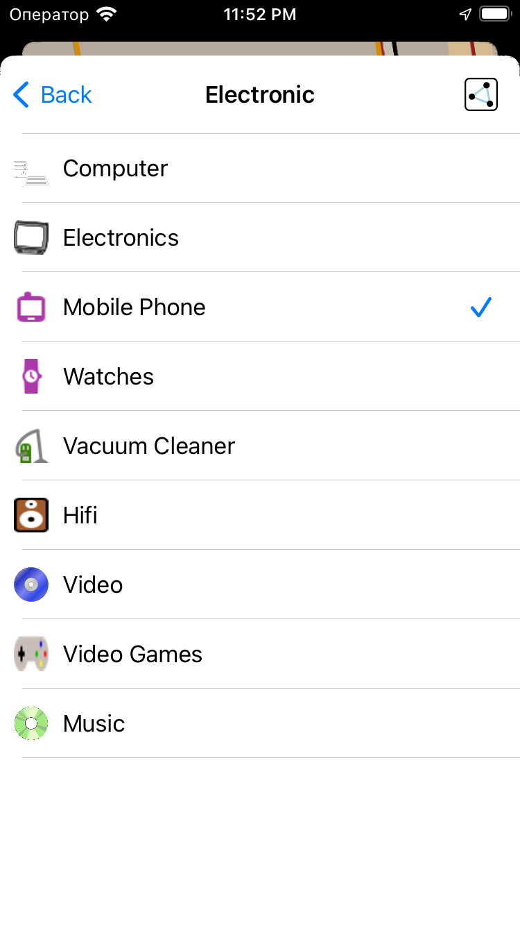
In its initial version, OpenStreetEditor allows users to add new points, edit tags of existing points, lines, and polygons, as well as delete objects that are not referenced by other objects.
OpenStreetEditor is built on the foundations of JOSM presets and the highly efficient GLMap framework, designed for seamless interaction with OpenStreetMap data.
The editor is distributed under the GPLv3 license, and we warmly invite anyone interested to participate in its development. We eagerly look forward to your involvement and feedback as we strive to refine the application.
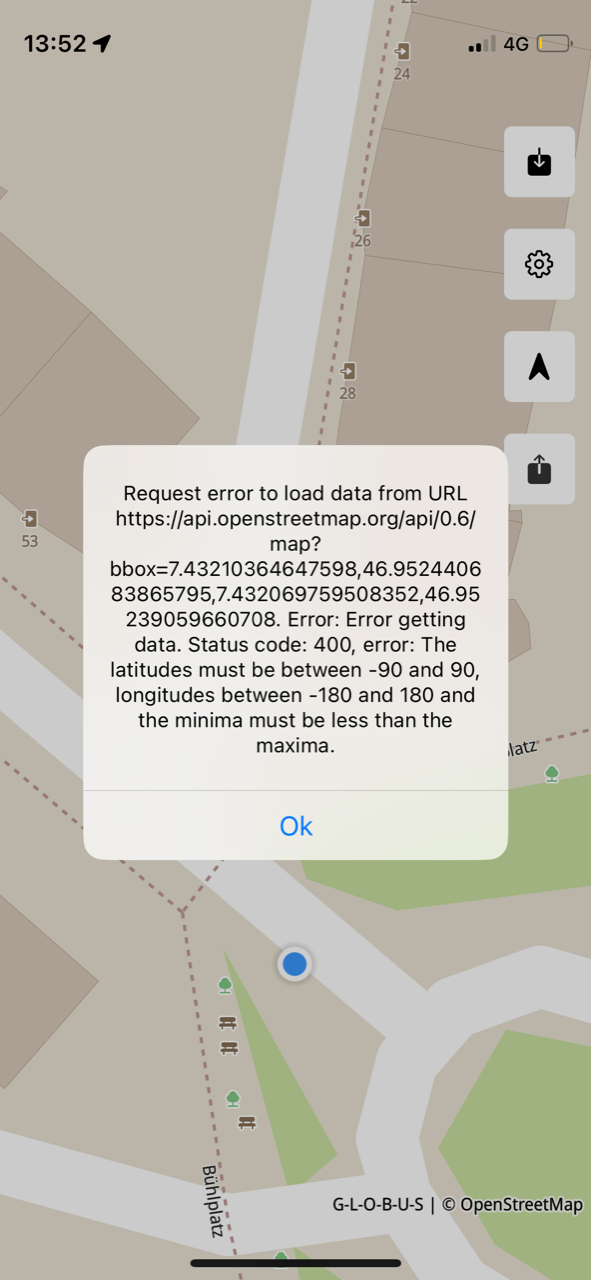
Thanks again for the feedback, the problem is the incorrect determination of the geographical coordinates of the screen after the map is rotated. Added this bug to the list for the nearest elimination.
Happy to provide feedback, but this will not happen in the Telegram chat.
It strikes me as a bit strange that the changeset tag contact=https://t.me/OpenStreetEditor is added.
Are GitHub issues also a good feedback mechanism for you?
But I do need to point out that naming the project “OpenStreetEditor” is a bad idea, while using the OpenStreetMap trademark is permitted for non-commercial software projects see Trademark Policy - OpenStreetMap Foundation I consider it highly problematic to imply exclusivity in you project name, not to mention rather unfair towards competitors on the same platform for example GoMap! that took the minor effort required to create an original product name.