In Chiang Mai we talked about server infrastructure from time to time, now it’s real.
I’m please to announce some serious improvements on the server infrastructure.
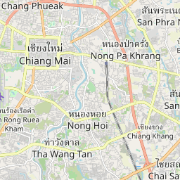
The server behind http://www.osm-tools.org/ (also known as http://thaimap.osm-tools.org/) is no longer a virtual machine, but running on its own dedicated hardware. This gives a huge improvement in rendering speed of the map as i/o operations have no longer to be shared with other users.
This was made possible with the help of a generous donation by Mentz Datenverarbeitung.
The setup process took a while as I migrated all services bit by bit keeping the system operational and without service interruptions all the time. I mostly succeeded. Only small issues popped up. I had to fix some problems with the rendering stack which I already contributed back to OSM. The server even had its first hard disk failure. I was quite pleased by the fast response time of the new hosting company. The defective disk was replaced within 20 Minutes. All caused only minimal downtime.
Things look pretty stable now so it’s time to announce it officially.
For those interested in the server specs: It is an i3770@3.2 GHz, 32GB RAM, 240 GB SSD for the database and 3TB data storage. 1GBit/s uplink (data-center total connectivity 570 GBit/s). The machine is connected to AS24940 https://www.robtex.com/as/as24940.html
All software was upgraded to the latest available versions. Rendering is now based on CartoCSS enabling us to merge in the main site modifications easier. Currently it’s enabled on a separate layer. Previous bilingual modifications will be merged into it.
Enhanced services:
• to better visualize some dense mapped areas the maximum zoom level is now increased to 20. This is double the resolution than what’s provided on osm.org. One pixel on the map is roughly 15cm in reality.
• The server runs an analyzer back-end for osmose. You can see the reports on the main site. Thai translations of the front-end are possible.
• Currently osmose processing is enabled for Myanmar (Burma), Laos, Cambodia, Thailand, Vietnam, Malaysia, Singapore and Brunei.
• Map coverage was extended. It now includes the full territory of Myanmar (Burma), Laos, Cambodia, Thailand, Vietnam, Malaysia, Singapore and Brunei.
• Quality assurance reports on http://reports.osm-tools.org/ have been improved
○ A new report lists areas tagged as landuse=reservoir where the covered area is suspiciously small. Most likely these are other man-made features like water=pond, leisure=swimming_pool or such
○ A new report lists roads with numbers in the name tag. This is usually not the name of the road. Reference numbers belong into the ref tag
○ Mixed Thai/English detection has been improved to report less false-positives
○ A new page shows some osmose graphs about the development of these issues in Thailand
○ A new report provides some statistics about editing activities
• To check out the server speed for your connection you can use an instance of speedtest mini running at http://speedtest.osm-tools.org/. Depending on your ISP you should see some decent rates.
Future improvements:
• They map style is not that beautiful in the high zoom level 20. Some improvements would be needed. If you would like to work on cartography, please let me know as I certainly would need help with modifying the map style.
• Some front-end pages still use an older release of OpenLayers. This will be updated soon.
• I plan to extend the highway/water comparing map OSM vs. Google to a worldwide coverage. You can find it at http://compare.osm-tools.org/
• I plan to update WDYE so it can actually work with up-to-date data
• I have a ton of more ideas what could be implemented. If you have ideas of something to host for Thailand, please contact me.
If you notice any problems with the site please let me know so it can be fixed. Also if you have suggestions for improvements: Letting me know increases the chance that they will be implemented.