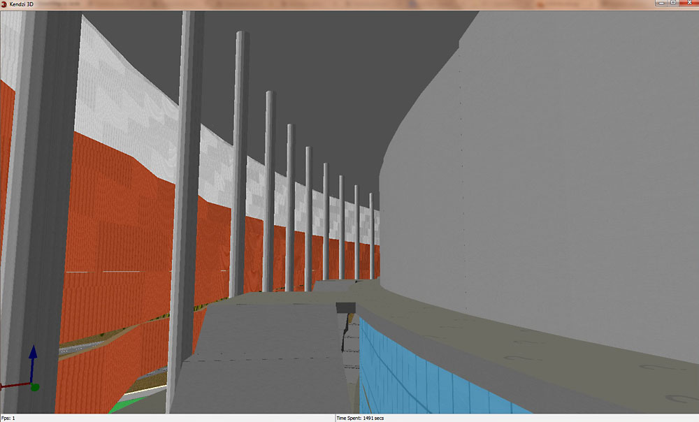
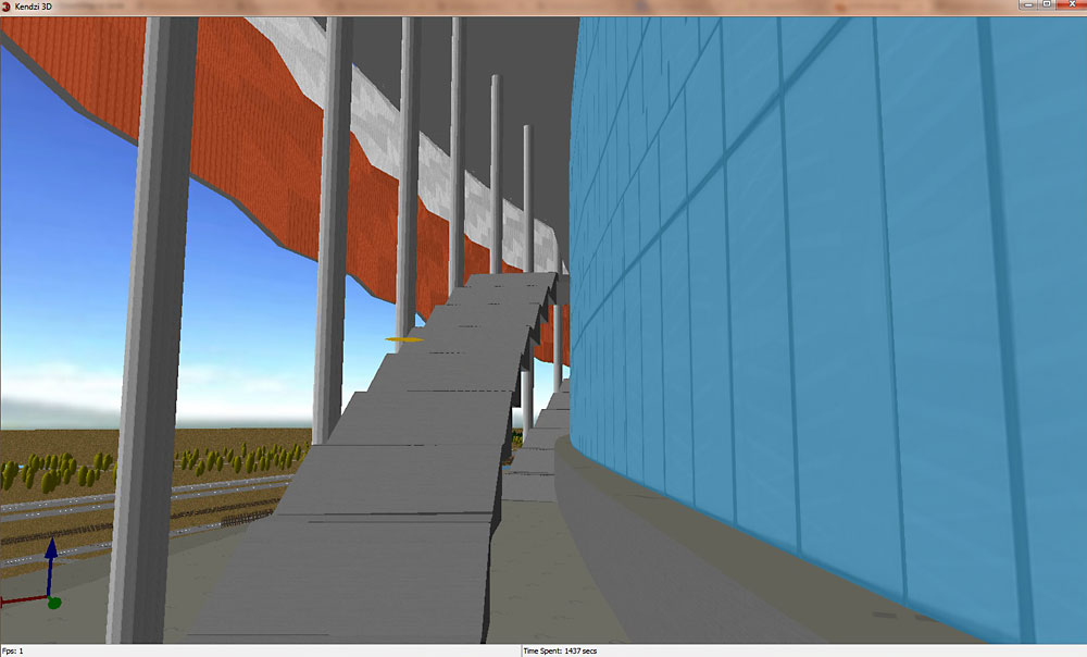
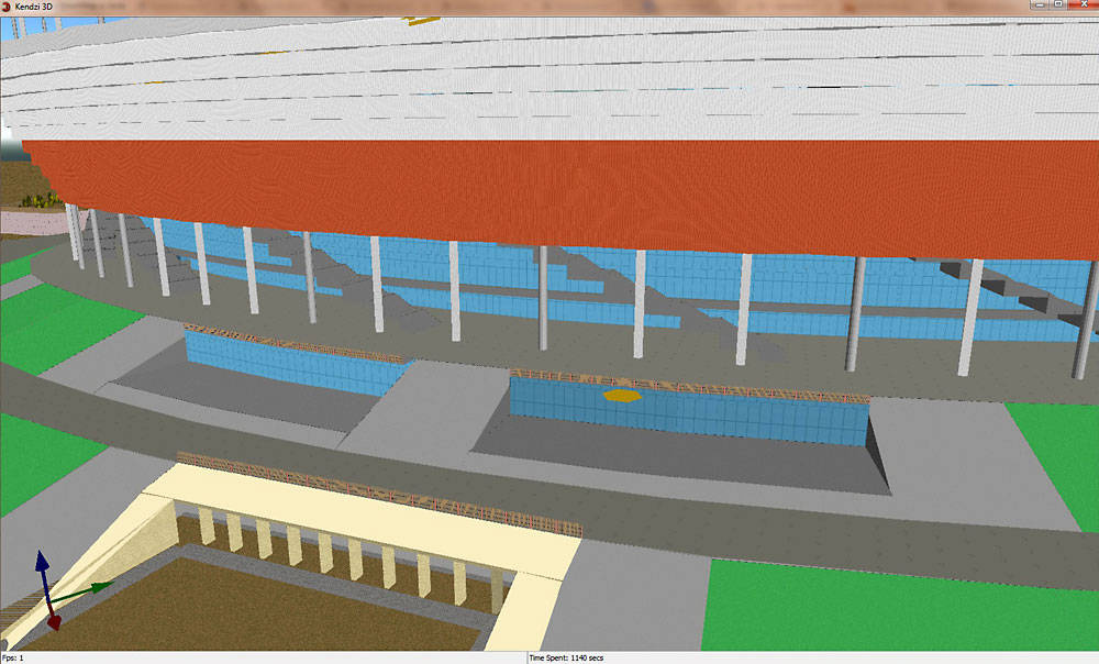
There is something new in Kathmandu, Nepal:
Thank you guys, good job!
Marek
There is something new in Kathmandu, Nepal:
Thank you guys, good job!
Marek
Please check the mapping before giving links to such a mess:
most roof:height are missing so it gives different rendering between projects (on F4Maps most of wall are screwed because generated roof:height is higher than heigh-min_height)
roof:colour=#cococo i think using “0” would be better for a color than “o”
height=0.1 on building outline with higher parts (outline height should be the max height of every parts)
many dupplicated nodes, overlapping buildings and other JOSM Warnings
Well, cmif4, the best possibility for us to teach the people there.
They are very happy to achieve this results and enthusiastic.
What they need is feedback from us.
I don’t understand how it has been pushed to osm, there are self-intersecting polygons, a big mess with S3DB tags, partial taggings etc.
It look weird in both Kendzi3D and F4Maps (I didn’t checked osm2world but i can predict it won’t look nice).
I don’t blame the contributor if he is learning S3Db but he could at least check the result inside a 3D renderer.
I contacted him by private message to ask him to check and fix his rendering with Kendzi3D and redirect him on this topic to ask if he needs help.
Great cmif4!
I have recently unfortunaltely no time for teaching. Normally I like it.
Thank you!
Marek
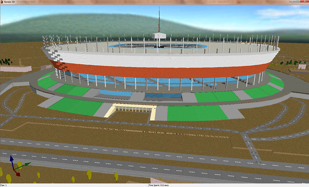
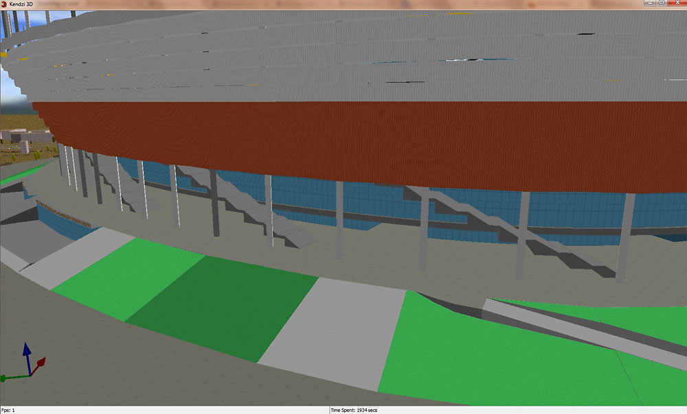
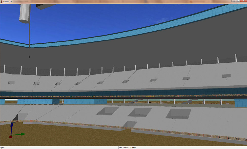
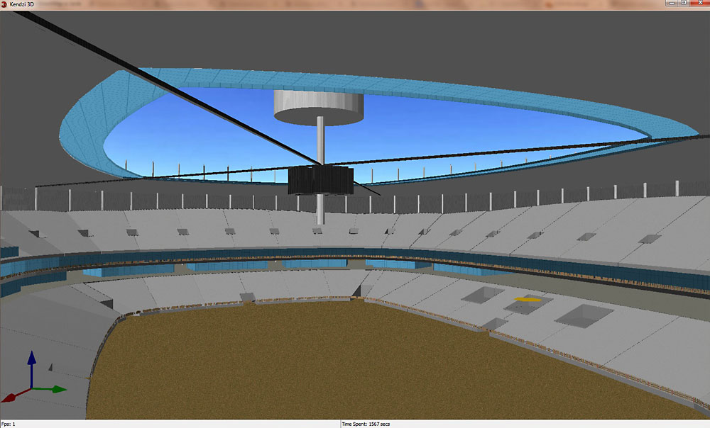
It is not perfect but this is what is being made http://en.wikipedia.org/wiki/Pashupatinath_Temple
most roof:height are missing
This is because roofs have been digitized separately than buildings. Since roofs cover much larger area than the building, atleast twice as large. So roofs are made as buildings without the lower part.
generated roof:height is higher than height - min_height
This is because there is no support for trapezoidal roof, Pyramidal roof are made by giving higher value for roof:height and then another structure is used to cover up the extra part. Since values are not exact, there are some mismatches.
roof:colour=#cococo
This has been corrected.
many dupplicated nodes, overlapping buildings and other JOSM Warnings
duplicated nodes have been corrected, but there are no overlapping buildings.
Look at this example from polish OSM user marcin_b:
http://www.openstreetmap.org/#map=17/52.23935/21.04544
Great 3D model!
The data are too big for f4-maps. Use Kendzi3D or opensciencemap instead.
Rendered images:
http://skw.org.pl/mb/osm/osm3d-sn13.jpg
http://www.skw.org.pl/mb/osm/osm3d-sn02.jpg
http://www.skw.org.pl/mb/osm/osm3d-sn04.jpg
http://www.skw.org.pl/mb/osm/osm3d-sn05.jpg
http://skw.org.pl/mb/osm/osm3d-sn07.jpg
http://skw.org.pl/mb/osm/osm3d-sn08.jpg
http://skw.org.pl/mb/osm/osm3d-sn09.jpg
http://skw.org.pl/mb/osm/osm3d-sn10.jpg
http://skw.org.pl/mb/osm/osm3d-sn11.jpg
http://skw.org.pl/mb/osm/osm3d-sn12.jpg
a colleague made a quick fix for it to display
a lot of building:part are outside the building outline and so won’t display.
same problem for the ceiling, it’s too big compared to outline so it’s not included in the building. also outline includes a hole in the middle, explaining the loss of middle stuff!
for the part that looks like ceiling, it’s the outline leftovers, use building:part=no to remove it.
http://demo.f4map.com/#lat=52.2395797&lon=21.0463683&zoom=18&camera.theta=58.514&camera.phi=166.627
looks like there are the same problems on opensciencemap
http://opensciencemap.org/map/#&scale=17&rot=-4&tilt=49&lat=52.239&lon=21.045
insane level of details though ! ![]()
looks good now ! ![]()
Which editor has been used for that kind of tagging?
He used JOSM with Kendzi3d for preview.
Beautiful:
http://demo.f4map.com/#lat=54.7735798&lon=-1.5766062&zoom=19&camera.theta=45.859&camera.phi=-63.598
http://demo.f4map.com/#lat=3.1578288&lon=101.7138771&zoom=18&camera.theta=50.779&camera.phi=-87.376
Also Burj Khalifa : http://demo.f4map.com/#lat=25.2005512&lon=55.2742917&zoom=17&camera.theta=38.697&camera.phi=43.258
If you wish to find interesting buildings for 3D modeling, look into the www.skyscrapers.com
Good Example from India, Mysore Palace:
http://demo.f4map.com/#lat=12.3053845&lon=76.6546715&zoom=20&camera.theta=56.173&camera.phi=53.572
Good job ![]()
Good job from Malaga:
http://demo.f4map.com/#lat=36.7319454&lon=-4.4358539&zoom=19&camera.theta=62.762&camera.phi=-87.663
Thanks!
Marek
Dome of Siena. Still in progress:
http://demo.f4map.com/#lat=43.3184795&lon=11.3294446&zoom=19&camera.theta=65.054&camera.phi=-16.329
Looks really good.
I noticed that a lot of buildings (including the last one) are not connected to some high level relation. Is it just because of “work in progress”? I’m working on my generator for Unity3D and it is quite important to group all parts by one relation so that I can create one Unity’s GameObject instead of hundreds. This is major performance optimization f and also this way I can interact with the building as single mesh which is quite important from business logic. For example, I like this one:
http://www.openstreetmap.org/relation/3224486
With my generator, I’m able to create one mesh here instead of hundreds.
We’ve had a mapping party at Grozny city recently. And here’s a bit of results:
http://demo.f4map.com/#lat=43.3176756&lon=45.6940556&zoom=20&camera.theta=59.037&camera.phi=-165.871
Dear Felis Pimeja,
fantastic model, great job in Grozny!
Dear eis_kalt, that´s true, the Siena Cathedral is still in progress.
Could you be so nice and add your hint into the subpage: http://wiki.openstreetmap.org/wiki/Simple_3D_buildings#Building_relation.
Maybe a link to an other Page with examples showing what happens with 3D model without building relation.