I do not see any need for this approach. Indicate the source in the changeset.
And why had you mapped such simple geometries as buildings as multipolygons? One click to select all points of a building outline and one keystroke to unmap it from the neighbouring building.
Yes, and had I known that (for ID) when starting mapping in earnest roundabout late 2020, I’d have saved countless hours, not caused countless nodes set to have missed the target, and would have been finished before discovering this ‘Feature’ in JOSM late 2022. Now I’m JOSM 99.9% simply because of the speed and absence of involuntary map dragging in ID without touching a button of the mouse… endlessly tedious.
The only time I use ID is for their Presets which are NSI driven, pull in wikidata/wikipedia/brand info, so I just snoop there, pick the tags and formulate a JOSM custom preset, for banks, supermarkets, postoffices, pharmacies, and never a key tag wrong at that when doing a new one, and barely a chance of missing a tag. A complete pharmacy POI here takes 18 lines and this does not even include payment methods, so passé to me. They all take Visa, Maestro, Mastercard, debitcards, and still cash. Anyway, not going to sit here paining the space between the audio receptacles to remember them all.
Please pay attention:
There are now three different aspects of multipolygons being discussed in this discussion, but they should be handled differently and have little to do with each other:
for two and more neighbouring areas - stack (“glue”) the edges of the touching polygons vs. sharing one (!) edge in different multipolygons (a MP then has more than 1 outer).
Connecting areas with roads - again “gluing” a polygon to a way vs. sharing a way as an edge for a multipolygon - both are big crap!
Thnks muchos, found a thread Name Suggestion Index in JOSM - #11 by vorpalblade-kaart discussing this to which I will turn if probs/queries arise such as freezes which I did not experience but maybe a few micro seconds. That discussion ended Nov’22.
I’ll need to (as you say), start typing to discover the benefits (maybe it does solve another issue I had/have ‘pre’ custom presets, of the forgotten tags/values after starting a new session. My noted custom presets essentially fill all the fields, have picklists for the most frequent and variables for a bank, supermarket etc.
In general, I share your view. For the buildings however, it really depends. The building number 12 isn’t sitting on top of the garden but is really adjacent to it. It has to be two polygons.
edit: besides: any complex building has to be drawn as a relation anyway.
In any case you need to create a new “geometry” which means - planting new nodes on the map. So whats the point here? I am simply saying that collecting individual lines into relations is pretty much a tedious job and prone to error.
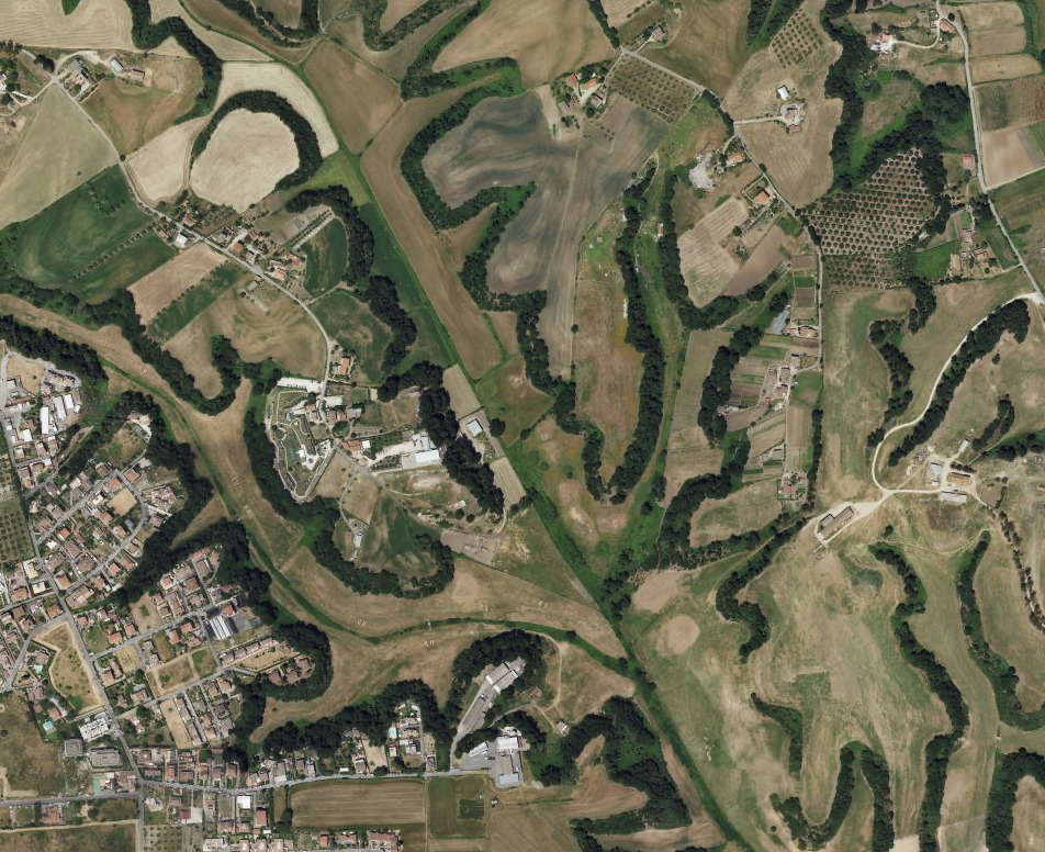
I was referring to landscapes without rectangular shapes like here, where you would duplicate lots of nodes with the overlapping ways method (e.g. borders farmland and wood) it is much simpler reusing them in relations.
Absolutely agree, they are bad for everybody. It is unnecessarily complicated, it has several disjunct outer rings, and the very minimum would be splitting it into these. If it remains too complicated, the resulting parts can be further split at adequate cuts (primarily I would do it at roads, railways and waterways, but also according to leaf types and other properties).
Thanks for this example. I had not figured out a way to do this that didn’t involve much tedious ungluing, then and moving of each overlapping node. The “difference” provided by More Tools → Split Object (a.k.a. ALT+x) makes this so much easier. Thank you for pointing this out.
Thanks for this example. I had not figured out a way to do this that didn’t involve tracing over each node of the shared ways to build up the border between the existing and new objects. The “difference” provided by More Tools → Split Object (a.k.a. ALT+x) makes this so much easier. Thank you for pointing this out.
In JOSM, you can just hold down the “F” key and it’ll zip along the border until it reaches a point where it can’t decide which way to go. I’ve mapped adjoining farm fields in a matter of seconds this way.