I’ve now done this. There’s now a Superrelation for the Wolds Way. Most of the route is in the original relation (which is also part of E2), with the link into Hull separate.
One outstanding question is which of the two routes past Market Weighton E2 follows. At the north end at least there’s no signage of the Wolds Way that suggests that one is “main” and one “alternative”. If there’s anything anywhere for the E2 it might make sense to split out one braid,
I had heard the Humber Bridge was blocked? Am I mistaken, or has it been reopened?
I wondered about the link - there is no signage at all, no E2 and no local or regional routes, so I decided to leave the gap on OSm as well.
(Currently my personal map-a-gap policy. Which reminds me: I still have to remove a few link sections I created up under my old map-a-gap policy, based on non-ground truth).
I don’t really mind, but I would very much prefer if there were at least signs of the regional routes pointing to each other. Then I would create link route relation, enter it into both regional superroutes with the role connect (or approach) and also (withiout role) into the E2 ‘hyperroute’.
Yeah - I use it only incidentally for a comparison. To really work as a monitor in a multi-user workflow, it would need a few more user functions, such as marking an issue with a status (e.g. ignore) and attaching a note (eg “Survey needed”, or “Adapt OSM”, or “Adapt GR vzw” or “New route will be waymarked 2024-01”) . And some form of notification (rss).
If you’re referring to the closure in 2021, then apparently it did reopen, and among other things the bridge’s website has an extra link on it to try and help with the problem.
I haven’t walked across the bridge for ages and couldn’t say what local, national or international signage there currently is there. There wasn’t a gap in OSM before - the old relation used to duplicate most of the Wolds Way and join up with the Viking Way. I just moved the relations around; I didn’t change which ways were ultimately part of the Wolds Way or part of the local E2 relation.
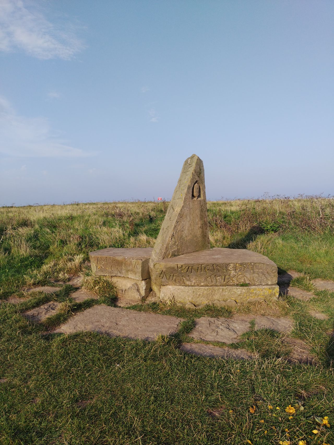
Edit: I forgot to mention that I did edit the Wolds Way at the Filey end - that was following survey. The markers where the Wolds Way joins the Cleveland Way is pretty clear:
Carved onto it are various places on the Wolds Way and Cleveland Way - no mention of anything outside Yorkshire though. Adjacent is the distance marker for the Wolds Way:
That’s pretty much a solved problem; it just needs someone to “actually do it”
As mentioned above, this diary entry explains what I do for UK/IE, using a rendering database. Route deletions are easy to spot because the number of database “lines” for a relation drops to zero. Superroutes are slightly different, but querying the API once every few days for the existence of a relation isn’t going to cause anyone to lose any sleep.
We’re planning to hike part of the E8 Romania soon. I noticed that it has recently been published on the ERA website and I downloaded the GPX from here and uploaded it to OSM here There are considerable differences between what is already on OSM and the newly published GPX: at first sight about 20% of the route (200-300 km) deviates. Before starting to edit the route relation, I was wondering if anyone here has worked on this route and can tell me why there are such big differences. Ping @steenkobberoe