It’s perfectly possibly in the real world for an area to have more than one “landuse”, both in terms of OSM tags and in terms of actual land use.
Just up the road from me there’s an area that:
is used by the military for exercises
is used as a nature reserve (with woodland, heath, scrub and wetland areas, and areas that are mixtures of all of them) where public access is prioritised - almost but not quite a park
is used for agricultural cattle and sheep grazing
Mapping something like this will always be a bit of a compromise.
I have already replied to exactly these military exercise areas in my last post.
And yes, I know some mappers understand overlapping landuse as ok, others (like me) don’t …
(With the caveat that Australia is quite different than where I map.)
I also map overlapping landuse areas, for the simple reason that the landuse key is a misnomer: somehow, in the annals of history, the community decided to put both land use and land cover under the same key. The fact that the landcover key never took off doesn’t diminish the fact that land cover is a distinct concept across GIS and other fields. I would absolutely make a landuse=residential area overlap the landuse=grass area representing someone’s lush front lawn, because otherwise landuse=residential would be synonymous with building=detached in many places. I’d probably make a landuse=residential area overlap a landuse=highway area to avoid atomizing the landuse=residential area into something less meaningful, especially if it’s a named landuse area.
What’s more, in most conversations where people bring up “land use areas”, they really mean anything that would typically be filled in by a renderer such as openstreetmap-carto, including amenity=hospital, leisure=park, and natural=wood. Surely a park or a cemetery can include some wooded areas. I know of no other way to say that this golf course is part of this military airfield.
I probably wouldn’t overlap a landuse=residential with a landuse=retail. But that’s different because residential and retail are formally two distinct kinds of land use, not merely lumped under landuse. I normally wouldn’t overlap a natural=wood with a natural=wetland either, except when mapping a bayou.
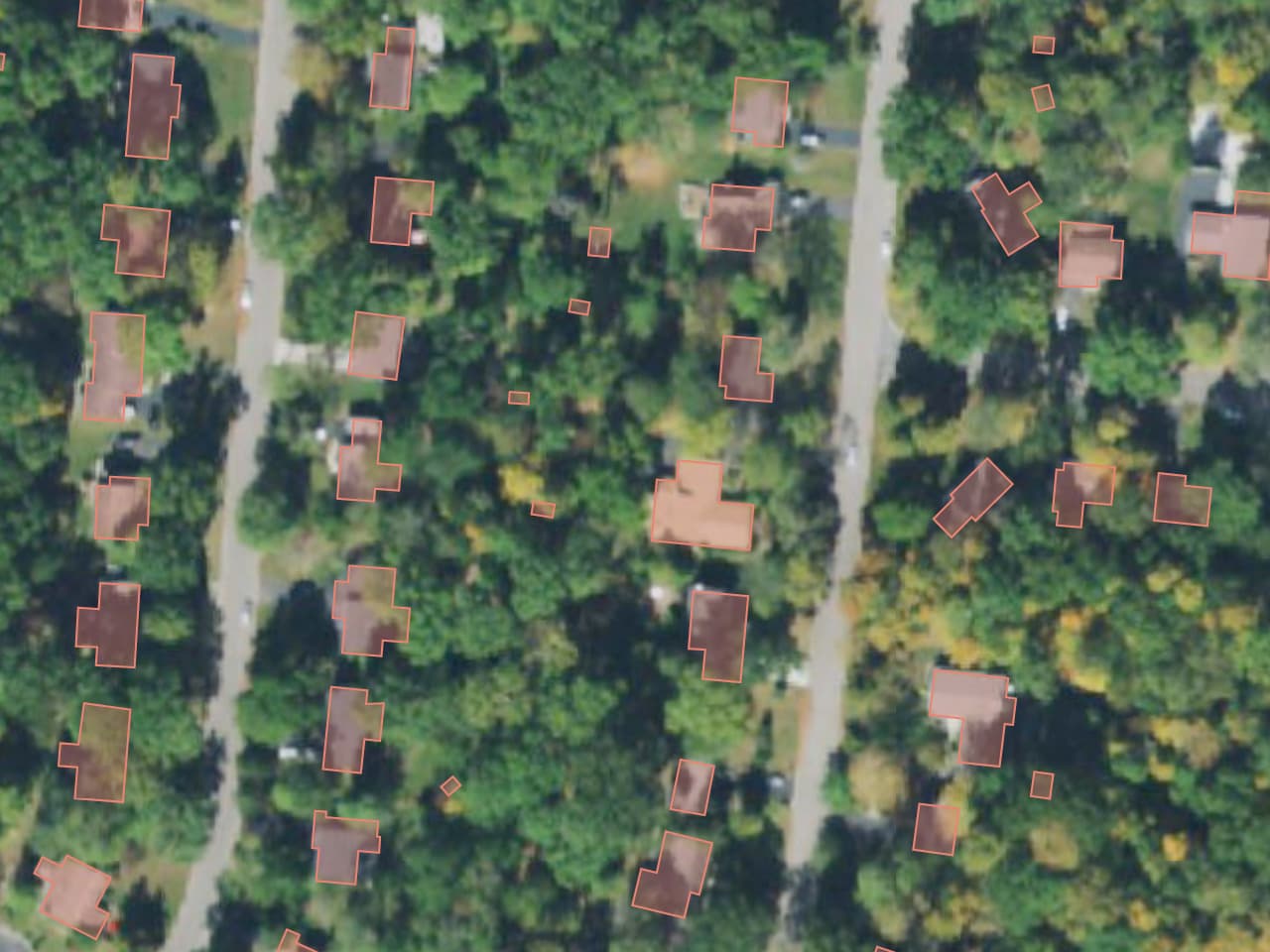
Wooded lots are very popular in many parts of the U.S. Often, the tree canopy covers the house by design. I’m too young to remember when this residential subdivision was developed in the 1970s, but by now, it looks like the houses have been there as long as the trees. Yet obliterating the landuse=residential area in favor of the woods would be counterfactual, implying somehow that this is undisturbed woodland and the many residences and residential streets are just there by coincidence.
Definitely. This subdivision looks similar to many in my area (street view). It looks appropriately mapped, not with a forest area overlapping the whole residential area, but with smaller forest areas covering the back parts of the lots where the woodland is much closer to its natural state. I definitely have mapped smaller areas of forest within a suburban residential neighborhood overlapping the larger residential polygon like this. For larger forest areas I generally don’t do this, though. The larger the forest, the less it feels “part of” the residential area.
Agreed. I would not support mapping in this way either.
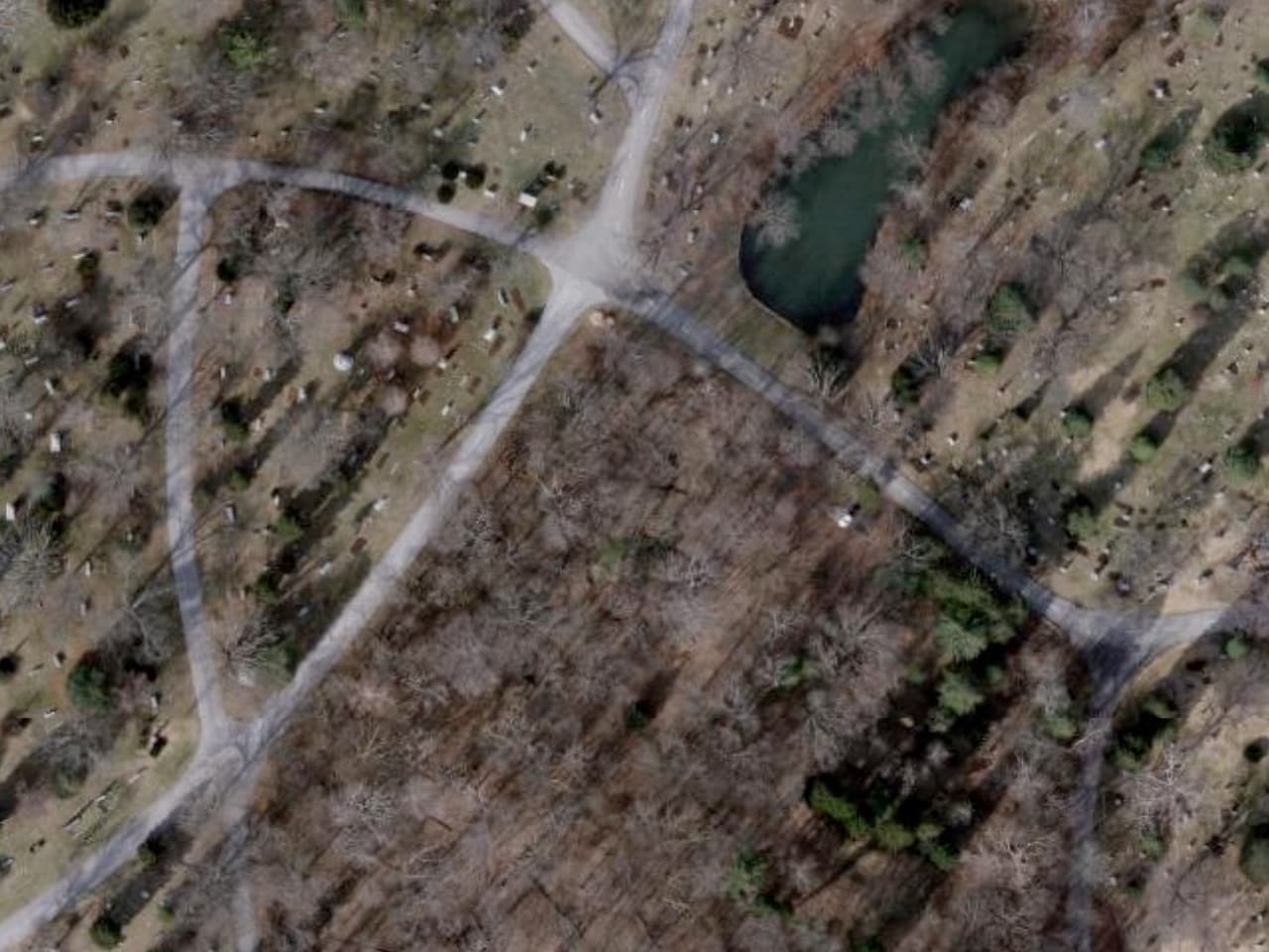
There is no overlapping of the farmland and the military exercise area as far as I can see from the aerial pic. The farmland ends exactly at the borderline of the military area which is coverd with grass, scrub and wood.
I get your point, makes sense in some way. Nevertheless for me what I see on the aerial pic I would never call a forest or wood. I understand this as residential where the private properties are planted with trees and tree groups. I believe not many mappers would think about adding an overlapping landuse=grass or natural=grassland to a residential area where most of the private gardens are covered with grass/lawns or would you?
Again, here in Germany landuse=forest or natural=wood would be misleading in some way as by law everyone is allowd to enter forest or wood for recreational purposes … I believe the owner of these properties would not be happy about that (but well, this may be different in the US).
How you managed to divine info about border of military polygon from aerial? Farmland may be also within reservoirs / military bases and so on (typically use of land is coordinated, for example farming scheduled in way that fields lays fallow when land is flooded or used for military exercises, or land is closed for military exercises with minimal use - for example for land within safety range of area used for artillery training).
Note that legal German definition of forest should not be assumed to match “tree covered area” definition used in OSM for landuse=forest and natural=wood (in particular, meadow within forest is part of forest but not part of landuse=forest area)
When you check the aerial of your sample you will see that the farmland ends directly at the mapped borderline of the military area. I am sure in other places there may be farmland within a military area. Here in Germany I myself have not seen that so far. I believe a farmer would not be very happy to dig the shells out of his acre after artillery training.
The legal situation in Germany is such that forest and woodland as described in the wiki are open to the public as well as any meadow within is.
Before we continue arguing about further details: I have no problem to accept your point of view, no wahalla. My understanding of landuse is different and (coming back to the topic) I would definitely not overlap a residential area with landuse=forest or natural=wood.