I just made a script to create a geojson file highlighting stops that mappers have moved from their GTFS position. See it here:
And the results:
If you don’t want to run the script yourself you can just download moved_stops.geojson as a raw file and open it with JOSM or whatever other software. Looks like this (used Ctrl+A to Select All and highlight everything):
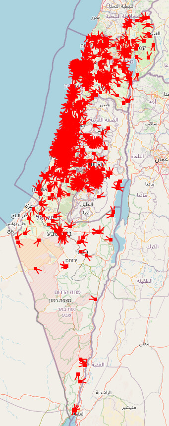
Zooming in to a random spot in Tel Aviv for example:

So this means these two stops were moved by mappers. We can use this to try and spot mistakes. For example, I am familiar with this stop in Haifa and I’m pretty sure this was wrongly moved:
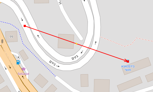
If you use this to edit, you should move the stop back to where the line starts. If it’s less than 3 meters away from the line start, gtfs2osm will automatically snap it back to its exact original location.