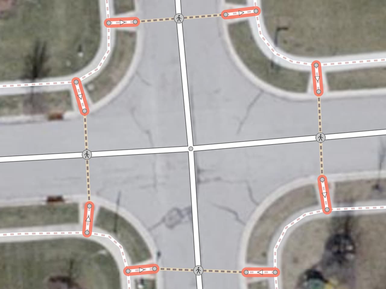
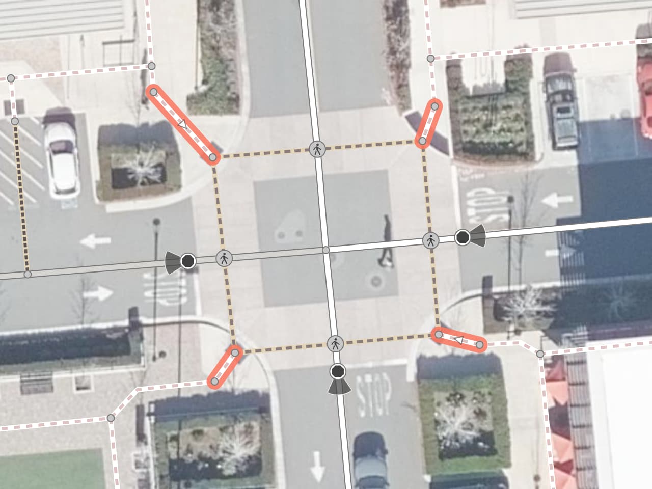
Often, these little stubs represent curb ramps. How you map the stubs depends on how you map the adjoining ways, so the following examples are an attempt to demonstrate how the stubs fit into an intersection layout.
The term “curb ramp” depends on an accessible ramp for wheelchairs and strollers (prams). As with footway=access_aisle, it’s pretty common to extend the stub a foot or two longer to meet the sidewalk way at the landing and tag it all as a sidewalk. Moreover, there are still many raised “curbs” without curb cuts or curb ramps, and sometimes they don’t connect to a path going all the way across the street. There’s no set term for the same geometry over one of these street corners. If I had to come up with one, I’d go with something generic like “crossing approach” or “curb approach”.
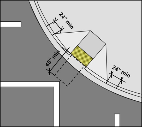
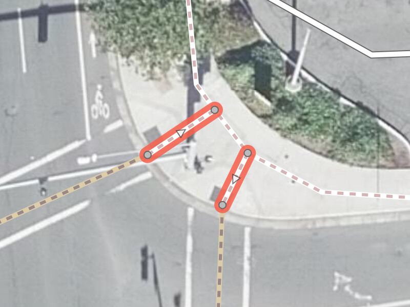
Diagonal curb ramp
I would make the two crossings meet at the tactile paving, then draw a footway from that meeting point to the landing above the diagonal curb ramp, connecting to one or more sidewalk ways. That footway would be a sidewalk too, because the curb cut marks the point at which both crossings end.
Thrush Court at Victor Avenue:
Almaden Expressway at Cherry Avenue:
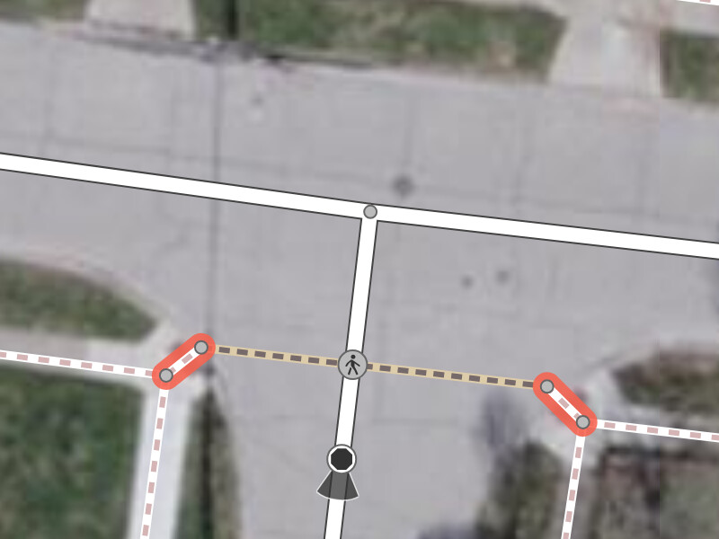
Parallel curb ramp
I would map no extra stub to represent a parallel curb ramp, because someone who stays on the sidewalk and continues straight past the crosswalk would still have to traverse both sides of the ramp.
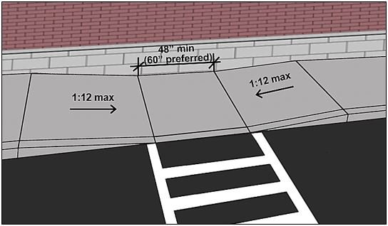
Valley Health Center Morgan Hill parking lot:
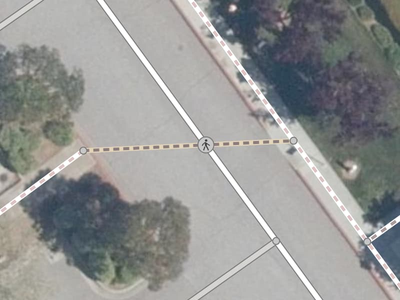
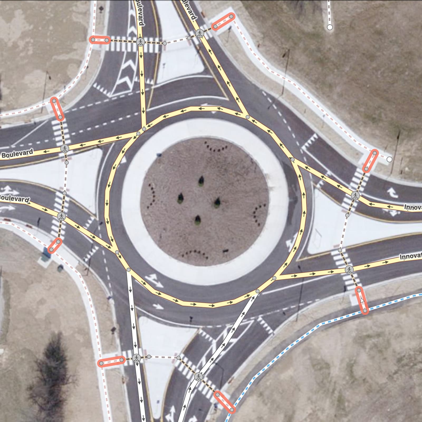
Offset crosswalk approaches
Sometimes the crosswalks are offset from the intersection but still parallel the street. Someone going straight through the intersection would need to curve around on the sidewalk, turn onto the curb ramp, cross the street, and turn back onto a sidewalk to go back around to the intended street. I still tag the approaches as footway=sidewalk.