Hi!
Let me explain the problem in detail:
We started to work on a travel guide based on openstreetmap data. To build a valuable website we need to build a hierarchy for each interesting place on earth so the user can navigate using this hierarchy. The task here is basically reverse geocoding, as it is done by a number of tools and even by the search on openstreetmap.org.
We started by extracting all the administrative areas (polygons/multipolygons with boundary=administrative and admin_level IN (2 … 11) as described on this page: http://wiki.openstreetmap.org/wiki/Tag:boundary%3Dadministrative
The next step was that we tried to actually build the hierarchy. In our case it is really important to know if an area is an country, some subnational administrative area (state, disctrict, region), a populated settlements (city, town, village, hamlet) or an subarea of such an settlement (borough, suburb).
Now lets look at two examples in areas where the inconsistencies cause problems:
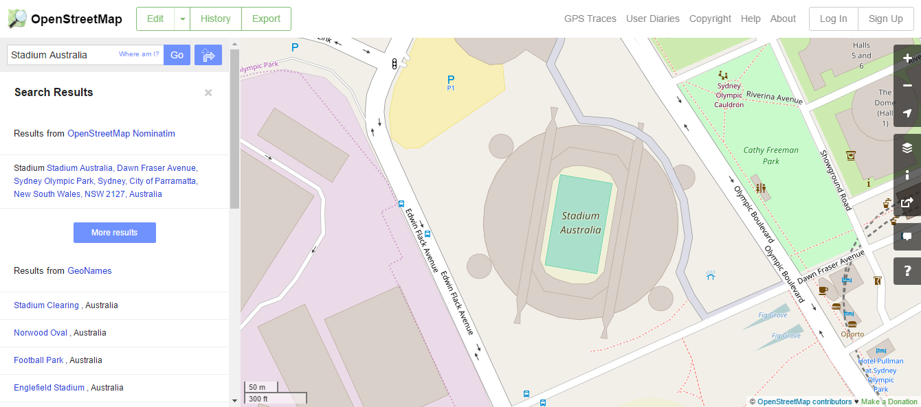
Stadium Australia
http://www.openstreetmap.org/search?query=Stadium%20Australia#map=17/-33.84712/151.06339
This is how it is currently geocoded:
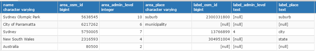
This is how it should be geocodes:
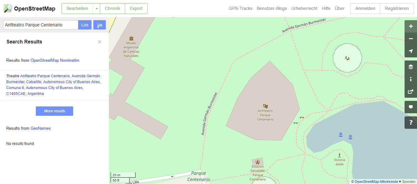
Anfiteatro Parque Centenario
http://www.openstreetmap.org/search?query=Anfiteatro%20Parque%20Centenario#map=19/-34.60593/-58.43672
This is how it is currently geocoded:
This is how it should be geocodes:
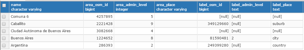
The problem here is that the information about the place can be present at two different locations (relation or the label node). Quite often the important information to build the hierachy is only available at the label node. In addition most of the tags are also only available on the label node.
The current inconsistencies make impossible to build a trustworthy hierarchy for quite some areas. And as pointed out even the geocoding on the openstreetmap website fails horribly because of those inconsistencies.
Hope this helps to get a better understanding. I am quite aware that I can not fix this kind of stuff without involving the local communities and it should definitively be fixed in the local communities. However I just don’t have the time to contact a lot of peoples to get them fix this.
My current idea is:
- Verify with you that this is really a problem that should be addressed and/or come up with a better algorithm for reverse geocoding.
- Have someone challenges for Maproulette (http://maproulette.org/) to get this fixed in the local communities.
I would really love to read your thoughts on this.
Best Regards
Tobias