- If it would be an emergency lane, I would have used
designatedinsteadyesas value. - If the lane is not suitable for any transport mode at all just skip
emergency:lanes[:*].
I’m not sure it’s a good idea to model a virtual gore area as simply a closed lane, even if it seems convenient. (Lanes can be closed too, but they aren’t necessarily painted like this.) The only thing it has in common with a lane is that there are lane dividers on either side.
Like any virtual traffic island or bike lane buffer, a virtual gore area can be much narrower than a standard lane:
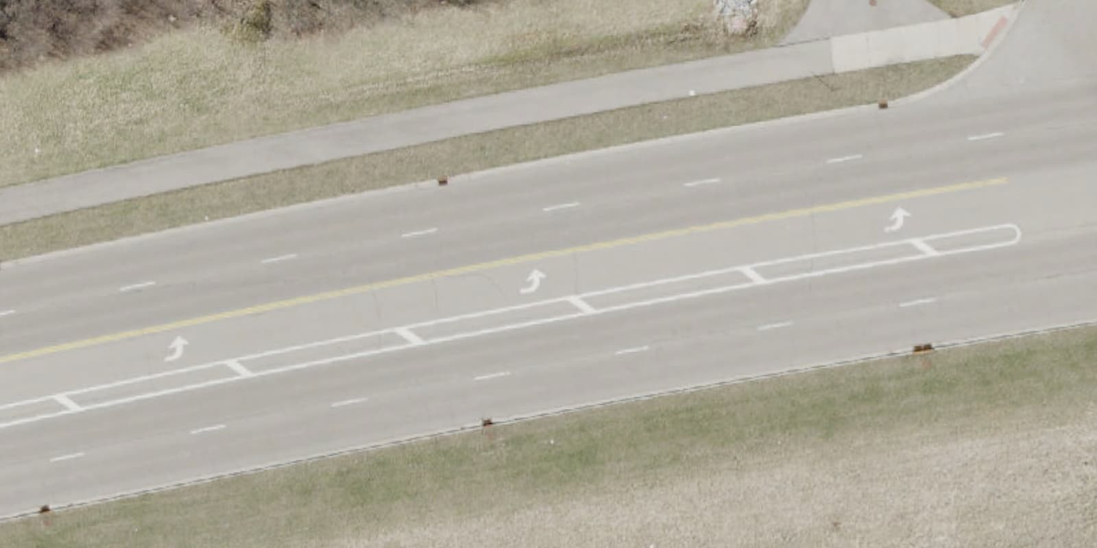
Or or much wider, varying in width from one end to the other:
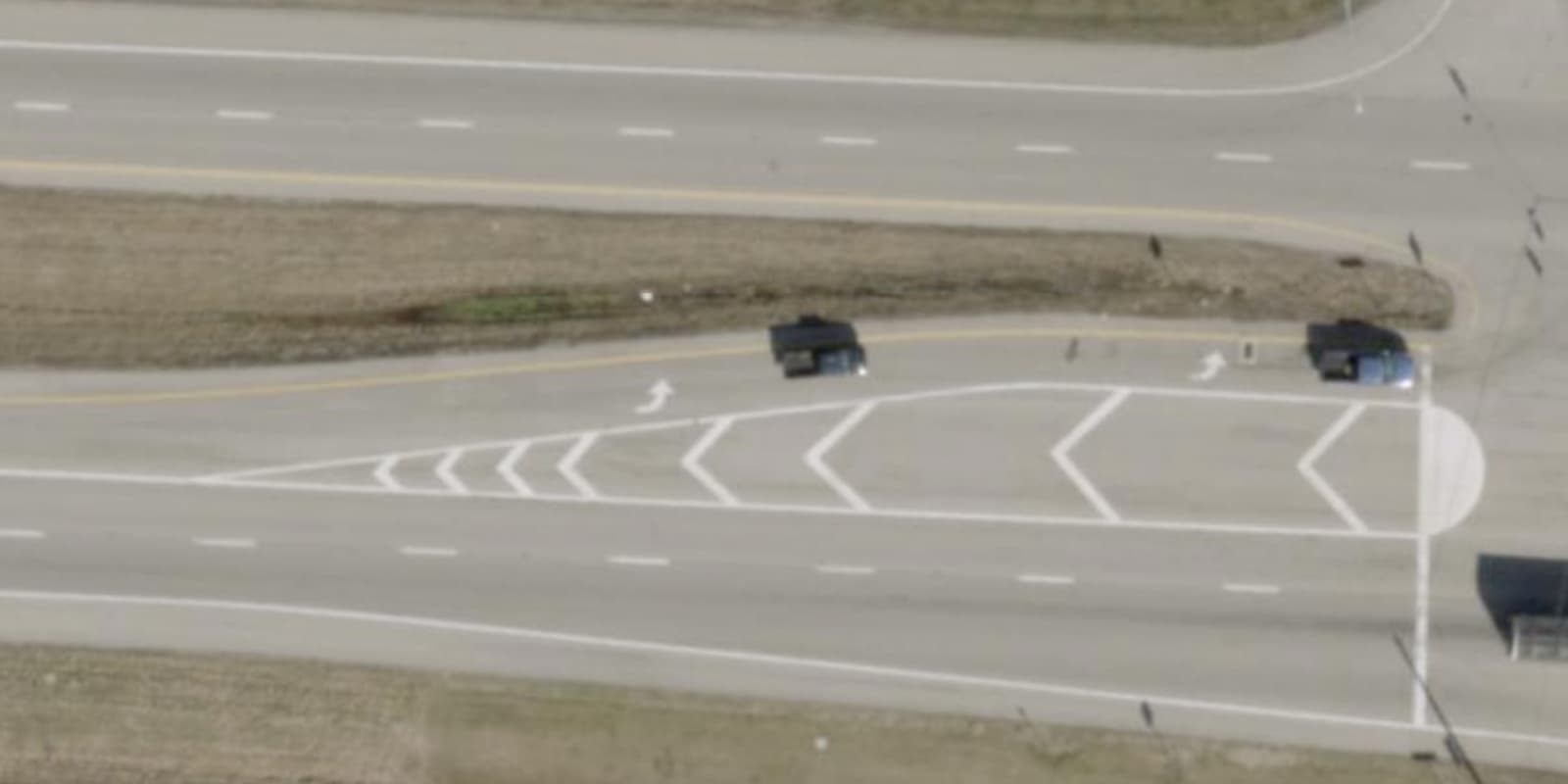
There can be a real, physical traffic island at the very tip of a virtual gore area to protect the crosswalk:
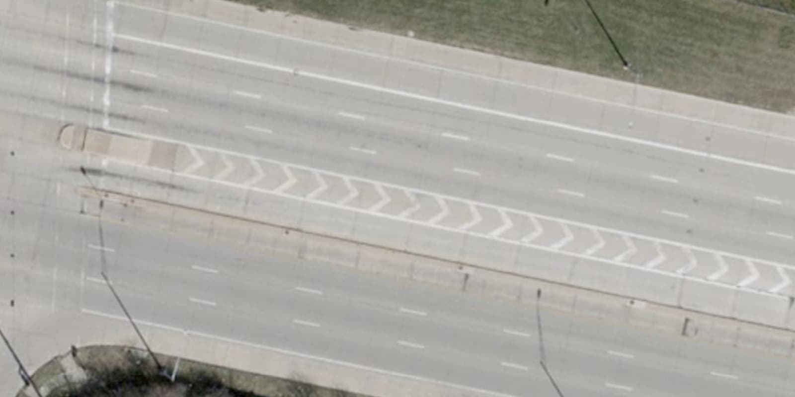
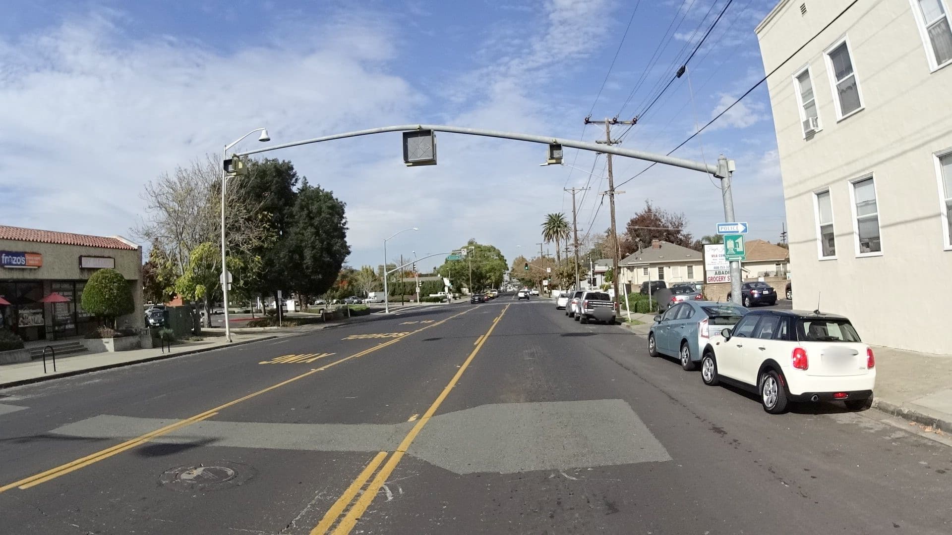
To be fair, sometimes these virtual gore areas do get converted into travel lanes. Originally, the through lane on this roadway was closed off and painted as a virtual gore area until the road to the south of the intersection opened several years later, making it possible to go straight through the intersection.
1 Like
Note, I do not count them as lanes as the values for lanes=*, lanes:forward=* and lanes:backward=* show.
- width is not a problem as we can use
width:lanes[:*]=*similar to bicycle lanes which do not count aslanes=* - if there is a real physical separation (not just some paint on the tarmac), I would still split the way and use a separate way for the turn lane but only starting at the point of the physical separation and not at the beginning of the turn lane.
Personally, my biggest issue is how to handle these restricted “lanes” in the middle of a two-way road as some QA tools do not like *:both_ways or *:lanes:both_ways without lanes:both_ways=* and others if the sum of lanes:backward=*, lanes:forward=* and lanes:both_ways=* is not equal to the value of lanes=*, see both_ways für Straßen-Sperrflächen ?
You would be correct to exclude a traffic island from the lane count. But these aren’t actually lanes, so adding access tags and potentially other tags to undo the very essence of a lane would amount to mild troll-tagging.
I’m not very familiar with German traffic laws, but the original example in that thread would clearly not be a two-way turn lane (aka center turn lane) in any jurisdiction that I’m familiar with. In the U.S., both virtual traffic islands (aka buffer space) and two-way left turn lanes are extremely common, and every driver knows the difference between them. A virtual traffic island is required as a buffer any time the direction of a lane changes, such as from a two-way left turn lane to a standard left turn lane.
Perhaps it would help to see these distinctions visually. Going from east to west, Mount Carmel Tobasco Road’s eastbound and westbound lanes gradually diverge, forming a virtual traffic island in the middle that grows to a width of about two lanes. Eventually, half of it becomes a two-way left turn lane, providing access to some abutters, while the other half becomes a left turn lane for an intersection further to the west:
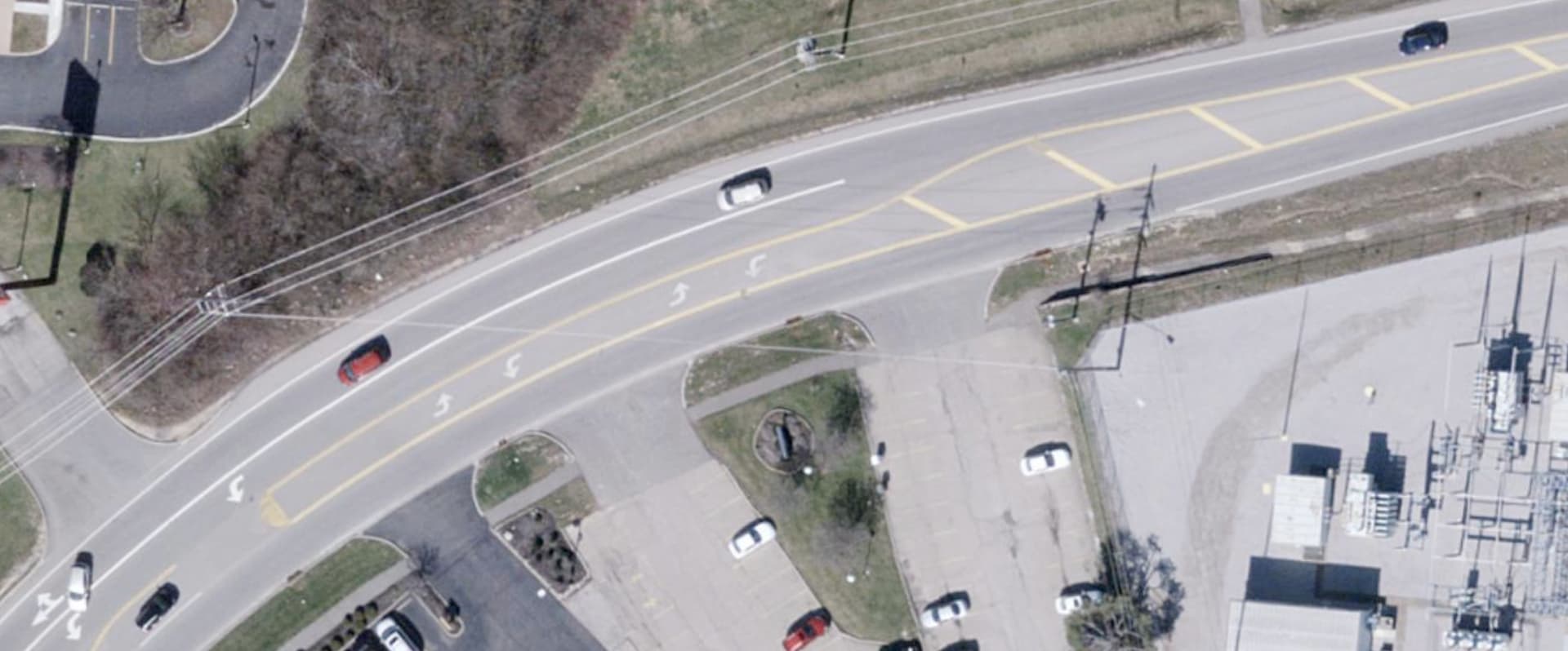
Modeling a traffic island as a closed two-way left turn lane would make it indistinguishable from a two-way left turn lane that is closed. For example, the center lane of Lafayette Street is sometimes a two-way left turn lane, sometimes a one-way lane, and sometimes closed, depending on the symbol on the activated blank-out signs overhead:
Given all the possible tags that have been proposed for virtual traffic islands specifically, it doesn’t seem to me that conflating them with travel lanes or turn lanes is worth the convenience.
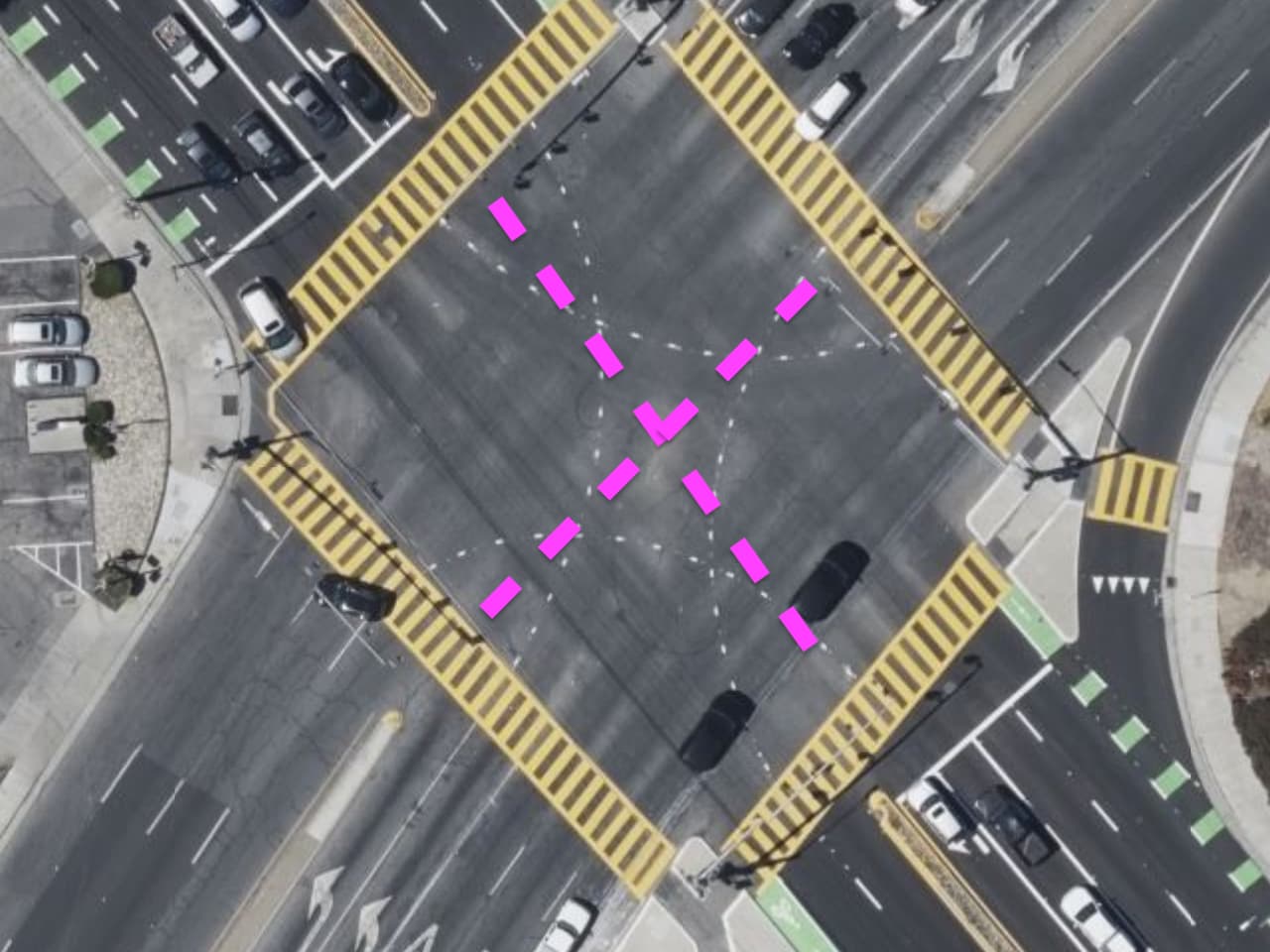
Oh, maybe I caused some unnecessary confusion by bringing this up. What I was referring to was the use of both_ways to indicate this space within an intersection, not the virtual gore area or traffic island:
It doesn’t seem to be a common practice in the areas where I map though.