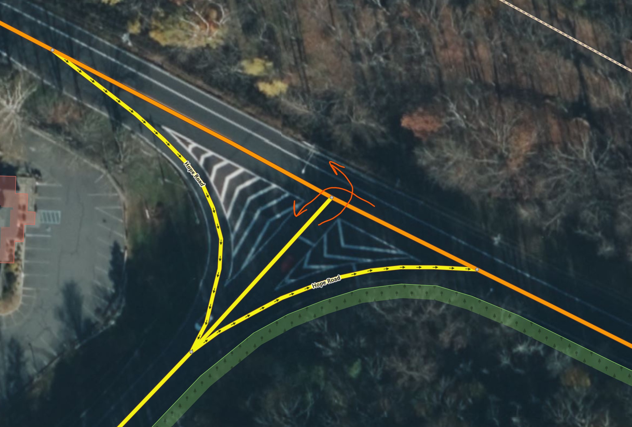
I marked arrows in the screenshot for how the turns are only allowed.
See Relation:restriction - OpenStreetMap Wiki
In this case (iD editor) click on the shared node
maybe inline animation will work:

2 Likes
That helps. I never knew about this feature!
Is it really necessary to tag restrictions on junctions like this one? It adds complexity to data, and possibility to break restrictions, and routers aren’t going to route differently with or without these restrictions. The only legal route is the shortest route anyway. The only scenario in which it is useful is if the driver didn’t follow routing instructions, went straight, and then decides to nevertheless turn. But these are such short distances and short time that the satnav can’t pick up that the driver is trying to do something illegal.
I wouldn’t delete the restriction if someone has put in the effort, but in my opinion, we shouldn’t bother putting them in in the first place.
Yes, it is necessary. No, it is not always the “only legal route”.
- Not all jurisdiction ban turns at the main intersection area when there is a slip lane anytime, or every time. Traffic-wise, it’s not required when there is no crosswalk, conflicting movements, speed differential, or high flow volume. The slip lane in that case is merely a channelization for smoother geometry, or handling more lanes.
- At complicated junctions, multiple turn opportunities for the same direction or even side may be provided at multi-way intersections, when there is or weaving.
If arguing it is a country’s default, it will be complicated process this worldwide. It is not representable within OSM, and require application-by-application work. It is also something with visible effect.
As you said, routers should provide the shortest route. Then there’s no harm in adding or leaving this.
2 Likes
It adds complexity to data, and possibility to break restrictions, and routers aren’t going to route differently with or without these restrictions. The only legal route is the shortest route anyway.
we do not only tag for routing in “normal settings”, for example if you want to make traffic simulations, and the shortest way gets jammed with vehicles, it may become relevant whether other alternatives are legal or not.
3 Likes
That’s true, I forgot about that data consumer.
Also, rerouting after someone missed an intersection and routing looking for places to make U-turn often is fooled by missing turn restrictions and proposes nonsense solutions.
2 Likes