Depending on your country, you may get some good results by checking the relation tags only:
rel[admin_level=4]["ISO3166-2"~"^PL-"];
out geom;
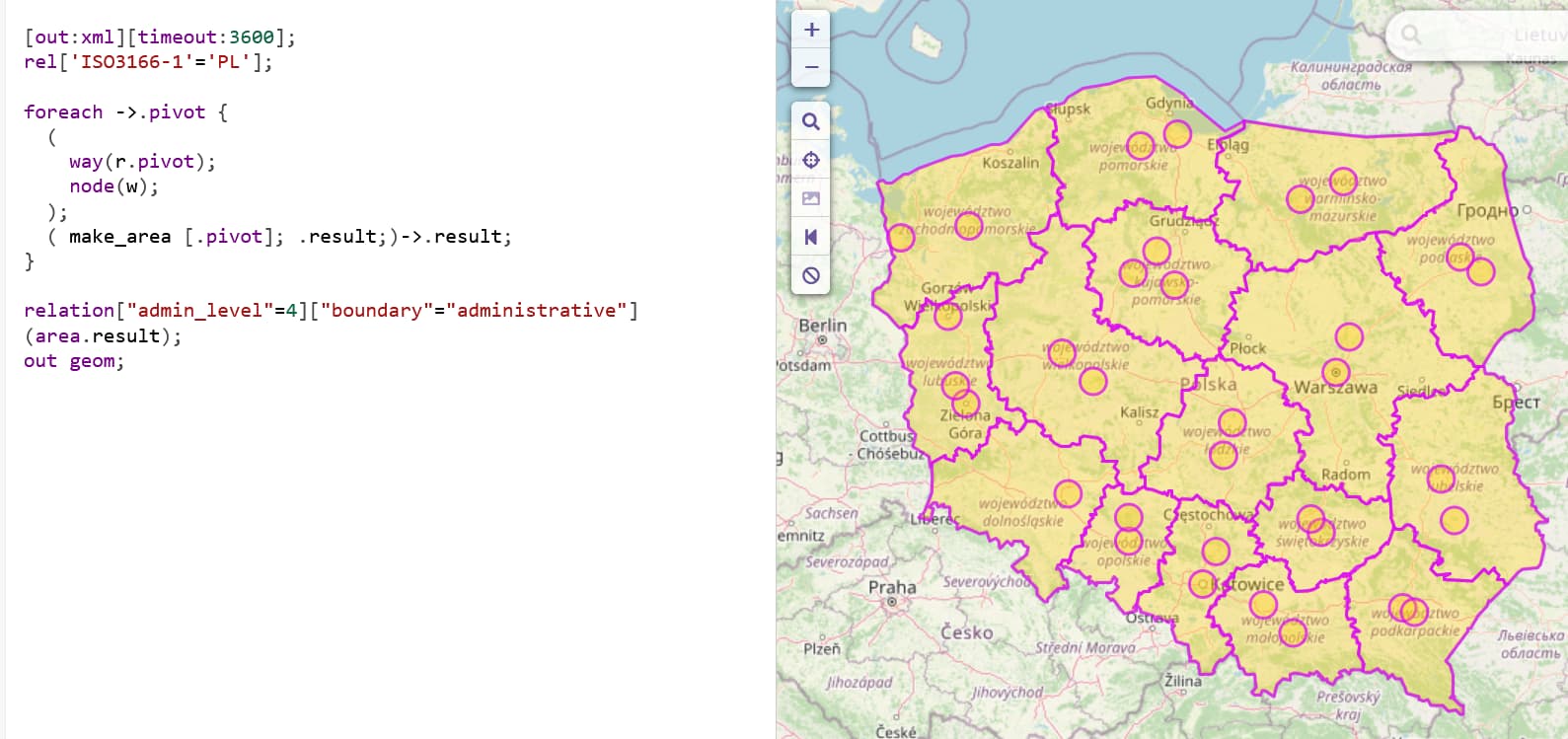
Obviously, the results you’re gettings are mainly due to the outdated areas. If you calculcate areas on the fly (not support on the main instance), the result looks as expected:
An mentioned elsewhere already, outdated areas are an operational issue that can only be fixed by the operator of an instance.