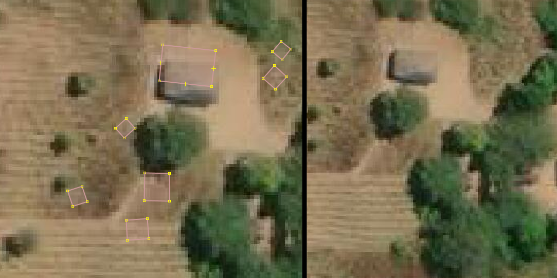
Hi, i am started doing tasks for Zambia Local Impact Governance Activity in Hot OSM. This consist of adding buildings, but when i open a task zone, it already contains some buildings but they look wrong. The instructions of the project is to use Maxar Premium Imagery. Should i remove these buildings? Clearly there is nothing there.
Here is a screenshot, image on the left is a “Available for mapping” zone that i just opened.
It may be that these buildings have been mapped by Akros (users that have *mspray *in their name).
They state they use “privately licensed DigitalGlobe evwhs imagery not available to other mappers” but usually they will state other sources like Bing, Esri or Mapbox in their changesets.
Unfortunately that makes it hard to verify but feel free to contact them about it in the relevant changeset because there are times where trees have been mapped as buildings.
Either way it’s probably always good to check the history of an object to know where these buildings might have come from.
The same thing happened in Malaysia. Seems that corporate mappers get access to newer maxar imagery (so they claim in their changesets) resulting in roads over forest, ponds and such. Of course, local mappers can use google map to verify that but then…