I’m new to OSM, and would need some time to learn how to map.
Meanwhile I need some help in updating the map of Kochav Yair as I would like to use it in an article I write about the settlement (mainly the streets grid). It is a part of a serie of articles I write about walks I take with my dog. You can get a glimps of it here:
Great articles!
Now if you could only get a GPS recorder for your dog, we’d have your tracks, and were able to map them!
I mapped parts of Kochav Yair using Bing imagery. Clouds prevented me from completing the streets… May I suggest that you walk around Tzur Yigal? It is better mapped at the moment.
I also added some more streets, farms, parks in that area.
Of course most of it is just guessing, but you should have a good base to continue and people see the full place in the map.
Great what is possible in such a small time frame.
The result is very impressive for mapping where nobody visited the site itself
(except a dog and his owner )
great to see that our work has been used in his article.
But I still don’t understand why it looks sooooo different than the source map.
Why does his map have streets inside that the OSM doesn’t have.
Great work, but why wasn’t it added to OSM and than he would just add some numbers and special icons to it.
He used OSM, added a lot of very important and interesting POI, addresses etc. to it and placed it to his article.
Please provide your data to OSM and I would be very happy to assist you in your next dog walk city @Ori : If you have any question how to map something you are always welcome to ask in this discussion board.
אני מעדיף עברית כי קצב ההדפסה שלי באנגלית איטי באופן מחריד.
אדרוך ביקש את השתתפותי בדיון, ולמרות שאני לא רואה שאלה ספציפית אני אספר על הנסיון שלי עם האתר.
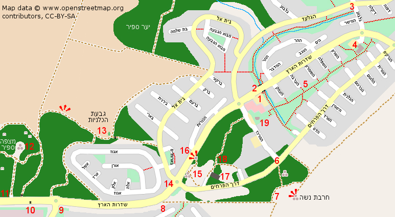
זו הכתבה ה-18, ובכל הכתבות עד עכשיו השתמשתי במפות שציירתי בג’ימפ על בסיס או.אס.אם. כתבה מספר 19 (עם המפה) נשלחה כבר, וכעת אני עובד על הכתבה האחרונה שתשלח בהקדם. המידע שאני מוסיף למפות מבוסס על סיורים בשטח, רישום וצילום.
הסיבה שלא הוספתי את המידע לבסיס הנתונים של או אס אם היא שלא ממש חשבתי על זה, מה גם שבמסגרת הזמן שיש לי בין כתבה לכתבה, זה נראה לי מורכב וטיים קונסיומינג. בנוסף, המידע שאני כולל הוא פעמים רבות רב מהמקובל כאן, ולכן העדפתי להשתמש בנסיון הגרפי של עם מפות מאו אס אם, שצברתי כאשר התאמתי מפות מכאן לצרכי וויקיפדיה.
רק לאחרונה דיברתי עם טל שהציע לי להשתלם בנושא, והבטחתי לו שבעתיד לבוא, אתחיל לתרום לאתר.
הייתי שמח למצוא מישהו בסביבת תל אביב, שישמח להפגש איתי ולהדריך אותי קצת.
אני חייב להודות לכם על העבודה המבורכת והקשה שאתם עושים כאן, כי המפות שלכם עזרו לי מאוד.
we have new sat images for Israel and one new area that is visible now is Kochav Yair Tzur Yigal.
So if you want to add your collected details back to Openstreetmap you are welcome to start with: http://www.openstreetmap.org/?lat=32.22504&lon=35.00404&zoom=17