Feb 12, from a Netherlands IP address:
1 Like
Whatever solution is chosen (by OSM, since OSM seems to march to it’s own drummer) please make sure it is a solution that could be rolled back in 4 years. My own suspicion, is that this paradigm will be repeated many times between now and then.
3 Likes
It seems that the rest of the world does not give a damn what Trump thinks. At least in OSM a place can be known by two names: “name:en” as the main name, and “name:en1” as an alternative name.
And Gulf of America is alright with me because the USA is not America.
…
I suspect you might have been slightly waylaid by some screenshots above showing how other mapping services are handling the situation for their various target audiences. The change to OSM so far is to add official_name:en-US=Gulf of America which seems entirely reasonable.
Or are you referring to something else?
14 Likes
For some comic relief vespucci: "Seems as if President Trump has decided to name t…" - OSM Town | Mapstodon for OpenStreetMap
8 Likes
It seems there is at least one place where gmaps doesn’t show Golf of America, and this is, tataa:
Mexico
As indicated by this map, the node to refer to such name should be inside USA maritime waters 'Gulf of America' is officially on Google Maps : NPR
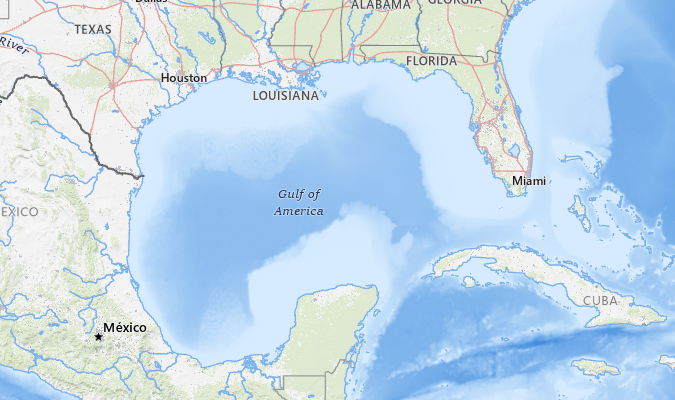
This seems to me like another case where the ‘official truth’ and the ground truth are at odds. When people say “The gulf of America” they aren’t talking about just the bits inside the US maritime zone, they are talking about the entire gulf.
4 Likes
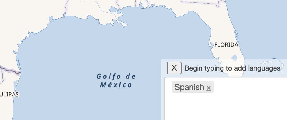
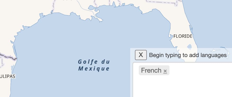
I don’t think “Gulf of America” should be in the official_name:en-US= tag because that is saying whenever anyone around the world is using the English language, they will see Gulf of America.
It shouldn’t be tied to a language, but as an alternate name of the gulf by the country of the United States of America. Mexico would have its own name which happens to be Spanish, and England would use “Gulf of Mexico”, etc.
3 Likes
In Canada, using the language setting en-US is exceedingly common since most websites fail to implement en-CA. Here, we routinely abbreviate United States of America as “America”, just like how we refer to citizens of the USA as “Americans”.
Right now, I see the following which are problematic for me as a Canadian:
official_name:en-US=Gulf of America.
Please be aware that both the President of the United States and our own Prime Minister of Canada have confirmed that the United States is attempting to annex us.
4 Likes
official_name:en-US=* essentially means the name used by the U.S. government in English. It does not mean the name used by English-speakers worldwide. Software will only output “Gulf of America” to the extent that it chooses to prioritize official_name over name. Nothing is stopping someone from making such a map if they really want, but it would be a very specialized map that users would recognize as such. A developer who wants to make that map might as well special-case the Gulf to say whatever they want anyways.
As documented on the wiki, the official_name key is for “some elaborate official name, while a different one is a common name typically used”. It says “elaborate” because most official names contrary to popular usage are unwieldy, but fanciful and aspirational names often wind up in the same key. Think of these official_name tags as sidenotes, not overrides.
Yes, I think it would be appropriate at this point to add more official_name:en-COUNTRY=* tags for completeness, to the extent that governments have made their positions known. There are already plenty of name:language=* tags reflecting common usage, and still more to add.
Virtually every OSM data consumer either shows name=* verbatim (currently in Spanish), disregarding this setting, or implements the ICU language fallback algorithm, which will look for name:en-CA=*, falling back to name:en=* and finally name=*. Or in the case of OSM Carto (the “Standard” layer on the homepage), nothing at all.
In theory, a more sophisticated data consumer could fall back to name:en-US=* before name:en=*, reasoning that Canadian English resembles American English in many respects. However, I don’t know of any existing rendered map that labels bodies of water according to official_name=*, let alone official_name:en-US=* when the locale is en-US, let alone official_name:en-US=* when the locale is en-CA.
22 Likes
For everyone who is unhappy about the recently added official_name:en-US tag, please understand that the choice of whether or not to actually use this tag to render a label is entirely up to each independent map producer. Most map makers prefer to display the common names found in the name and name:{lang} tags. As an example you can have a look at americanamap.org.
9 Likes
(post deleted by author)
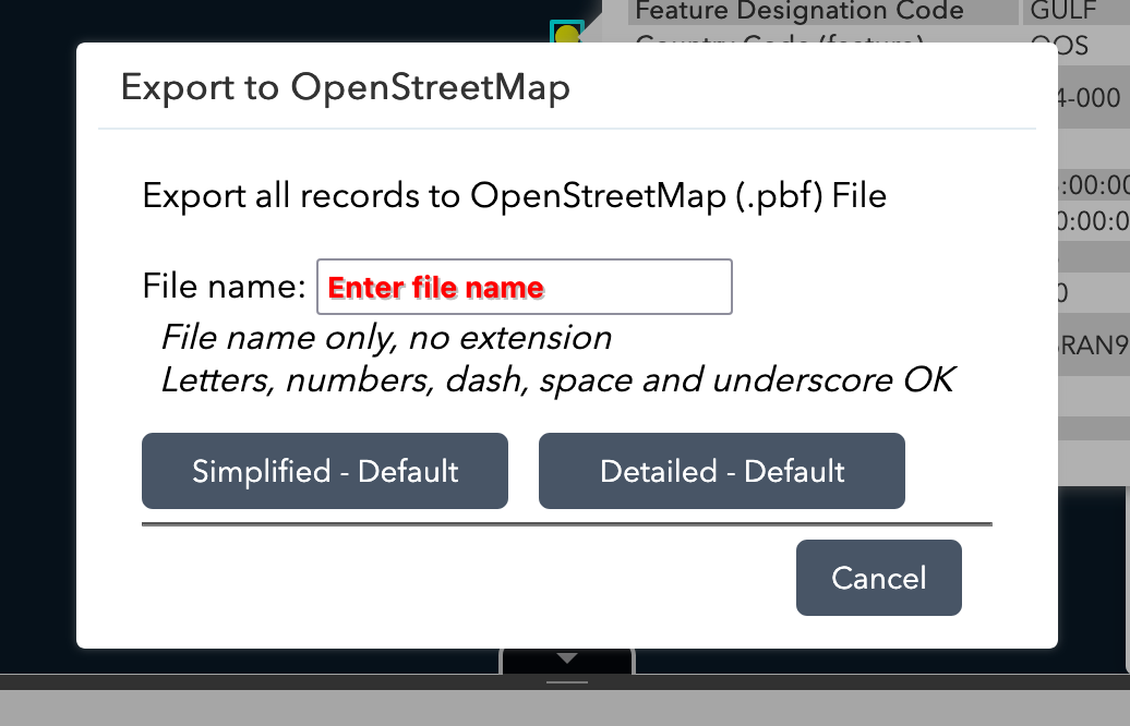
As with GNIS, the National Geospatial-Intelligence Agency has updated the GNS entry to list “Gulf of America” as the conventional name and “Gulf of Mexico” as one of the variant names, alongside two Spanish names (or misspellings thereof). Here’s a before and after:
![A map of the Gulf annotated with a single point at the centroid. A popup identifies the point feature’s conventional name as Gulf of Mexico, with variant names Golfo de Méjico and Golfo de Mexico [sic]. (Public domain as a work of the U.S. federal government.)](https://community-cdn.openstreetmap.org/uploads/default/original/3X/1/5/1570b8b5341eb541a8625681db386fe4cded5463.jpeg)
![A map of the Gulf annotated with a single point at the centroid. A popup identifies the point feature’s conventional name as Gulf of America, with variant names Golfo de Méjico, Golfo de Mexico [sic], and Gulf of Mexico. (Public domain as a work of the U.S. federal government.)](https://community-cdn.openstreetmap.org/uploads/default/original/3X/4/7/477add357536ff022cc56e895019856be997d9b6.jpeg)
This only clarifies that the U.S. federal government considers the same name to apply in both a domestic and international context, whereas before it was technically unclear if they intended to continue to use “Gulf of Mexico” in foreign relations (but we kind of already knew).
I made one small change per GNS: the feature has always been tagged with gns:uni=-2149892, as though this UNI refers to the gulf, but in reality it refers only to the name “Gulf of Mexico”. It’s more accurate to tag a feature with its UFI in GNS:id=*; the original use of UNIs was probably a mistake. I removed the gns:uni=* rather than replacing it with the new UNI. At some point, it would probably be a good idea to replace the 23,987 occurrences of gns:uni=*, gns:UNI=*, GNS:uni=*, and GNS:UNI=* with the correct GNS:id=*. This will require joining on the actual database rather than a simple tag transformation.
To reiterate, GNIS and GNS are only relevant to an appropriately qualified official_name tag, not a name tag, because of the on the ground rule. For this kind of feature, common sense would place a lot of weight on overall common usage, since sending someone to survey the facts “on the ground” would be… difficult. As of version 91, OSM’s default name=* label remains unchanged since 2020, when “Gulf of Mexico” was replaced by “Golfo de México”, and name:en=* also remains unchanged.
By the way, if someone really wants “Gulf of America” as the primary name for their own purposes, without all the nuance OSM brings to the table, they can get that directly from the federal government. GNS can export query results in OSM’s native format – our taxpayer dollars at work. However, this is really only for third-party use. OSM has rules about importing, no matter how the NGIA may title this dialog box.
7 Likes
OSM really shouldn’t change the name.
2 Likes
Luckily that was finished before DOGE ![]()
This is absolutely correct (as I mentioned upthread), but you are welcome to go through the whole long drawn-out process of agreeing a tagging scheme for “official name according to a particular country”, or you could just go for the nearest approximation in an attempt to resolve this interminable dispute, which is what we’ve done.
Personally I would like to tag it with name:asshole=Gulf of America to reflect the genesis of the proposed name, but even I am realistic enough to understand this would not be a good way of resolving an interminable dispute.
18 Likes