Now, I would like to start working with the community.
I’ve looked around and tried to get things started with OSM but it seems kind of difficult to start with.
My map is bicycle routes only with the purpose of downloading the map to my gps unit and being able to navigate without risking the option that my gps will take me on a highway or no bicycle trail.
I achieve this with my map because it only has roads that are ridable.
Is this possible with OSM?
I know of the MTB Wiki but I don’t know enough to utilize it.
Me too (quite new to OSM, have Garmin Vista HCX).
Let me try to answer and ask:
I’ve found that generating routable maps for that english-only device mentioned above can be easily done by:
java -Xmx512M -ea -jar mkgmap.jar --keep-going --route --road-name-pois --gmapsupp --name-tag-list=name:en,name --tdbfile …..\israel.osm\israel.osm
(israel.osm file was downloaded from the cloud)
Followed by copying generated gmapsupp.img to Garmin directory on SD card.
Using MTB only can be done in setup->routing menu, choose bicycle/pedestrian and mark checkbox to avoid highways/toll roads/etc.
Few questions of my own:
When choosing car/motorcycle mode and picking an offroad waypoint inside ben-shemen/yarkon, the device still routes me through Shvil Israel, which is not for cars(!). Is it normal?
How do I get started easily edit the map? I already noticed missing street in hod hasharon (“Bat Hen”), and want to update the map that there’s no left turn to Namir road, coming from Haalacha junct driving on Goren street (east to west).
I guess that once you’re off road, the gps would try to use an off-road way, thinking that it’s better to try that way, than to go straight as the crow flies.
Re learning how to edit, a good general suggestion about the internet:
If you want to do something that you didn’t do before, chances are that someone already did it.
Look at what they did, and try to copy their work.
Thanks Bzb. I’ll try that.
Right now what I do is to download the map from cloudmate as layer 1 and use my map (which is already very extensive) as layer 2.
This way I can always disable one of them, depending on the use.
Usually I agree but in this case I feel that there is an overload of information and a point in the right direction could save a lot of time.
My first question is probably - Which editor should I start with? (Josm, Potlach, something else?)
Here is an example.
You’ll see that there are 3 players (to, via, from) and that each of the ways should start or end in that node.
You cannot have a restriction on the middle of the road, that’s why Ibn Gvirol is cut into smaller pieces.
There is no clear answer to that.
Each has its pros and cons.
Potlatch:
Works on any computer (with Flash), like your friends’, internet cafe, etc.
doesn’t need installation.
Need to be online throughout the edit session.
JOSM:
Needs Java installation on the computer (if you create your own maps using mkgmap then you already have that installed)
Can work ofline and upload the whole edit session at once. (This can hazardous if you don’t remember what you did…)
JOSM has a steeper learning curve, and Potlatch is very intuitive.
If you want the latest and greates of JOSM - you’ll have to remember to check for updates, download and install.
Potlatch is always updated. (Version 2.0 is due out soon)
Thanks!
I’ve started working with potlatch as it seems easier for a newcomer.
I’ve also come to a conclusion that OSM cannot be as detailed as my Polish Format map since i have so many small paths and trails that would be an overload for the OSM.
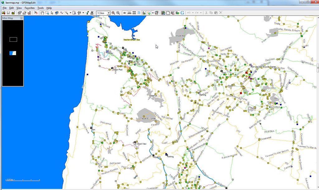
So I guess I’ll have to go on using both… Screenshot of my map in gpsmapedit by benkatz100, on Flickr
Don’t worry about the OSM database size.
It contains the whole world already, and a few paths and POIs in a small country as Israel is nothing.
See for example how detailed Netanya is, or the Old City of Jerusalem.
Even some parts in Tel Aviv are nicely detailed.
Not to mention the Tel Aviv University, and Weizman Institute (or the Eretz Israel Museum…)
As for off road:
Lately we invested a lot of effort in this direction, trying to atract new mappers (like you… )
and some of the popular MTB areas are pretty well covered, including names of singles, etc.
I agree with talkat that you will not overload the OSM map with your “very detailed” information.
Every Information you add will be helpful. No matter if its a GPS track, a POI, a housenumber or a trail that you are not very sure where its located but you know its there.
Just take a look onto cities in Europe like London, Berlin or Amsterdam. Every tiny thing you can map is already there.
Israel will become the same way in the future and of course it will be helpful in the future to have that “tiny little trail” that you think nobody needs today.