HI,
I am developing a small application that must generate some Images with Polygon shapes. Unfortunally the details are not so good as expected. Here is an example of the result. We tried to maximize the zoom level and so on. The provider acutally was azure maps and the result look like this:
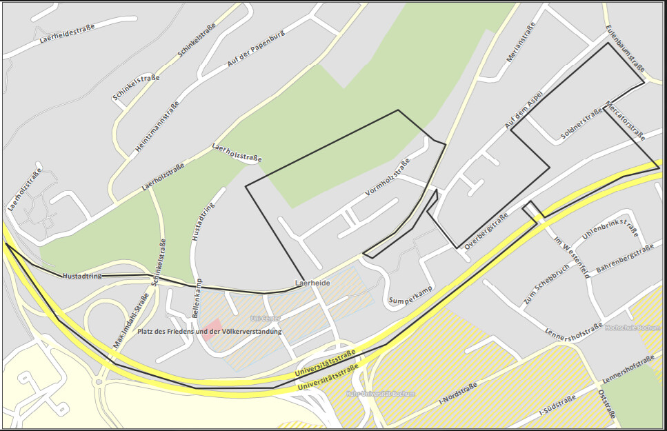
So in our opinion OSM will be a better descission, because it contains more information on the same zoom level and so (Maybe).
I develop the application in .Net and I’m very new in OSM. SO the first question is:
Is it possible to get a map tile (like the example above) with a custom shape (polygon data are as geo data available) and export it as an image so that we can use it into a pdf extract?
The next question is
Who we can do it? Is there any kind of howto for dummies? 
So what I figured out
- we must download a pbf file for Germany (this is enoug for us).
- After that we must fokus on to a spezific point try to calculcate the bounding box.
- Drawing the Polyon (with a shape file?)
- Merge all togethert (how?)
- Export a image (how?)
Sorry for the newbie question, but I get a little bit stuck in this…