In 2016, the island of Sardinia in Italy went from eight provinces to four (plus a metropolitan city of Cagliari).
Can you update the map of Italy so that it shows Sardinia’s current provinces instead of the old ones
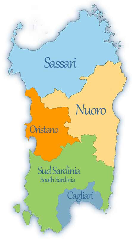
Here is what the current provinces of Sardinia look like:
Do we have access to an authoritative open dataset that has these boundaries?
Hello Jack, and welcome here in the community!
Your picture does not display the current provinces of Sardinia. There was another reform in 2021, see https://www.consregsardegna.it/wp-content/uploads/2021/04/LR2021-07.pdf. I think there’s no need to change the current boundaries because these are probably the valid ones.
Best regards
1 Like
I did not know that there was another reformation. Is it true that in 2021, the old provinces had been remade, of which Olbia-Tempo is now called Northeast Sardinia and Carbonia-Iglesias is now called Sulcis Iglesiente?
English wikipedia isn’t current ![]() The italian version includes this paragraph:
The italian version includes this paragraph:
So yes, the old provinces has been remade with the two new names you mentioned.
ops grazie