Just found a diary entry from Jeff Underwood, published yesterday: So how does the Facebook’s AI Assisted Road Import Process work?
I just read through the diary entry: “So how does the Facebook’s AI Assisted Road Import Process work?”
I must say, that methodology, while obviously not perfect, is still very impressive. I’m going to risk getting criticism from the dedicated mappers who have worked in Thailand for years and say that I think the FB team has made a huge contribution to our Thailand map. Yes, there have been problems and those will no doubt continue but overall they’ve added data that would have taken us years to do without their help. I have often passed over adding residentials to small towns just for lack of time and because there were always more important things to map. FB has added many, many uninteresting, boring-to-map sois to those towns. I wish there was a way to get them interested in mapping geographic features and aligning miserable PGS coastlines in Alaska!
My advice is to accept the fact that making mistakes is part of the learning process and to appreciate what Facebook has contributed to the overall project. You can all remember when the only satellite imagery we had was Bing’s. Because of FB’s deep pockets, we now we have several excellent overlays, some of which are so good that, with my experience with camping and fishing in Alaska, I can practically transport myself to the location.
Today I came across a node I had added to OSM in Alaska four years ago. I had named it and made a note but had forgotten to say what it was! Amenity, attraction, landuse? I would not make that same mistake today. FB mappers are paid to do a job. Some of those employees will rise to the occasion and do good work, others won’t — to those latter people, it’s just a job. But I’m in favor of following the old adage, “don’t throw the baby out with the bath water.” To my mind, mass reverting all their edits would be doing just that. There’s definitely some bad stuff they added but there’s also an awful lot of good.
Cheers,
Dave
I agree with you insofar as recent edits are concerned. But the older stuff is largely pollution at this point. While I would not want it deleted outright, re-tagging it as road or track is appropriate. The question is: where do we draw the line?
Where I live, here in Central Thailand, the data is so bad I wish it wasn’t there.
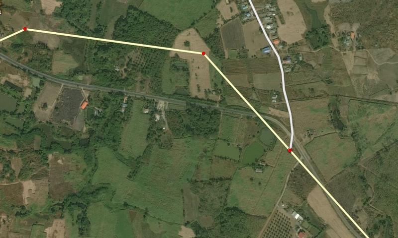
Here are 3 tricky junctions. the top one in this picture (ignore the junction that needs fixing and the street on the left:
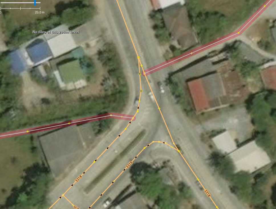
and just a few metres North two more
There is a median clearly visible on all imagery that I checked. R turns are impossible. We have two choices: either put in turn restrictions or draw a dual carriageway for the few 100 m. We can’t expect FB to do the former, but what about the latter? Do I write something in the changeset or should I just edit it?
Thanks,
Peter.
Peter,
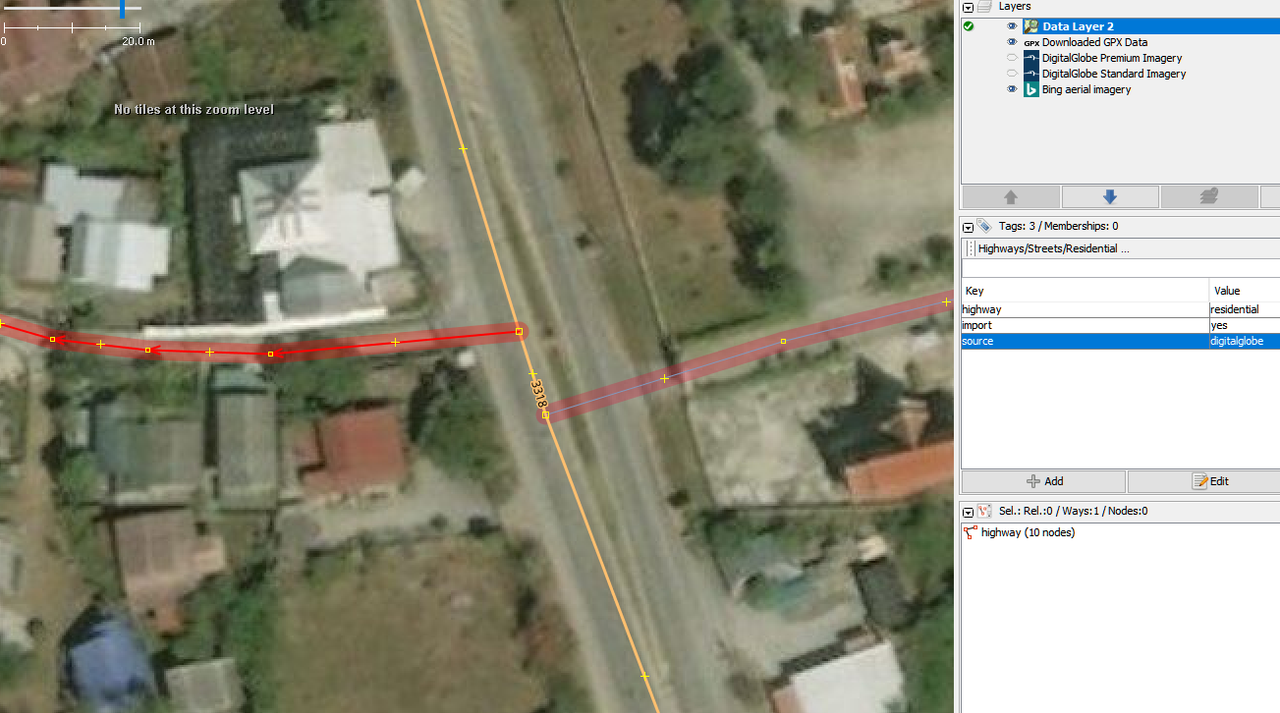
Happy Xmas ! Since the DWG requested, I have been documenting the errors with Way numbers in all changesets. Apart from the first one, I have not had a single further reply from anyone at FB. This leads me to believe they are all blowing their own trumpets citing a successful project completed, and have simply abandoned OSM to move onto other new exciting things.
So, we are stuck with this crap now … one one will fix … and its just too late for reverts… so lets just bite the bullet and put every mistake right, one at at time. I see no point in continual changeset comments which end up in empty mailboxes.
Oh, and Yes, I would draw the short section of d/c, rather than a turn restriction, in order to solve the problem.
Russ.
Hi Russ,
I’ve had another reply a few days ago. But, as I said, they need to go over the old stuff from the beginning and fix it, because only they have the manpower. And while it’s too late for a revert, it’s not too late for a mass re-tag, which is what I favour.
Anyway, this post was not meant to criticise their mapping in this instance. This is more advanced and I would not expect newbie mappers to get this right. I’m just wondering whether we should fix this kind of thing, or is it worth letting them know. I assume they are still mapping OSM?
Happy new year to you all,
Peter.
Every day, I find another FB instance of lazy/bad mapping.
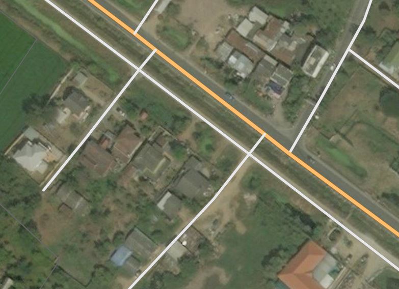
Todays popped up quite quickly… check out the two residential roads that have imaginary bridges to connect directly with Hwy 3412:
Before …
After my correction …
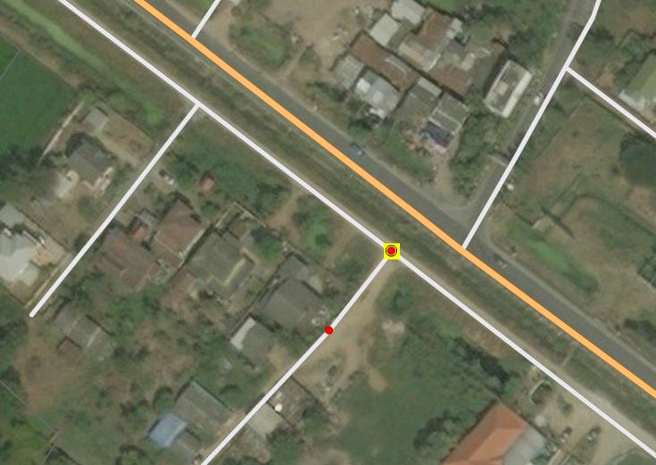
The irony is, there are 4 bridges on that road that clearly do make the connection, but yet none of these were added. I suppose if the AI Machine didn’t find it, then why would the FB mapper even bother to look. Yup, “bang it in and move on”.
But the point is, the nameless FB mapper, who I refer to as Wonder Woman from her Avatar, was quite active until 4 months ago when all edits stopped. This does add support for the assumption that FB has left us with a bunch of crap, and got rid of its mappers, leaving us to sort the mess. I see no more responses from them in this forum any more.
I left a changeset comment https://www.openstreetmap.org/changeset/62356072#map=14/14.3473/100.5379 but like all the others, I’m sure it will fall on deaf ears.
Russ
So for today’s episode of Facebook related comments, I present the following :
*
Changeset: 59408507 - Verifying connections, updates to classifications and simplifying roads - Closed 7 months ago by VLD042*
Way 559552127 - Dear Jon from Grand Junction. Ironic as junctions are just not your forte!
Anyway you have been pretty lazy plotting this junction. I mean, just look at the poor accuracy of the yellow tertiary ลย.3015 which we did many years ago when all we had was low res aerials.
So you come along with your fancy machine learning, plot the residential perfectly, but are just to damn lazy to give us a few minutes of your time to add a few extra nodes to the Tertiary road, and make the junction come a bit closer to looking like it does in real life.
I appreciate your brief might have been to leave existing OSM data alone, but c’mon, you could have used your discretion here.
However, with no edits for three months, I suppose my comments fall on stony ground?
Russ.
Here is the pic before I revised the whole road :
Russ
Yuk. Just awful!
Everybody interested in this subject: this is from the BBC topic:
I propose that we figure out a cutoff date, before which we consider most FB edits to be so poor that they should be mass-tagged as “road”. This will remove the edits from routing, but keep them to be verified in the future.
Once we have consensus, we request the DWG perform the mass-retag.
Let’s get this mess sorted out.
That’s what I use a style-rule for.
I do not need such automated re-tagging, but I do not oppose it either.