A small project with OSM done: I enjoy riding around my vicinity, and would like to not pass along the same road twice. First step to help ‘ad-hoc route planning’ would be to mark all roads, which are dead ends. Or, more generally, which are cut edges (Wikipedia definition what it is) in the road network.
Below a screenshot of how it looks like, cut edges painted with thick blue dashed lines:
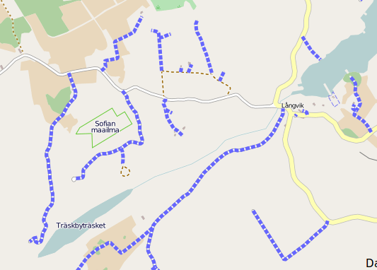
![]()
![]()
![]()
Here are the maps. As I do not have too much online space and bandwidth, I rendered only a small part of my vicinity. I do not see a way how this can be provided for the whole Earth without storing all tiles (and re-rendering them in line with OSM updates).