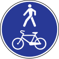
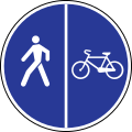
Does your country have the (legal) concept of "Designated for pedestrians, but cyclists allowed"?

Surely not true for France at least. The round blue signs indicate an obligation of use.
Nothing to do with design: it may be poorly designed but the mandatory usage signed (because the main road is reserved for motor traffic for instance).
Or designed but with no signage (later there is a sign asking the cars and cyclists to share the road).

Side note: if signed (being designated or not), you can add traffic_sign= to a node where you have a sign, or traffic_sign= on the way.
Side note 2: for the first example, it’s a square not a round, meaning only cyclists are supposed to use the… sidewalk.

In Nederland, we use designated as: “intended for certain road users by the traffic authority, by rules of traffic or the owner.” We require the intention to be visible on the ground, preferably by signage, but sometimes it may be tied to other visible things, such as a kerb and elevation.

Traffic regulations are always tied to visible elements; traffic signs have their meaning assigned to them by law, and the same holds true for other visible attributes. If not, they are not valid and we don’t tag it, except where a private landowner uses their own signage on their own land and announces it in a clear way. If they do that, then the signage is again backed up by law: private owners are allowed by law to do that and people have to comply.
I think access rules are always tied to something visible (how else could a traveler know?) and to the regulations stating which access follows from the visible ground truth.

For a footway, foot=designated and motor_vehicle=no are implied by highway=footway, and bicycle=no is the default. If cycling is allowed on the footway bicycle=yes can be added. This way, we think the Dutch situation is mapped in a way that worldwide routers can handle, without having to know specific country dependant signage, markings and rules, and without massively tagging the obvious.

For a cycleway, bicycle=designated is implied by highway=cycleway. Our default foot access on cycleway is foot=yes. If pedestrians are explicitly excluded from the cycleway, we tag foot=no.

(BTW To my surprise, the worldwide access defaults table gives foot=no for foot access. I think that is a mistake, I think most of the world in principle allows foot access to cycleways, and I suspect most routers accept cycleways in their foot profiles.)

Mandatory use is another thing. Many Dutch cycleways are mandatory for cyclists, and many cycleways are not. Mandatory means, if there is a road next to it, cyclists must use the cycleway. We do not tag mandatory access on the cycleway itself, mandatory cycleways are certainly designated cycleways, so designated is the access. Then on the road we tag bicycle=use_sidepath (bicycle=no is also still used a lot), so that expresses that the cycleway should be used.

Again, this way we think the Dutch situation is mapped in a way that worldwide routers can handle, without having to know specific country dependant signage, markings and rules, and without massively tagging the obvious.

A path which is designated to both bicycles and pedestrians, we tag as highway=path & bicycle=designated & foot=designated, possibly with segregated=yes|no. This combination does occur in Nederland, but it is unusual. Far more common is a sidewalk attached to a cycleway, which usually is tagged as sidewalk=right|left on the cycleway.
(BTW some tools have been known to add segregated=yes to cycleways where sidewalk=* was already tagged. This is redundant. If found, data users should treat sidewalk=* as further refinement of the kind of segregation, and ignore it.)
1 Like

That matches my expectations for *=designated too.

When you say “worldwide access defaults table”, what exactly you mean? Some wiki page (which one?). Some tagging in database?

I think that is a mistake, I think most of the world in principle allows foot access to cycleways, and I suspect most routers accept cycleways in their foot profiles.

It seems to be country-specific then, so fail-safe global default seem reasonable (i.e. better than fail-dangerously global default) :man_shrugging: .

In Croatia for example (and probably at least half a dozen neighboring countries which used to be one country before some wars), pedestrians are expressly forbidden to use cycleways for walking. Pedestrians here are only allowed to cross cycleways carefully in shortest possible way (i.e. orthogonally), and even that only after they verified there is no bicycle traffic (ref. Zakon o sigurnosti prometa na cestama, Članak 129., 124.)

It comes as a surprise to many mappers, which is why id-tagging-schema has a separate preset for a cycleway that also allows pedestrians, known as a “hike and bike trail” in American English. However, mappers in some countries like France and Norway have pushed to suppress this preset in favor of highway=path for any path that’s technically a shared use path.

It’s the one that was recently debated in this thread:

An overview inspection of the country specific default access tables (on the osm wiki page about access) shows that OSM-wide, world wide, pedestrians are allowed on most road types including cycleways. So, osm routers will default to foot=yes.
Of course, that is a PITA for the countries where the default differs! Nederland has many specific access rules for vehicle types, cycleway types and circumstances, which means we have to tag many things explicitly. We can’t expect routers to know all our specialities, traffic signs and traffic regulations, and we can’t expect routers to switch to country specific default tables whenever a boundary is crossed, so we have to “translate” the specifics into explicit tags that are understood OSM-wide.

We can’t expect routers to know all our specialities, traffic signs and traffic regulations, and we can’t expect routers to switch to country specific default tables whenever a boundary is crossed, so we have to “translate” the specifics into explicit tags that are understood OSM-wide.

we also do this in Italy for pedestrian highways, which by default are open to bicycles (but not footways). We just tag them explicitly as bicycle=yes despite it is the national default, because otherwise routing would not work with common routers, and because the idea of having defaults is generally contested in the community

1 Like

YM defaults in general, or seperate national defaults?

Since OSM data is in nature incomplete, I think data users will always have to decide what to do when a tag is missing, if they think it matters to their software/the users of the software.
Routers have to decide whether to include a way in the route or not, depending on way type and vehicle type. It’s yes or no. (Well, ok, you can use include yes, then check all kinds of things and come up with a very high penalty, so it’s sort of no anyway).
The best way to handle this, to me, is to have as best a spec as we can manage, which we all use, at the mapping side use it while mapping, and at the data use side use it for routing decisions and rendering decisions.

Of course, national data users can use other defaults, tailored to national regulations and knowledge, but I sincerely think no one nation can be the standard here, they all have their things and issues different than anywhere else. We’re all special, aren’t we? (“No I’m not!”, I hear in the background… YES YOU ARE!)

Since OSM data is in nature incomplete, I think data users will always have to decide what to do when a tag is missing, if they think it matters to their software/the users of the software.

yes of course every software has to decide how to evaluate data and account for the possibility that many tags that would be useful for the usecase are not present.

What I meant was that some people prefer to not tag properties explicitly that are somewhere defined as default for the area (and a few of them are even removing tags for this reason), while others take the stance that missing tags mean the property is unknown or not checked (e.g. streetcomplete).

I think it is uncontested that a highway=<general road class and not a service or track or footway etc.)> has a default of access=yes, but that’s the only real default (and even there it is maybe not completely clear whether edge cases like tracks or services are roads in this sense or not). When people start tagging
foot=yes
bicycle=yes
hgv=yes
motorcar=yes
horse=yes
psv=yes
goods=yes
etc.
on a highway=tertiary, the next mapper who sees it will give (the newbie) a hint.

the country specific routing access defaults are close to it but less accepted, and removing for example a bicycle=no from a highway=trunk (which doesn’t have a motorroad=yes :wink: ) could easily be contested.

I would have expected most people to assume it’s at least vehicle=designated on top of that, since roads are nowadays usually made specifically for vehicles, not pedestrians or horses. Everyone who wears minimalist shoes will agree with me :wink:

Yes, I see that happening too, and I understand the argument. It’s a QA workflow thing, and it could work if every mapper used the method and used it consistenty, mapping a load of tags explicitly even if it is obvious to the whole world. But even then, data user software still has to decide what to do when there is no tag.

I think OSM doesn’t work like that, and QA workflows shouldn’t use regular tags to decide about a question, issue or challenge.

Anecdote: back in the days before I entered the arena, we had in Nederland an import of landuse and natural objects, which we still complain a lot about, but it filled the empty space with nice colours, and not too badly according to the standards at that time. But the importers knew all the objects would have to be checked and adapted. To mark the imported elements, a source tag was set, with the value “3DShapes”. I dont know the exact workflow, if any, for the checking and correcting workflows, but over the years the ideas got lost, were revived etcetera. Moost mappers didn’t know anything about this anymore, so when adapting landuse/naturals the just left the unknown tags where they were, including when splitting area’s. In the end (now), anything can have a 3Dshapes tag, saying absolutely nothing about the review status or any adaptations made later. Or the tags may have been removed because the source dosn’t exist anymore, without any serious update of tags and geometry. So signal value is absolutely and totally and irrevocably lost.

For Latvia.

Do you make a distinction if a way is “Designated for cyclists and pedestrians” and “Designated for pedestrians, but cyclists are allowed”?

Technically, yes, but there aren’t any actual examples of the latter. I have personally never seen the “pedestrians only” sign altered with a “but bicycles allowed” modifying sign like the OP’s example, because this normally would simply be signed as a shared unsegregated cycleway or more likely just not signed at all (or signed against vehicles). As far as I know, they don’t exist in the real world (of Latvia).

For context, Latvia has pretty much 4 variants with these implications:

Latvia_road_sign_415.svg - foot=designated, bicycle=no

Latvia_road_sign_413.svg - bicycle=designated, foot=no

Latvia_road_sign_417.svg - foot=designated, bicycle=designated, segregated=no

Latvia_road_sign_421.svg - foot=designated, bicycle=designated, segregated=yes

Everything else that is unsigned allows bicycles by default (traffic law doesn’t forbid cycling anywhere except for specific exceptions).

Our tagging guidelines list these and all the other common scenarios here: https://wiki.openstreetmap.org/wiki/Lv:Latvian_tagging_guidelines#Veloceļi_un_veloinfrastruktūra

Now, theoretically, the white additional info sign could alter pretty much any traffic sign with pretty much any condition:

Latvia_road_sign_824.svg (this could have text like “except bicycles” or “only on weekends”, etc.)

But this seems more like a hypothetical scenario than a practical one.

Should StreetComplete offer both “Designated shared-use path” and “Footway, but a sign allows cycling” in your country, or should one of them be removed to avoid confusion?

In conclusion, I don’t see the point of “Footway, but a sign allows cycling” in Latvia if it just takes up UI space in SC, because this sort of signage is not used (although theoretically possible). If this variant is included, then theoretically any sort of combination of “For xxx, but sign allows xxx” is possible.

1 Like

I would be interested to know what is the actual tagging in these 4 cases, including highway=* ?
Do you tag the implicated access eplicitly?

The tagging guidelines I linked describes the actual tagging used in practice based on signage: https://wiki.openstreetmap.org/wiki/Lv:Latvian_tagging_guidelines#Veloceļi_un_veloinfrastruktūra . It pretty much matches common OSM tagging for footways and cycleways as per stuff like Tag:highway=cycleway - OpenStreetMap Wiki. 99% mappers just use iD and JOSM presets, so it’s basically that.