I was able to get a local copy of the data by opening the service in QGIS and then exporting as a shapefile.
I have found one or two cases where the position of the current OSM trail data could be improved, but for the most part aligning OSM to the proposed “import” data would make OSM worse. Here is an example from near 40.665357, -111.546045:
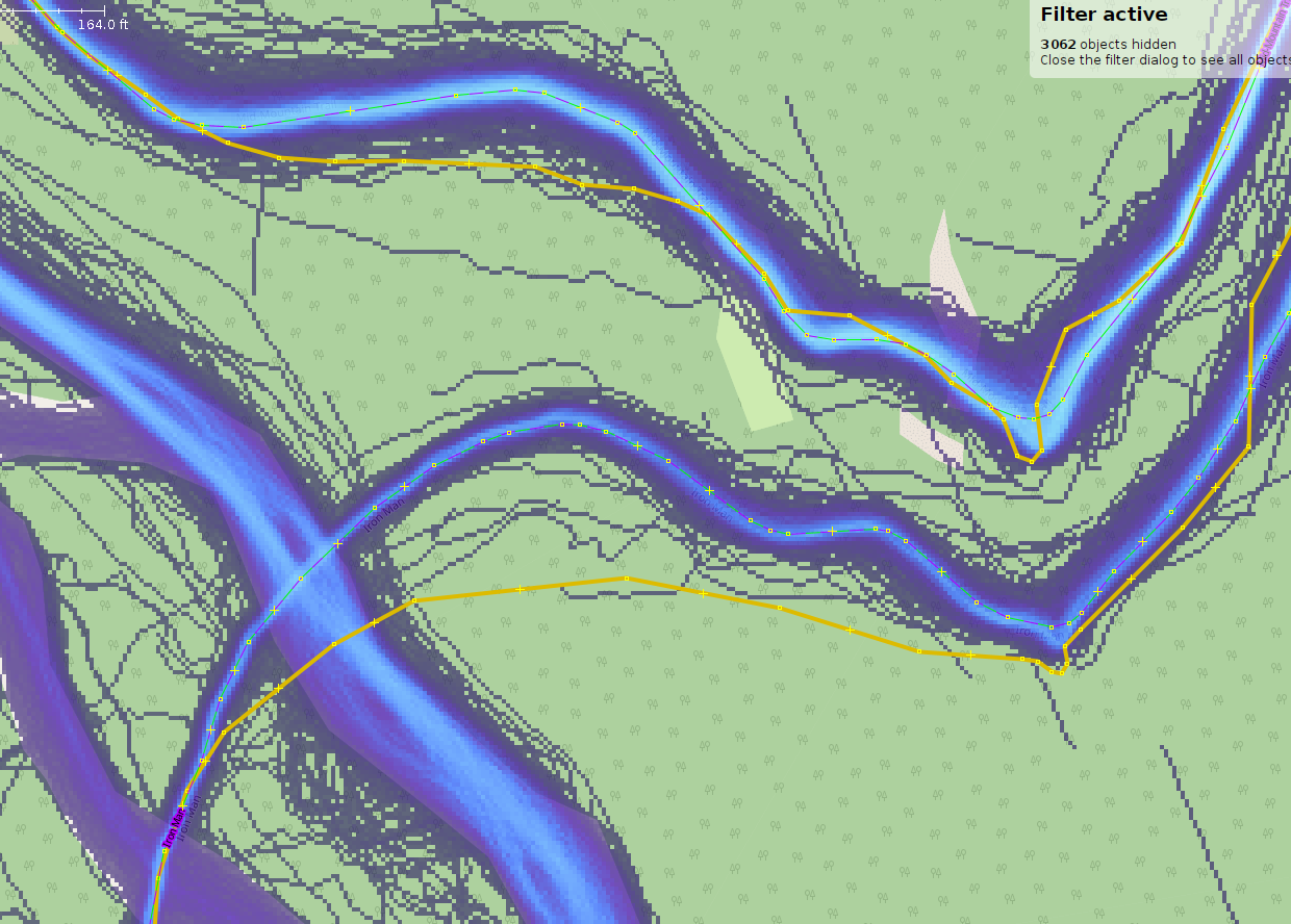
The proposed “import” data is in yellow, the existing OSM data is dashed purple-green, the Strava heatmap is in blue. One can see that the OSM data is much more closely aligned with the Strava Heatmap. In case the scale in the upper left corner cannot be seen in the screenshot, the maximum difference between the two data sources appears to be more than 230 feet (70 meters).