A rudimentary fix for this issue is now live on the site. Search and query results now label each feature according to its border_type=* value, from among the most common border_type=* values. If the feature is tagged with an unrecognized border_type=* or none at all, its label will fall back to the admin_level=* value as before, but now just the numeric value without any interpretation. That said, if you search Nominatim and it’s able to link the boundary to a place=* node, the place node’s existing description will take precedence over anything else.
For example, if you query for features near Niagara Falls, the results will distinguish between New York as a state and Ontario as a province:
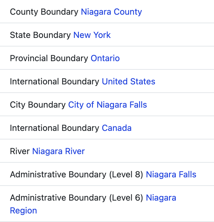
It’s a good thing too, because some countries care a lot about the distinction these days:
If you speak a language other than English, please head on over to Translatewiki.net (filter for geocoder.search_osm_nominatim.border_types) and contribute translations for the most common border_type=* values. This table on the wiki links to Wikipedia articles that may give you ideas about how to translate each string. (No ferrets, promise!)
As I mentioned, this is only a rudimentary stopgap fix. In my own Vietnamese translations of these strings, I’ve still had to provide multiple translations for ambiguous words in English such as “town”. Even the correct translation of “province” differs between Canada and most other countries that have provinces. A more robust fix will need to vary the translatable strings by country, but hopefully this is enough to tide us over for now.