Hello Thai Community,
This is Salim from TomTom.
It may be helpful to you to take part in a MapRoulette challenge related to Add Surface to Highway in Thailand.
The goal of this challenge is to identify and add missing surface tags on motorways and motorway links as they represent high speed roads, and it is desirable to accurately tag the surface for these highways. We queried OSM for ways with certain highway=* values where the surface tag was missing.
Whenever you have questions or comments, feel free to contact me - and happy editing!
Hi @sbaido, unpaved highways should have been already tagged, so you can consider any missing values for major highways to be paved, and mostly likely asphalt.
If you need the exact surface values (asphalt vs concrete), https://roadnet2.doh.go.th/ has them.
Click on the search icon on the homepage, then choose ชนิดผิวจราจร under Layers control on the map.
Unfortunately, the WMS server seems to be down right now, so you will need to wait until it’s back.
Thank you for your reply @julcnx and sharing the source of information: we detected these inconsistencies, and if you and the community think that filling these tiny gaps are useful then we will be happy that it was a benefit.
We spotted approx. 70% of the motorways and motorway links missing surface that will probably add value to OSM to make sure that. motorways tags are captured in a consistent manner across the whole country, and they are highly classified and in our opinion important roads.
If you can probably have a look at a couple of tasks if not yet done so you can assess the value.
@sbaido just one comment regarding the maproulette description: there will be no way to identify the exact surface from imagery, it should be done only with local knowledge (survey, Mapillary, Karta) or any external sources that we have authorization for.
Yes indeed @julcnx it is maybe tough, probably some motorways can be visible? but I agree that “local” sources and knowledge will need to be applied to solve these cases. We will look into the challenge description and thank you for your valued suggestion/remark.
@sbaido – I’ll be interested to hear of that reply from your American colleague. Does this mean that you don’t know why you’re asking the Thailand community to take on this challenge?
ZeLonewolf - That is not true as I am trying to avoid you receiving a similar answer from multiple tomtomers, and I am still in conversation with the Thai community to understand if these types of challenges will add value. We thought this challenge would be simple compared to other QA challenges as we discovered inconsistencies and/or gaps.
Throughout the process, we listen, learn, acknowledge issues/matters, and do our upmost to improve; If any community feels no real value will result in any type of challenge/s, we will respect that and respond accordingly (e.g. hide, stop posting, improve).
I fear that quest is a bit misleading. In general it is a good idea to know the surface of a road as otherwise routing could send you on very unpleasant roads. It happened to us once while on a road-trip in Thailand where we ended up on a very bumpy unpaved road as we made the mistake of using OSM for routing.
So yes: adding the surface tag is helpful. Especially if it helps to spot unpaved surface.
But I share a bit the concerns of others: How do you think the people will work on that challenge? Maproulette mainly targets on users doing armchair mapping.
For roads with painted markings, I think it is easy to identify them as paved. But other than that gets quite difficult from aerial imagery.
I also wonder a bit why you had chosen motorways (and doing the query on a global scale). My gut feeling tells me that in California the majority of motorways are paved. At least in Thailand they are. I fail to get a single example of an unpaved motorway in Thailand.
So the task would be more to tell whether something tagged as a motorway is actually a motorway. Plainly wrong tagging, by example from one of the numerous mapping campaigns by HOT or others, is relatively easy to spot. For other areas it is again nearly impossible to tell this from aerial imagery.
The type of pavement is also very difficult to spot from satellite imagery. If the surface is dark black, then it is likely fresh asphalt. But I can’t distinguish older grey asphalt from concrete. And I would consider myself quite experienced in looking at such kind of imagery.
We could do a generic “surface=paved”. For the specific highway class of motorways, it is probably safe to assume it is paved.
Way more interesting are the lower highway classes. If you are looking at tertiary, then there are a lot of unpaved ones around. These are the ones you like to avoid on routing, as they come with a significant penalty of what driving speed and comfort is possible.
Spotting these areas and detecting their suitability for remote fixing is a challenge. So if you would be able to compile a list of highways without surface tagging (start with higher highway classes is fine) and correlate that with availability of street level imagery. Present all matches to remote mappers to confirm the type of tagging by showing the nearby tagging in context and the aerial imagery. Then ask the remote mapper to identify the surface using the street level imagery, falling back worst-case to generic surface=paved/unpaved. If nearby road segments have a more specific surface tag, you might want to present this as a choice to confirm or maybe to challenge. The later one would create another task for further verification.
Hi @stephankn : checking again on the consistencies on the main highway, you will find tags missing if the community would like to fill with the proper tag.
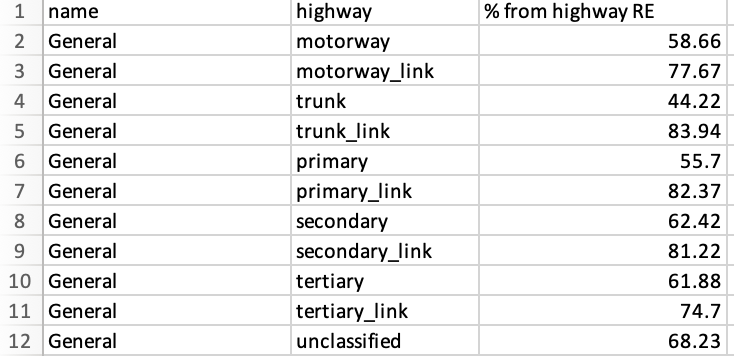
The table here is to illustrate a quantifiable measurement for the % of missing tags on lower classes which can trigger the community looking into the network and conduct a check and solve accordingly.
These is a share of road elements lacking the surface tag.
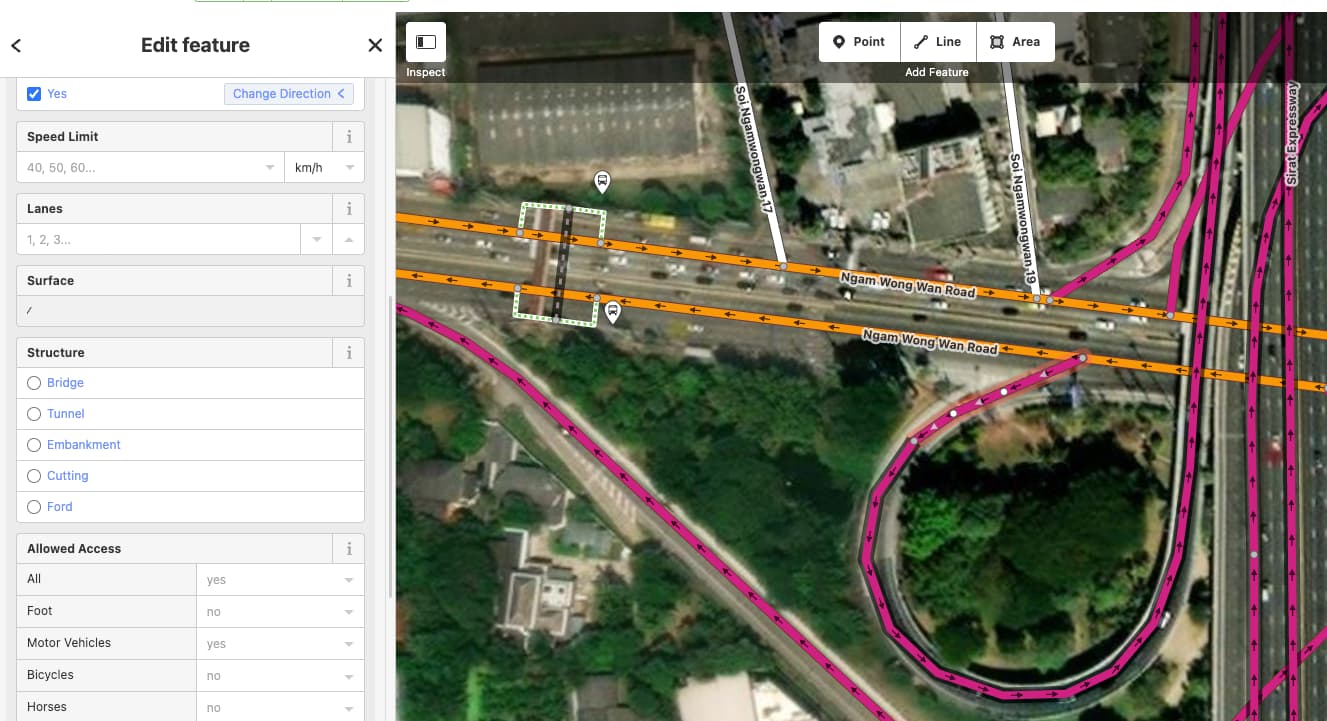
I am a bit uncertain what you mean with the above screenshot from iD. What kind of missing tags do you have in mind? The preset suggests some useful tags. Not having them is not wrong. It is just not having them.
The later table is more interesting. It is quite safe to assume that all motorway and probably trunk as well are paved. So we might want to ignore them a bit when checking for missing surface.
More interesting are the lower highway classes. Tertiary might have some unpaved roads. With unclassified we certainly have way more. For these it would be great to have more surface tags added.
I want to note that adding them purely based on aerial imagery can be quite tricky. I am not certain this is a task for people not familiar with the situation on the ground for a particular area.
With the extremely high number of missing surface tags i also wonder how suitable such a task is.
Maybe working dedicated on surface tags is not right. But if you are editing a specific area and have good source of road surface, then adding would make sense. Mapillary or similar ground-level photography is a quite good source for road surface.
So if you happen to look at them in a location without surface tag, make sure to add a surface as well.