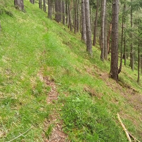
Here a photo of mine, there are two paths to be seen, one trail_visibility=excellent, one trail_visibility=good (when reading the wiki documentation to the letter):
It’s probably better when you’re actually there, but I’d rate that intermediate at best just judging from what’s (not) visible on the photo.
I missed the TV=good path when I went there. But the documentation says, if you see the continuation when looking further, 20m or so, never mind the GAP, and you see it, then it is “good”. Remember, you have to know, there is a path, perhaps the general direction too? Perhaps I should have looked more at the screen than on the ground?
BTW: the excellent one is solely for the deer, it leads nowhere, but it goes on for several hundreds of meters, more than 1km: The “good” one leads to a hunting cabin, Pz 13 14 gesamt by Plateauzeitung Medien gmbh - Issuu page 3. Apart from the hunter and myself, I’d say no human was there for the last 3 years. The location is set apart from the traffic network by a class 1 scramble at least due to demolition by natural forces.
To sum this up, if there is a path or if there is no path, that may be not so easy to tell, regardless of attributes.
Compared with File:Trail visibility good1.jpg - OpenStreetMap Wiki I guess both paths (not) in the picture of mine should earn excellent ![]()
BTW: I used to map TV like you and many others do, so giving intermediate there, but I stopped mapping TV, because there actually are people following the documentation to the letter. The key is useless by design.
